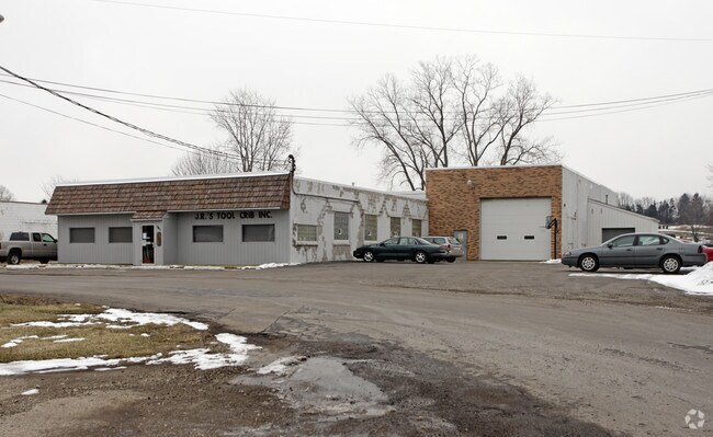
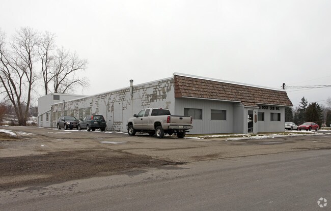
Property Record
941 High Grove Blvd, Akron, OH 44312
NEARBY LISTINGS FOR SALE OR LEASE
Property Detail
941 High Grove Blvd
Akron, OH
TR 7 E OF PROP RD .420A
51-05503
Summit
Industrialgeneral
Ohio
2023
0.42 AC
2025
Akron
531002
Cleveland
11,250 SF
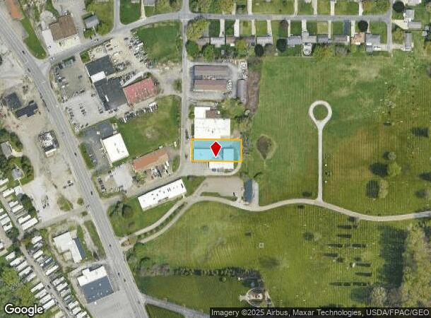
DEMOGRAPHICS near 941 High Grove Blvd
1 mile
3 mile
5 mile
2024 Total Population
8,362
47,439
130,566
2029 Population
8,276
46,914
129,638
Pop Growth 2024-2029
(1.03%)
(1.11%)
(0.71%)
Average Age
43
42
40
2024 Total Households
3,807
20,746
54,732
HH Growth 2024-2029
(1.08%)
(1.15%)
(0.76%)
Median Household Inc
$51,175
$55,380
$51,680
Avg Household Size
2.10
2.20
2.30
2024 Avg HH Vehicles
2.00
2.00
2.00
Median Home Value
$127,504
$133,190
$134,065
Median Year Built
1962
1958
1958
Nearby Places
Map Layers
Map Styles
 Street
 Aerial
Transit
 Traffic
 Biking
Places
Listings with unknown addresses are not visible on the map
- Restaurants
- Banks
- Shops
- Fitness
- Groceries
PUBLIC TRANSPORTATION
COMMUTER RAIL
Drive
Walk
Distance
16 min
7.3 mi
AIRPORT
Akron-Canton Regional
Drive
Walk
Distance
Akron-Canton Regional
21 min
11.5 mi
Cleveland-Hopkins International
Drive
Walk
Distance
Cleveland-Hopkins International
67 min
46.5 mi
Nearby Properties
Address
Land Use
TOTAL SIZE
Lot Size
Zoning
Address
Land Use
TOTAL SIZE
Lot Size
Zoning
Address
Land Use
TOTAL SIZE
Lot Size
Zoning
162,774 SF
16.58 AC
Address
Land Use
TOTAL SIZE
Lot Size
Zoning
264,753 SF
22.87 AC
Address
Land Use
TOTAL SIZE
Lot Size
Zoning
Address
Land Use
TOTAL SIZE
Lot Size
Zoning
Address
Land Use
TOTAL SIZE
Lot Size
Zoning
145,684 SF
27.98 AC
Address
Land Use
TOTAL SIZE
Lot Size
Zoning
245,911 SF
14.48 AC
Address
Land Use
TOTAL SIZE
Lot Size
Zoning
639,478 SF
29.51 AC
Address
Land Use
TOTAL SIZE
Lot Size
Zoning
270,860 SF
131.89 AC
Address
Land Use
TOTAL SIZE
Lot Size
Zoning
115,586 SF
4.93 AC
Address
Land Use
TOTAL SIZE
Lot Size
Zoning
374,370 SF
27.79 AC
Address
Land Use
TOTAL SIZE
Lot Size
Zoning
56,529 SF
3.67 AC
Address
Land Use
TOTAL SIZE
Lot Size
Zoning
203,059 SF
55.62 AC
Address
Land Use
TOTAL SIZE
Lot Size
Zoning
489,909 SF
23.77 AC
Address
Land Use
TOTAL SIZE
Lot Size
Zoning
5,863 SF
343.43 AC
Address
Land Use
TOTAL SIZE
Lot Size
Zoning
882,093 SF
50.96 AC
Address
Land Use
TOTAL SIZE
Lot Size
Zoning
68,979 SF
5.07 AC
Address
Land Use
TOTAL SIZE
Lot Size
Zoning
124,939 SF
13.89 AC
Address
Land Use
TOTAL SIZE
Lot Size
Zoning
667,050 SF
24.55 AC
Address
Land Use
TOTAL SIZE
Lot Size
Zoning
187,454 SF
12.59 AC
Address
Land Use
TOTAL SIZE
Lot Size
Zoning
243,424 SF
13.24 AC
Address
Land Use
TOTAL SIZE
Lot Size
Zoning
55,072 SF
3.41 AC
Address
Land Use
TOTAL SIZE
Lot Size
Zoning
97,454 SF
3.14 AC
Address
Land Use
TOTAL SIZE
Lot Size
Zoning
235,498 SF
21.41 AC
Address
Land Use
TOTAL SIZE
Lot Size
Zoning
141,342 SF
6.34 AC
Address
Land Use
TOTAL SIZE
Lot Size
Zoning
60,276 SF
11.81 AC
Address
Land Use
TOTAL SIZE
Lot Size
Zoning
538,000 SF
21.51 AC
Address
Land Use
TOTAL SIZE
Lot Size
Zoning
329,075 SF
14.11 AC
Address
Land Use
TOTAL SIZE
Lot Size
Zoning
291,490 SF
14 AC
Address
Land Use
TOTAL SIZE
Lot Size
Zoning
212,724 SF
17.99 AC
The World's #1 Commercial Real Estate Marketplace
Connect with us
© 2026 CoStar Group
The information above has been obtained from sources believed reliable. While we do not doubt its accuracy we have not verified it and make no guarantee, warranty or representation about it. It is your responsibility to independently confirm its accuracy and completeness. Any projections, opinions, assumptions, or estimates used are for example only and do not represent the current or future performance of the property. The value of this transaction to you depends on tax and other factors which should be evaluated by your tax, financial, and legal advisors. You and your advisors should conduct a careful, independent investigation of the property to determine to your satisfaction the suitability of the property for your needs.