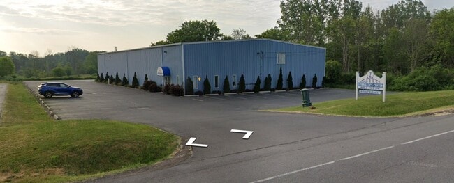
Property Record
941 Maple Rd, Elma, NY 14059

Property Detail
941 Maple Rd
144200-155-000-0002-045-121
ERIE
Recreationalentertainmentgeneral
New York
COMM
45.121
B and X Area of moderate flood hazard, usually the area between the limits of the 100-year and 500-year floods.
1.60 AC
2025
Outlying Erie County
2025
Buffalo/Niagara Falls
014101
Buffalo-Cheektowaga, NY
14,028 SF
NEARBY LISTINGS FOR SALE OR LEASE
DEMOGRAPHICS near 941 Maple Rd
1 mile
3 mile
5 mile
2025 Total Population
1,130
15,030
30,653
2030 Population
1,129
15,077
30,767
Pop Growth 2025-2030
(0.09%)
+ 0.31%
+ 0.37%
Average Age
46
45
46
2025 Total Households
456
6,163
12,562
HH Growth 2025-2030
0.00%
+ 0.26%
+ 0.33%
Median Household Inc
$104,878
$101,870
$101,915
Avg Household Size
2.40
2.40
2.40
2025 Avg HH Vehicles
2.00
2.00
2.00
Median Home Value
$397,125
$360,846
$347,269
Median Year Built
1966
1958
1967
Nearby Places
Map Layers
Map Styles
 Street
 Aerial
Transit
 Traffic
 Biking
Places
Listings with unknown addresses are not visible on the map
- Restaurants
- Banks
- Shops
- Fitness
- Groceries
PUBLIC TRANSPORTATION
AIRPORT
Buffalo Niagara International
Drive
Walk
Distance
Buffalo Niagara International
26 min
14.8 mi
Niagara Falls International
Drive
Walk
Distance
Niagara Falls International
50 min
33.5 mi
Freight Ports
Albany, NY Port
Drive
Walk
Distance
Albany, NY Port
343 min
285.9 mi
Nearby Properties
Address
Land Use
TOTAL SIZE
Lot Size
Zoning
Address
Land Use
TOTAL SIZE
Lot Size
Zoning
121,465 SF
4.20 AC
Address
Land Use
TOTAL SIZE
Lot Size
Zoning
1,409 SF
2.70 AC
Address
Land Use
TOTAL SIZE
Lot Size
Zoning
167,315 SF
5.32 AC
Address
Land Use
TOTAL SIZE
Lot Size
Zoning
129,572 SF
13.10 AC
Address
Land Use
TOTAL SIZE
Lot Size
Zoning
60,651 SF
2.01 AC
Address
Land Use
TOTAL SIZE
Lot Size
Zoning
178,744 SF
27.90 AC
Address
Land Use
TOTAL SIZE
Lot Size
Zoning
42,750 SF
1.10 AC
Address
Land Use
TOTAL SIZE
Lot Size
Zoning
7,512 SF
14.11 AC
Address
Land Use
TOTAL SIZE
Lot Size
Zoning
Address
Land Use
TOTAL SIZE
Lot Size
Zoning
124,495 SF
6.15 AC
Address
Land Use
TOTAL SIZE
Lot Size
Zoning
21,572 SF
2.76 AC
Address
Land Use
TOTAL SIZE
Lot Size
Zoning
13,364 SF
407.01 AC
N000
Address
Land Use
TOTAL SIZE
Lot Size
Zoning
15,990 SF
2.09 AC
Address
Land Use
TOTAL SIZE
Lot Size
Zoning
143,358 SF
15.62 AC
Address
Land Use
TOTAL SIZE
Lot Size
Zoning
68,880 SF
11.66 AC
06 - INDUS
Address
Land Use
TOTAL SIZE
Lot Size
Zoning
34,575 SF
2.12 AC
Address
Land Use
TOTAL SIZE
Lot Size
Zoning
55,413 SF
3.19 AC
Address
Land Use
TOTAL SIZE
Lot Size
Zoning
190,420 SF
117.90 AC
Address
Land Use
TOTAL SIZE
Lot Size
Zoning
13,874 SF
1.69 AC
Address
Land Use
TOTAL SIZE
Lot Size
Zoning
Address
Land Use
TOTAL SIZE
Lot Size
Zoning
5,246 SF
2.42 AC
Address
Land Use
TOTAL SIZE
Lot Size
Zoning
36,244 SF
1.80 AC
Address
Land Use
TOTAL SIZE
Lot Size
Zoning
117,130 SF
55.30 AC
Address
Land Use
TOTAL SIZE
Lot Size
Zoning
13,708 SF
1.30 AC
Address
Land Use
TOTAL SIZE
Lot Size
Zoning
57,600 SF
3.24 AC
06 - INDUS
Address
Land Use
TOTAL SIZE
Lot Size
Zoning
864 SF
16.90 AC
Address
Land Use
TOTAL SIZE
Lot Size
Zoning
13,286 SF
1 AC
Address
Land Use
TOTAL SIZE
Lot Size
Zoning
459 SF
27.81 AC
Address
Land Use
TOTAL SIZE
Lot Size
Zoning
Address
Land Use
TOTAL SIZE
Lot Size
Zoning
5,950 SF
3 AC
06 - INDUS
The World's #1 Commercial Real Estate Marketplace
Connect with us
© 2026 CoStar Group
The information above has been obtained from sources believed reliable. While we do not doubt its accuracy we have not verified it and make no guarantee, warranty or representation about it. It is your responsibility to independently confirm its accuracy and completeness. Any projections, opinions, assumptions, or estimates used are for example only and do not represent the current or future performance of the property. The value of this transaction to you depends on tax and other factors which should be evaluated by your tax, financial, and legal advisors. You and your advisors should conduct a careful, independent investigation of the property to determine to your satisfaction the suitability of the property for your needs.