Property Record
941 N Coleman St, Prosper, TX 75078
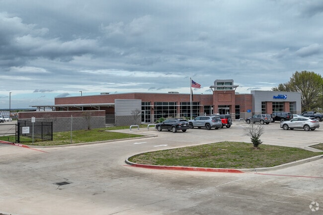


Property Detail
941 N Coleman St
Dallas-Fort Worth-Arlington, TX
UNITED STATES POSTAL SERVICE ADDITION, BLK A, LOT 2
R-11992-00A-0020-1
COLLIN
Federalproperty
Texas
B and X Area of moderate flood hazard, usually the area between the limits of the 100-year and 500-year floods.
2
0
5.21 AC
2025
N Collin Cty Outlying
030304
Dallas/Ft Worth
14,542 SF
NEARBY LISTINGS FOR SALE OR LEASE
DEMOGRAPHICS near 941 N Coleman St
1 mile
3 mile
5 mile
2024 Total Population
7,639
51,009
129,938
2029 Population
9,487
64,302
161,498
Pop Growth 2024-2029
+ 24.19%
+ 26.06%
+ 24.29%
Average Age
35
35
35
2024 Total Households
2,195
15,218
39,522
HH Growth 2024-2029
+ 24.24%
+ 26.40%
+ 24.62%
Median Household Inc
$158,091
$165,592
$150,193
Avg Household Size
3.40
3.30
3.30
2024 Avg HH Vehicles
2.00
2.00
2.00
Median Home Value
$499,360
$556,812
$481,936
Median Year Built
2011
2011
2011
Nearby Places
Map Layers
Map Styles
 Street
 Aerial
Transit
 Traffic
 Biking
Places
Listings with unknown addresses are not visible on the map
- Restaurants
- Banks
- Shops
- Fitness
- Groceries
PUBLIC TRANSPORTATION
AIRPORT
Dallas Love Field
Drive
Walk
Distance
Dallas Love Field
42 min
33.3 mi
Dallas-Fort Worth International
Drive
Walk
Distance
Dallas-Fort Worth International
41 min
34.1 mi
Freight Ports
Port of Shreveport
Drive
Walk
Distance
Port of Shreveport
246 min
226.6 mi
Nearby Properties
Address
Land Use
TOTAL SIZE
Lot Size
Zoning
Address
Land Use
TOTAL SIZE
Lot Size
Zoning
479,244 SF
26.82 AC
COMM
Address
Land Use
TOTAL SIZE
Lot Size
Zoning
980,997 SF
93.94 AC
Address
Land Use
TOTAL SIZE
Lot Size
Zoning
491,094 SF
14.06 AC
Address
Land Use
TOTAL SIZE
Lot Size
Zoning
151,733 SF
Address
Land Use
TOTAL SIZE
Lot Size
Zoning
530,080 SF
16.91 AC
Address
Land Use
TOTAL SIZE
Lot Size
Zoning
528,218 SF
32.80 AC
PD
Address
Land Use
TOTAL SIZE
Lot Size
Zoning
357,333 SF
15.01 AC
Address
Land Use
TOTAL SIZE
Lot Size
Zoning
218,013 SF
32.85 AC
AG
Address
Land Use
TOTAL SIZE
Lot Size
Zoning
536,616 SF
23.21 AC
MF-M
Address
Land Use
TOTAL SIZE
Lot Size
Zoning
348,136 SF
23.07 AC
MF-L
Address
Land Use
TOTAL SIZE
Lot Size
Zoning
143,590 SF
30.89 AC
Address
Land Use
TOTAL SIZE
Lot Size
Zoning
275,288 SF
19.40 AC
MF-M
Address
Land Use
TOTAL SIZE
Lot Size
Zoning
343,725 SF
11.21 AC
Address
Land Use
TOTAL SIZE
Lot Size
Zoning
262,995 SF
10.27 AC
Address
Land Use
TOTAL SIZE
Lot Size
Zoning
200,259 SF
44.76 AC
Address
Land Use
TOTAL SIZE
Lot Size
Zoning
251,455 SF
35.62 AC
Address
Land Use
TOTAL SIZE
Lot Size
Zoning
300,566 SF
7.86 AC
Address
Land Use
TOTAL SIZE
Lot Size
Zoning
436,200 SF
24.95 AC
Address
Land Use
TOTAL SIZE
Lot Size
Zoning
208,462 SF
24.46 AC
Address
Land Use
TOTAL SIZE
Lot Size
Zoning
429,823 SF
73.82 AC
Address
Land Use
TOTAL SIZE
Lot Size
Zoning
136,969 SF
19.87 AC
Address
Land Use
TOTAL SIZE
Lot Size
Zoning
220,499 SF
35.28 AC
Address
Land Use
TOTAL SIZE
Lot Size
Zoning
140,868 SF
12.64 AC
Address
Land Use
TOTAL SIZE
Lot Size
Zoning
201,473 SF
48.22 AC
Address
Land Use
TOTAL SIZE
Lot Size
Zoning
1,600 SF
101.31 AC
Address
Land Use
TOTAL SIZE
Lot Size
Zoning
124,784 SF
15.10 AC
Address
Land Use
TOTAL SIZE
Lot Size
Zoning
139,799 SF
19.66 AC
RESI
Address
Land Use
TOTAL SIZE
Lot Size
Zoning
110.70 AC
Address
Land Use
TOTAL SIZE
Lot Size
Zoning
63,002 SF
59.05 AC
COMM
Address
Land Use
TOTAL SIZE
Lot Size
Zoning
212,155 SF
12.16 AC
The World's #1 Commercial Real Estate Marketplace
Connect with us
© 2026 CoStar Group
The information above has been obtained from sources believed reliable. While we do not doubt its accuracy we have not verified it and make no guarantee, warranty or representation about it. It is your responsibility to independently confirm its accuracy and completeness. Any projections, opinions, assumptions, or estimates used are for example only and do not represent the current or future performance of the property. The value of this transaction to you depends on tax and other factors which should be evaluated by your tax, financial, and legal advisors. You and your advisors should conduct a careful, independent investigation of the property to determine to your satisfaction the suitability of the property for your needs.