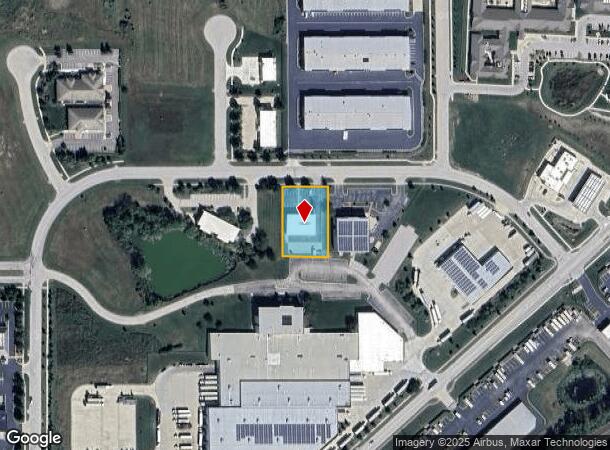
Property Record
941 W 141St Ter, Kansas City, MO 64145

Current Lease Availabilities
NEARBY LISTINGS FOR SALE OR LEASE
Property Detail
941 W 141St Ter
Kansas City, MO-KS
Bi-State Business Park 2Nd Plat
66-400-01-08-00-0-00-000
BI-STATE BUSINESS PARK SECOND PLAT LOT 41
Officebuilding
Jackson
X
Missouri
29095C0501G
41
2024
0.68 AC
2025
South KC
013405
Kansas City
10,540 SF
DEMOGRAPHICS near 941 W 141St Ter
1 Mile
3 Mile
5 Mile
2024 Total Population
3,350
43,492
133,288
2029 Population
3,489
44,969
137,638
Pop Growth 2024-2029
+ 4.15%
+ 3.40%
+ 3.26%
Average Age
43
42
41
2024 Total Households
1,358
16,316
54,049
HH Growth 2024-2029
+ 3.98%
+ 3.36%
+ 3.33%
Median Household Inc
$110,492
$144,141
$97,442
Avg Household Size
2.40
2.60
2.40
2024 Avg HH Vehicles
2.00
2.00
2.00
Median Home Value
$483,018
$482,717
$391,400
Median Year Built
2003
1995
1991
Nearby Places
- Restaurants
- Banks
- Shops
- Fitness
- Groceries
PUBLIC TRANSPORTATION
AIRPORT
Kansas City International
DRIVE
WALK
Distance
Kansas City International
53 min
41.6 mi
Freight Ports
Tulsa Port Of Catoosa
DRIVE
WALK
Distance
Tulsa Port Of Catoosa
250 min
221.9 mi
Nearby Properties
Address
Land Use
TOTAL SIZE
Lot Size
Zoning
Address
Land Use
TOTAL SIZE
Lot Size
Zoning
1,314,506 SF
174 AC
Address
Land Use
TOTAL SIZE
Lot Size
Zoning
384,819 SF
67.59 AC
AG
Address
Land Use
TOTAL SIZE
Lot Size
Zoning
184,524 SF
33.20 AC
AG
Address
Land Use
TOTAL SIZE
Lot Size
Zoning
173,314 SF
25.83 AC
R-1
Address
Land Use
TOTAL SIZE
Lot Size
Zoning
122,491 SF
19.30 AC
R-1
Address
Land Use
TOTAL SIZE
Lot Size
Zoning
102,411 SF
17.02 AC
AG
Address
Land Use
TOTAL SIZE
Lot Size
Zoning
166,097 SF
37.29 AC
R-1
Address
Land Use
TOTAL SIZE
Lot Size
Zoning
76,942 SF
15.10 AC
R-1
Address
Land Use
TOTAL SIZE
Lot Size
Zoning
72,184 SF
9.53 AC
AG
Address
Land Use
TOTAL SIZE
Lot Size
Zoning
319,892 SF
Address
Land Use
TOTAL SIZE
Lot Size
Zoning
9,508 SF
8.29 AC
RP-1
Address
Land Use
TOTAL SIZE
Lot Size
Zoning
68,493 SF
9.92 AC
R-1
Address
Land Use
TOTAL SIZE
Lot Size
Zoning
40,181 SF
1.80 AC
MXD
Address
Land Use
TOTAL SIZE
Lot Size
Zoning
43,021 SF
7.47 AC
SD-O
Address
Land Use
TOTAL SIZE
Lot Size
Zoning
36,012 SF
18.10 AC
AG
Address
Land Use
TOTAL SIZE
Lot Size
Zoning
67,523 SF
11.95 AC
R-1
Address
Land Use
TOTAL SIZE
Lot Size
Zoning
227,676 SF
15.86 AC
Address
Land Use
TOTAL SIZE
Lot Size
Zoning
26,022 SF
109.48 AC
IP-2J
Address
Land Use
TOTAL SIZE
Lot Size
Zoning
60,960 SF
4.82 AC
SD-NCR
Address
Land Use
TOTAL SIZE
Lot Size
Zoning
45,775 SF
17.05 AC
BP
Address
Land Use
TOTAL SIZE
Lot Size
Zoning
50,177 SF
5.54 AC
CP-2
Address
Land Use
TOTAL SIZE
Lot Size
Zoning
64,785 SF
24.54 AC
RP-4 (CURR
Address
Land Use
TOTAL SIZE
Lot Size
Zoning
41,203 SF
8.03 AC
MXD
Address
Land Use
TOTAL SIZE
Lot Size
Zoning
201,683 SF
5.38 AC
CP-2
Address
Land Use
TOTAL SIZE
Lot Size
Zoning
75,368 SF
26.38 AC
RP-3
Address
Land Use
TOTAL SIZE
Lot Size
Zoning
220,756 SF
19.65 AC
Address
Land Use
TOTAL SIZE
Lot Size
Zoning
122,684 SF
1.63 AC
R
Address
Land Use
TOTAL SIZE
Lot Size
Zoning
355,091 SF
41.50 AC
Address
Land Use
TOTAL SIZE
Lot Size
Zoning
118,266 SF
17.74 AC
RP-5
Address
Land Use
TOTAL SIZE
Lot Size
Zoning
109,737 SF
13.42 AC
RP-5
The World's #1 Commercial Real Estate Marketplace
Connect with us
© 2025 CoStar Group
The information above has been obtained from sources believed reliable. While we do not doubt its accuracy we have not verified it and make no guarantee, warranty or representation about it. It is your responsibility to independently confirm its accuracy and completeness. Any projections, opinions, assumptions, or estimates used are for example only and do not represent the current or future performance of the property. The value of this transaction to you depends on tax and other factors which should be evaluated by your tax, financial, and legal advisors. You and your advisors should conduct a careful, independent investigation of the property to determine to your satisfaction the suitability of the property for your needs.