Property Record
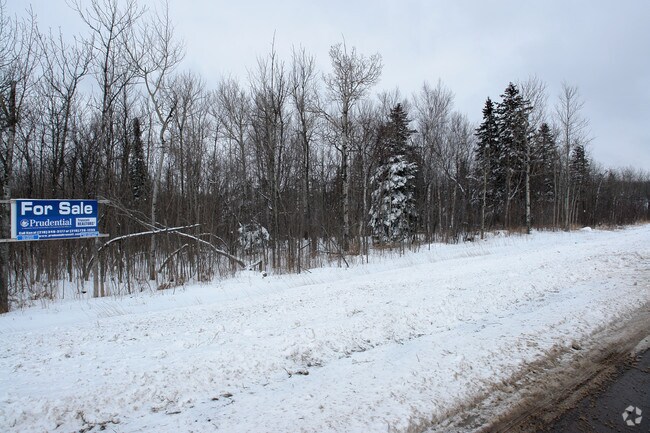
9427 Westgate Blvd, Duluth, MN 55810

NEARBY LISTINGS FOR SALE OR LEASE
Property Detail
9427 Westgate Blvd
Duluth, MN-WI
Proctor Lands In The City
185024000895
W 1/2 OF SE 1/4 OF NE 1/4 OF SW 1/4 EX 1AC FOR HWY SERIAL #
Commercialacreage
St Louis
AE
Minnesota
27137C3851E
4 AC
2025
South St Louis County
2024
Duluth
010100
DEMOGRAPHICS near 9427 Westgate Blvd
1 Mile
3 Mile
5 Mile
2024 Total Population
539
12,797
28,677
2029 Population
531
12,579
28,229
Pop Growth 2024-2029
(1.48%)
(1.70%)
(1.56%)
Average Age
42
41
41
2024 Total Households
221
5,413
12,142
HH Growth 2024-2029
(1.81%)
(1.92%)
(1.75%)
Median Household Inc
$82,143
$62,713
$64,493
Avg Household Size
2.40
2.20
2.20
2024 Avg HH Vehicles
2.00
2.00
2.00
Median Home Value
$230,357
$165,309
$173,287
Median Year Built
1971
1953
1953
Nearby Places
Map Layers
Map Styles
 Street
 Aerial
- Restaurants
- Banks
- Shops
- Fitness
- Groceries
PUBLIC TRANSPORTATION
AIRPORT
Duluth International
DRIVE
WALK
Distance
Duluth International
24 min
10.1 mi
Freight Ports
Port Milwaukee
DRIVE
WALK
Distance
Port Milwaukee
458 min
403.4 mi
Nearby Properties
Address
Land Use
TOTAL SIZE
Lot Size
Zoning
Address
Land Use
TOTAL SIZE
Lot Size
Zoning
87,768 SF
2.42 AC
Address
Land Use
TOTAL SIZE
Lot Size
Zoning
429,896 SF
15 AC
Address
Land Use
TOTAL SIZE
Lot Size
Zoning
76,000 SF
36.67 AC
Address
Land Use
TOTAL SIZE
Lot Size
Zoning
59,368 SF
0.46 AC
R1C
Address
Land Use
TOTAL SIZE
Lot Size
Zoning
24,873 SF
73.59 AC
Address
Land Use
TOTAL SIZE
Lot Size
Zoning
38,160 SF
2.28 AC
Address
Land Use
TOTAL SIZE
Lot Size
Zoning
38,160 SF
1.97 AC
Address
Land Use
TOTAL SIZE
Lot Size
Zoning
44,004 SF
1.66 AC
C2
Address
Land Use
TOTAL SIZE
Lot Size
Zoning
52,152 SF
0.29 AC
Address
Land Use
TOTAL SIZE
Lot Size
Zoning
48,528 SF
3.42 AC
Address
Land Use
TOTAL SIZE
Lot Size
Zoning
41,458 SF
1.97 AC
Address
Land Use
TOTAL SIZE
Lot Size
Zoning
8,428 SF
40 AC
Address
Land Use
TOTAL SIZE
Lot Size
Zoning
69,293 SF
1.22 AC
R3
Address
Land Use
TOTAL SIZE
Lot Size
Zoning
758 SF
1.15 AC
Address
Land Use
TOTAL SIZE
Lot Size
Zoning
32,760 SF
2.21 AC
Address
Land Use
TOTAL SIZE
Lot Size
Zoning
18,950 SF
0.46 AC
Address
Land Use
TOTAL SIZE
Lot Size
Zoning
61,800 SF
2.28 AC
Address
Land Use
TOTAL SIZE
Lot Size
Zoning
5,696 SF
3.70 AC
C2
Address
Land Use
TOTAL SIZE
Lot Size
Zoning
26,972 SF
0.57 AC
Address
Land Use
TOTAL SIZE
Lot Size
Zoning
7,874 SF
Address
Land Use
TOTAL SIZE
Lot Size
Zoning
32,012 SF
1.70 AC
Address
Land Use
TOTAL SIZE
Lot Size
Zoning
13,707 SF
0.16 AC
Address
Land Use
TOTAL SIZE
Lot Size
Zoning
7,800 SF
3.33 AC
R3
Address
Land Use
TOTAL SIZE
Lot Size
Zoning
35,063 SF
2.10 AC
Address
Land Use
TOTAL SIZE
Lot Size
Zoning
34,163 SF
0.19 AC
Address
Land Use
TOTAL SIZE
Lot Size
Zoning
13,545 SF
0.10 AC
Address
Land Use
TOTAL SIZE
Lot Size
Zoning
1,395 SF
8.50 AC
R1C
Address
Land Use
TOTAL SIZE
Lot Size
Zoning
14,020 SF
0.37 AC
Address
Land Use
TOTAL SIZE
Lot Size
Zoning
36.27 AC
Address
Land Use
TOTAL SIZE
Lot Size
Zoning
47,269 SF
8.74 AC
The World's #1 Commercial Real Estate Marketplace
Connect with us
© 2026 CoStar Group
The information above has been obtained from sources believed reliable. While we do not doubt its accuracy we have not verified it and make no guarantee, warranty or representation about it. It is your responsibility to independently confirm its accuracy and completeness. Any projections, opinions, assumptions, or estimates used are for example only and do not represent the current or future performance of the property. The value of this transaction to you depends on tax and other factors which should be evaluated by your tax, financial, and legal advisors. You and your advisors should conduct a careful, independent investigation of the property to determine to your satisfaction the suitability of the property for your needs.