Property Record
943 Blossom Rd, Rochester, NY 14610


NEARBY LISTINGS FOR SALE OR LEASE
Property Detail
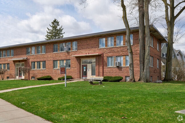
943 Blossom Rd
Rochester, NY
Monroe
261400 122.50-1-7.001
New York
Apartment
7.001
2025
17.42 AC
2024
Browncroft
007802
Rochester
8,064 SF
DEMOGRAPHICS near 943 Blossom Rd
1 Mile
3 Mile
5 Mile
2024 Total Population
13,699
108,469
271,030
2029 Population
13,516
106,658
267,019
Pop Growth 2024-2029
(1.34%)
(1.67%)
(1.48%)
Average Age
43
40
40
2024 Total Households
7,082
51,736
119,888
HH Growth 2024-2029
(1.41%)
(1.68%)
(1.51%)
Median Household Inc
$71,453
$63,416
$56,883
Avg Household Size
1.90
2.00
2.10
2024 Avg HH Vehicles
1.00
1.00
1.00
Median Home Value
$180,888
$180,852
$175,942
Median Year Built
1948
1948
1953
Nearby Places
Map Layers
Map Styles
 Street
 Aerial
- Restaurants
- Banks
- Shops
- Fitness
- Groceries
PUBLIC TRANSPORTATION
COMMUTER RAIL
Rochester (Empire Service - VIA Rail, Lake Shore Limited - VIA Rail, Maple Leaf - VIA Rail, Toronto - New York - VIA Rail)
DRIVE
WALK
Distance
Rochester (Empire Service - VIA Rail, Lake Shore Limited - VIA Rail, Maple Leaf - VIA Rail, Toronto - New York - VIA Rail)
8 min
3.7 mi
AIRPORT
Frederick Douglass/Greater Rochester International
DRIVE
WALK
Distance
Frederick Douglass/Greater Rochester International
15 min
7.7 mi
Freight Ports
Albany, NY Port
DRIVE
WALK
Distance
Albany, NY Port
263 min
224.1 mi
Nearby Properties
Address
Land Use
TOTAL SIZE
Lot Size
Zoning
Address
Land Use
TOTAL SIZE
Lot Size
Zoning
7.15 AC
Address
Land Use
TOTAL SIZE
Lot Size
Zoning
70,683 SF
53.22 AC
Address
Land Use
TOTAL SIZE
Lot Size
Zoning
0.13 AC
Address
Land Use
TOTAL SIZE
Lot Size
Zoning
51,276 SF
48.95 AC
02 - SINGL
Address
Land Use
TOTAL SIZE
Lot Size
Zoning
0.41 AC
Address
Land Use
TOTAL SIZE
Lot Size
Zoning
160,758 SF
20.95 AC
02 - SINGL
Address
Land Use
TOTAL SIZE
Lot Size
Zoning
198,655 SF
31.05 AC
02 - SINGL
Address
Land Use
TOTAL SIZE
Lot Size
Zoning
0.65 AC
Address
Land Use
TOTAL SIZE
Lot Size
Zoning
335,918 SF
10.19 AC
Address
Land Use
TOTAL SIZE
Lot Size
Zoning
151,590 SF
1.14 AC
Address
Land Use
TOTAL SIZE
Lot Size
Zoning
189,060 SF
30.68 AC
02 - SINGL
Address
Land Use
TOTAL SIZE
Lot Size
Zoning
233,579 SF
1.13 AC
Address
Land Use
TOTAL SIZE
Lot Size
Zoning
62,200 SF
17.92 AC
Address
Land Use
TOTAL SIZE
Lot Size
Zoning
266,701 SF
4.10 AC
Address
Land Use
TOTAL SIZE
Lot Size
Zoning
203,306 SF
3.91 AC
Address
Land Use
TOTAL SIZE
Lot Size
Zoning
742,711 SF
56.05 AC
Address
Land Use
TOTAL SIZE
Lot Size
Zoning
130,000 SF
2.76 AC
LLD
Address
Land Use
TOTAL SIZE
Lot Size
Zoning
227,440 SF
1.30 AC
Address
Land Use
TOTAL SIZE
Lot Size
Zoning
57.70 AC
Address
Land Use
TOTAL SIZE
Lot Size
Zoning
52,716 SF
10.72 AC
LLD
Address
Land Use
TOTAL SIZE
Lot Size
Zoning
1,878 SF
56.60 AC
MHP
Address
Land Use
TOTAL SIZE
Lot Size
Zoning
208,658 SF
1.46 AC
Address
Land Use
TOTAL SIZE
Lot Size
Zoning
97,862 SF
1.11 AC
14
Address
Land Use
TOTAL SIZE
Lot Size
Zoning
115,500 SF
6.63 AC
Address
Land Use
TOTAL SIZE
Lot Size
Zoning
67,463 SF
1.80 AC
Address
Land Use
TOTAL SIZE
Lot Size
Zoning
52,080 SF
21.10 AC
Address
Land Use
TOTAL SIZE
Lot Size
Zoning
38,776 SF
10.33 AC
MR
Address
Land Use
TOTAL SIZE
Lot Size
Zoning
5,156 SF
2.51 AC
Address
Land Use
TOTAL SIZE
Lot Size
Zoning
134,894 SF
16 AC
01 - NOT Z
The World's #1 Commercial Real Estate Marketplace
Connect with us
© 2026 CoStar Group
The information above has been obtained from sources believed reliable. While we do not doubt its accuracy we have not verified it and make no guarantee, warranty or representation about it. It is your responsibility to independently confirm its accuracy and completeness. Any projections, opinions, assumptions, or estimates used are for example only and do not represent the current or future performance of the property. The value of this transaction to you depends on tax and other factors which should be evaluated by your tax, financial, and legal advisors. You and your advisors should conduct a careful, independent investigation of the property to determine to your satisfaction the suitability of the property for your needs.