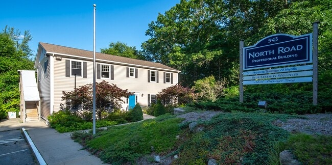
Property Record
943 North Rd, Groton, CT 06340

Property Detail
943 North Rd
Officebuilding
Southeastern Ct
IM
Connecticut
C and X Area of minimal flood hazard, usually depicted on FIRMs as above the 500-year flood level.
1.72 AC
2025
New London
2025
Hartford
702100
Norwich-New London-Willimantic, CT
4,368 SF
GROT-001699-000888-008329
NEARBY LISTINGS FOR SALE OR LEASE
DEMOGRAPHICS near 943 North Rd
1 mile
3 mile
5 mile
2025 Total Population
724
26,054
77,011
2030 Population
728
26,373
77,864
Pop Growth 2025-2030
+ 0.55%
+ 1.22%
+ 1.11%
Average Age
43
41
41
2025 Total Households
301
11,105
31,205
HH Growth 2025-2030
+ 0.66%
+ 1.22%
+ 1.29%
Median Household Inc
$97,499
$85,292
$80,989
Avg Household Size
2.40
2.30
2.20
2025 Avg HH Vehicles
2.00
2.00
2.00
Median Home Value
$381,817
$300,375
$331,665
Median Year Built
1973
1978
1968
Nearby Places
Map Layers
Map Styles
 Street
 Aerial
Layers
 Traffic
 Biking
Places
Listings with unknown addresses are not visible on the map
- Restaurants
- Banks
- Shops
- Fitness
- Groceries
PUBLIC TRANSPORTATION
COMMUTER RAIL
Mystic Amtrak (Northeast Regional - Amtrak)
Drive
Walk
Distance
Mystic Amtrak (Northeast Regional - Amtrak)
10 min
5.8 mi
New London (Shore Line East - Shore Line East)
Drive
Walk
Distance
New London (Shore Line East - Shore Line East)
9 min
6.6 mi
Freight Ports
Port of Davisville, RI
Drive
Walk
Distance
Port of Davisville, RI
63 min
47.7 mi
SALE & LEASE HISTORY
LISTING DATE
SALE/LEASE

Sep 25, 2016
For Lease
Oct 18, 2019
For Lease
Nov 28, 2018
For Lease
May 20, 2025
For Sale
Jun 11, 2025
For Sale
Jul 29, 2024
For Sale
Jan 19, 2017
For Lease
Jan 05, 2022
For Lease
Feb 19, 2026
For Lease
Nearby Properties
Address
Land Use
TOTAL SIZE
Lot Size
Zoning
Address
Land Use
TOTAL SIZE
Lot Size
Zoning
8,712 SF
RU-20
Address
Land Use
TOTAL SIZE
Lot Size
Zoning
42,688 SF
19.22 AC
RM
Address
Land Use
TOTAL SIZE
Lot Size
Zoning
8,820 SF
66.22 AC
R-12
Address
Land Use
TOTAL SIZE
Lot Size
Zoning
268,573 SF
74.66 AC
RS-20
Address
Land Use
TOTAL SIZE
Lot Size
Zoning
287.66 AC
RU-20
Address
Land Use
TOTAL SIZE
Lot Size
Zoning
11,880 SF
35.66 AC
RM
Address
Land Use
TOTAL SIZE
Lot Size
Zoning
13.68 AC
CR
Address
Land Use
TOTAL SIZE
Lot Size
Zoning
162,521 SF
44.19 AC
RS-20
Address
Land Use
TOTAL SIZE
Lot Size
Zoning
73,446 SF
69.87 AC
R-12
Address
Land Use
TOTAL SIZE
Lot Size
Zoning
104,052 SF
27.36 AC
RM
Address
Land Use
TOTAL SIZE
Lot Size
Zoning
74,433 SF
47.37 AC
RS-20
Address
Land Use
TOTAL SIZE
Lot Size
Zoning
66.87 AC
RU-20
Address
Land Use
TOTAL SIZE
Lot Size
Zoning
231,514 SF
9.33 AC
IM
Address
Land Use
TOTAL SIZE
Lot Size
Zoning
125,275 SF
10 AC
RM
Address
Land Use
TOTAL SIZE
Lot Size
Zoning
204,329 SF
17.92 AC
CR
Address
Land Use
TOTAL SIZE
Lot Size
Zoning
33.50 AC
R-12
Address
Land Use
TOTAL SIZE
Lot Size
Zoning
133,106 SF
17.25 AC
MTC
Address
Land Use
TOTAL SIZE
Lot Size
Zoning
33,404 SF
10.15 AC
MVC
Address
Land Use
TOTAL SIZE
Lot Size
Zoning
52,065 SF
12.40 AC
CN
Address
Land Use
TOTAL SIZE
Lot Size
Zoning
125,755 SF
14.63 AC
MVC
Address
Land Use
TOTAL SIZE
Lot Size
Zoning
65,512 SF
123.23 AC
RU-20
Address
Land Use
TOTAL SIZE
Lot Size
Zoning
7,112 SF
R-12
Address
Land Use
TOTAL SIZE
Lot Size
Zoning
60,592 SF
12.95 AC
MTC
Address
Land Use
TOTAL SIZE
Lot Size
Zoning
56,961 SF
3.43 AC
RM
Address
Land Use
TOTAL SIZE
Lot Size
Zoning
50,876 SF
57.34 AC
R-12
Address
Land Use
TOTAL SIZE
Lot Size
Zoning
21,870 SF
18.86 AC
RM
Address
Land Use
TOTAL SIZE
Lot Size
Zoning
520 SF
36.40 AC
RS-20
Address
Land Use
TOTAL SIZE
Lot Size
Zoning
83,470 SF
14.67 AC
CR
Address
Land Use
TOTAL SIZE
Lot Size
Zoning
37,434 SF
10.75 AC
MVC
Address
Land Use
TOTAL SIZE
Lot Size
Zoning
58,739 SF
21.85 AC
RU-40
The World's #1 Commercial Real Estate Marketplace
Connect with us
© 2026 CoStar Group
The information above has been obtained from sources believed reliable. While we do not doubt its accuracy we have not verified it and make no guarantee, warranty or representation about it. It is your responsibility to independently confirm its accuracy and completeness. Any projections, opinions, assumptions, or estimates used are for example only and do not represent the current or future performance of the property. The value of this transaction to you depends on tax and other factors which should be evaluated by your tax, financial, and legal advisors. You and your advisors should conduct a careful, independent investigation of the property to determine to your satisfaction the suitability of the property for your needs.