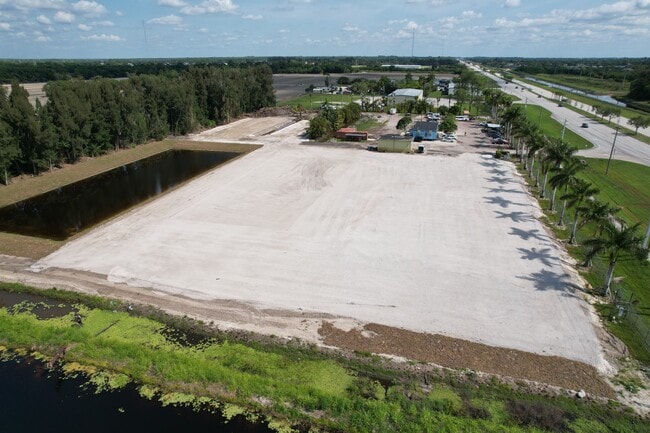
Property Record
9437 S State Road 7, Boynton Beach, FL 33472


NEARBY LISTINGS FOR SALE OR LEASE
Property Detail
9437 S State Road 7
00-42-43-27-05-052-0240
Palm Beach Farms Co Pl No 3
Shipyard
PALM BEACH FARMS CO PL NO 3 TR 24 (LESS ELY 206.18 FT SR 7 R/W) BLK 52
AE
Palm Beach
12099C0765F
Florida
2024
6.85 AC
2025
Palm Bch Cty Outlying
007772
South Florida
1,242 SF
West Palm Beach-Boca Raton-Delray Beach, FL
DEMOGRAPHICS near 9437 S State Road 7
1 Mile
3 Mile
5 Mile
2024 Total Population
679
27,730
92,410
2029 Population
701
28,265
94,726
Pop Growth 2024-2029
+ 3.24%
+ 1.93%
+ 2.51%
Average Age
41
51
51
2024 Total Households
220
10,925
37,769
HH Growth 2024-2029
+ 2.73%
+ 1.28%
+ 2.04%
Median Household Inc
$120,678
$100,601
$89,730
Avg Household Size
3.00
2.40
2.30
2024 Avg HH Vehicles
2.00
2.00
2.00
Median Home Value
$765,109
$448,513
$404,188
Median Year Built
2010
2004
1998
Nearby Places
Map Layers
Map Styles
 Street
 Aerial
- Restaurants
- Banks
- Shops
- Fitness
- Groceries
PUBLIC TRANSPORTATION
AIRPORT
Palm Beach International
DRIVE
WALK
Distance
Palm Beach International
26 min
18.5 mi
Freight Ports
Port of Palm Beach
DRIVE
WALK
Distance
Port of Palm Beach
38 min
25.7 mi
SALE & LEASE HISTORY
LISTING DATE
SALE/LEASE

Sep 24, 2016
For Sale
Sep 08, 2022
For Lease
Nov 22, 2019
For Sale
Nov 18, 2021
For Sale
Mar 28, 2018
For Sale
Jun 30, 2017
For Sale
Jun 14, 2017
For Sale
Feb 20, 2020
For Sale
Nearby Properties
Address
Land Use
TOTAL SIZE
Lot Size
Zoning
Address
Land Use
TOTAL SIZE
Lot Size
Zoning
259,086 SF
44.59 AC
MUPD
Address
Land Use
TOTAL SIZE
Lot Size
Zoning
410,663 SF
22.50 AC
PUD
Address
Land Use
TOTAL SIZE
Lot Size
Zoning
298,137 SF
17.93 AC
PUD
Address
Land Use
TOTAL SIZE
Lot Size
Zoning
271,613 SF
33 AC
MUPD/P
Address
Land Use
TOTAL SIZE
Lot Size
Zoning
145,825 SF
33.59 AC
MUPD
Address
Land Use
TOTAL SIZE
Lot Size
Zoning
161,858 SF
19.49 AC
MUPD
Address
Land Use
TOTAL SIZE
Lot Size
Zoning
671,429 SF
245.66 AC
AGRPUD/P
Address
Land Use
TOTAL SIZE
Lot Size
Zoning
69,092 SF
7.75 AC
MUPD
Address
Land Use
TOTAL SIZE
Lot Size
Zoning
88,456 SF
10.85 AC
MUPD
Address
Land Use
TOTAL SIZE
Lot Size
Zoning
88,125 SF
13.92 AC
AGR
Address
Land Use
TOTAL SIZE
Lot Size
Zoning
4,488 SF
52.12 AC
MUPD/P
Address
Land Use
TOTAL SIZE
Lot Size
Zoning
4,800 SF
39.40 AC
MUPD/P
Address
Land Use
TOTAL SIZE
Lot Size
Zoning
134,643 SF
12.92 AC
PUD
Address
Land Use
TOTAL SIZE
Lot Size
Zoning
179,196 SF
23.87 AC
MUPD
Address
Land Use
TOTAL SIZE
Lot Size
Zoning
97,182 SF
77.58 AC
IPF
Address
Land Use
TOTAL SIZE
Lot Size
Zoning
67,907 SF
0.68 AC
MUPD
Address
Land Use
TOTAL SIZE
Lot Size
Zoning
72,299 SF
10.76 AC
MUPD
Address
Land Use
TOTAL SIZE
Lot Size
Zoning
55.61 AC
AR
Address
Land Use
TOTAL SIZE
Lot Size
Zoning
49,884 SF
4.94 AC
CHO
Address
Land Use
TOTAL SIZE
Lot Size
Zoning
49,708 SF
4.24 AC
MUPD
Address
Land Use
TOTAL SIZE
Lot Size
Zoning
28,227 SF
485.85 AC
PC
Address
Land Use
TOTAL SIZE
Lot Size
Zoning
40 AC
MXPD
Address
Land Use
TOTAL SIZE
Lot Size
Zoning
73,848 SF
4.85 AC
IL
Address
Land Use
TOTAL SIZE
Lot Size
Zoning
43,884 SF
4.89 AC
CG
Address
Land Use
TOTAL SIZE
Lot Size
Zoning
36,214 SF
10.80 AC
MUPD
Address
Land Use
TOTAL SIZE
Lot Size
Zoning
83,569 SF
3.92 AC
MUPD
Address
Land Use
TOTAL SIZE
Lot Size
Zoning
47,177 SF
4.76 AC
RS
Address
Land Use
TOTAL SIZE
Lot Size
Zoning
36,144 SF
3.22 AC
MUPD
Address
Land Use
TOTAL SIZE
Lot Size
Zoning
38,306 SF
4.94 AC
RT
Address
Land Use
TOTAL SIZE
Lot Size
Zoning
7,200 SF
40.15 AC
AGR
The World's #1 Commercial Real Estate Marketplace
Connect with us
© 2026 CoStar Group
The information above has been obtained from sources believed reliable. While we do not doubt its accuracy we have not verified it and make no guarantee, warranty or representation about it. It is your responsibility to independently confirm its accuracy and completeness. Any projections, opinions, assumptions, or estimates used are for example only and do not represent the current or future performance of the property. The value of this transaction to you depends on tax and other factors which should be evaluated by your tax, financial, and legal advisors. You and your advisors should conduct a careful, independent investigation of the property to determine to your satisfaction the suitability of the property for your needs.