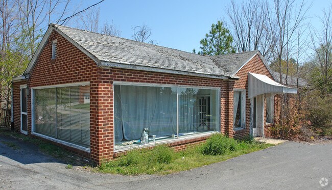
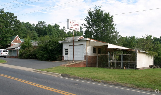
Property Record
945 E Salisbury St, Asheboro, NC 27203

Property Detail
945 E Salisbury St
7761-32-3900
E SALISBURY ST;N
Vacantlandnec
Randolph
B2
North Carolina
B and X Area of moderate flood hazard, usually the area between the limits of the 100-year and 500-year floods.
4.42 AC
2025
SE Randolph County
2025
Greensboro/Winston-Salem
030302
Greensboro-High Point, NC
NEARBY LISTINGS FOR SALE OR LEASE
DEMOGRAPHICS near 945 E Salisbury St
1 mile
3 mile
5 mile
2025 Total Population
5,294
24,930
42,978
2030 Population
5,419
25,488
43,997
Pop Growth 2025-2030
+ 2.36%
+ 2.24%
+ 2.37%
Average Age
40
40
40
2025 Total Households
2,090
9,904
17,025
HH Growth 2025-2030
+ 2.39%
+ 2.27%
+ 2.42%
Median Household Inc
$40,439
$46,253
$48,653
Avg Household Size
2.40
2.40
2.40
2025 Avg HH Vehicles
1.00
2.00
2.00
Median Home Value
$221,238
$200,427
$200,546
Median Year Built
1964
1972
1979
Nearby Places
Map Layers
Map Styles
 Street
 Aerial
Layers
 Traffic
 Biking
Places
Listings with unknown addresses are not visible on the map
- Restaurants
- Banks
- Shops
- Fitness
- Groceries
PUBLIC TRANSPORTATION
AIRPORT
Piedmont Triad International
Drive
Walk
Distance
Piedmont Triad International
48 min
34.2 mi
Nearby Properties
Address
Land Use
TOTAL SIZE
Lot Size
Zoning
Address
Land Use
TOTAL SIZE
Lot Size
Zoning
312,205 SF
6.83 AC
B2
Address
Land Use
TOTAL SIZE
Lot Size
Zoning
221,524 SF
22.11 AC
B2 (CZ)
Address
Land Use
TOTAL SIZE
Lot Size
Zoning
178,413 SF
36.13 AC
B2
Address
Land Use
TOTAL SIZE
Lot Size
Zoning
178,413 SF
35.87 AC
B2
Address
Land Use
TOTAL SIZE
Lot Size
Zoning
24.92 AC
B2
Address
Land Use
TOTAL SIZE
Lot Size
Zoning
5.24 AC
B3
Address
Land Use
TOTAL SIZE
Lot Size
Zoning
75,251 SF
18.75 AC
B2 (CZ)
Address
Land Use
TOTAL SIZE
Lot Size
Zoning
84,857 SF
8.31 AC
B2
Address
Land Use
TOTAL SIZE
Lot Size
Zoning
84,329 SF
71.50 AC
I2
Address
Land Use
TOTAL SIZE
Lot Size
Zoning
29,212 SF
104.58 AC
B2
Address
Land Use
TOTAL SIZE
Lot Size
Zoning
84,298 SF
8.25 AC
B2
Address
Land Use
TOTAL SIZE
Lot Size
Zoning
94,956 SF
15.15 AC
B2
Address
Land Use
TOTAL SIZE
Lot Size
Zoning
52,741 SF
2.53 AC
B2
Address
Land Use
TOTAL SIZE
Lot Size
Zoning
52,741 SF
2.15 AC
B2
Address
Land Use
TOTAL SIZE
Lot Size
Zoning
136,877 SF
25.59 AC
I1
Address
Land Use
TOTAL SIZE
Lot Size
Zoning
193,214 SF
17.06 AC
I1
Address
Land Use
TOTAL SIZE
Lot Size
Zoning
38,113 SF
8.56 AC
B2
Address
Land Use
TOTAL SIZE
Lot Size
Zoning
38,113 SF
8.16 AC
B2
Address
Land Use
TOTAL SIZE
Lot Size
Zoning
53,871 SF
11.36 AC
B2
Address
Land Use
TOTAL SIZE
Lot Size
Zoning
35,502 SF
2.83 AC
B2
Address
Land Use
TOTAL SIZE
Lot Size
Zoning
4,590 SF
15.50 AC
RA6
Address
Land Use
TOTAL SIZE
Lot Size
Zoning
18,144 SF
2.91 AC
B2
Address
Land Use
TOTAL SIZE
Lot Size
Zoning
47,797 SF
2.61 AC
B2 (CZ)
Address
Land Use
TOTAL SIZE
Lot Size
Zoning
14,800 SF
6.03 AC
I1
Address
Land Use
TOTAL SIZE
Lot Size
Zoning
5.58 AC
B2
Address
Land Use
TOTAL SIZE
Lot Size
Zoning
43,046 SF
4.09 AC
B2
Address
Land Use
TOTAL SIZE
Lot Size
Zoning
59,830 SF
0.85 AC
RA6
Address
Land Use
TOTAL SIZE
Lot Size
Zoning
75,024 SF
2.02 AC
B2
Address
Land Use
TOTAL SIZE
Lot Size
Zoning
8,614 SF
7.40 AC
RA6
Address
Land Use
TOTAL SIZE
Lot Size
Zoning
66,585 SF
7.16 AC
OA6
The World's #1 Commercial Real Estate Marketplace
Connect with us
© 2026 CoStar Group
The information above has been obtained from sources believed reliable. While we do not doubt its accuracy we have not verified it and make no guarantee, warranty or representation about it. It is your responsibility to independently confirm its accuracy and completeness. Any projections, opinions, assumptions, or estimates used are for example only and do not represent the current or future performance of the property. The value of this transaction to you depends on tax and other factors which should be evaluated by your tax, financial, and legal advisors. You and your advisors should conduct a careful, independent investigation of the property to determine to your satisfaction the suitability of the property for your needs.