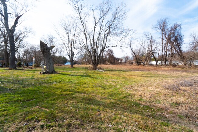
Property Record
945 State Route 33, Freehold, NJ 07728


NEARBY LISTINGS FOR SALE OR LEASE
Property Detail
945 State Route 33
New York-Jersey City-White Plains, NY-NJ
Monmouth
21-00175-0000-00035
New Jersey
Sfr
6.50 AC
X
Western Monmouth
34025C0301F
Northern New Jersey
2,365 SF
DEMOGRAPHICS near 945 State Route 33
1 Mile
3 Mile
5 Mile
2024 Total Population
1,201
28,655
73,498
2029 Population
1,179
28,354
72,683
Pop Growth 2024-2029
(1.83%)
(1.05%)
(1.11%)
Average Age
40
42
42
2024 Total Households
375
10,511
26,304
HH Growth 2024-2029
(1.87%)
(1.22%)
(1.29%)
Median Household Inc
$201,579
$106,882
$110,989
Avg Household Size
3.20
2.60
2.70
2024 Avg HH Vehicles
3.00
2.00
2.00
Median Home Value
$684,210
$470,048
$492,445
Median Year Built
1991
1984
1982
Nearby Places
Map Layers
Map Styles
 Street
 Aerial
- Restaurants
- Banks
- Shops
- Fitness
- Groceries
SALE & LEASE HISTORY
LISTING DATE
SALE/LEASE

Mar 09, 2020
For Sale
Nearby Properties
Address
Land Use
TOTAL SIZE
Lot Size
Zoning
Address
Land Use
TOTAL SIZE
Lot Size
Zoning
4,649 SF
40.27 AC
ML-7
Address
Land Use
TOTAL SIZE
Lot Size
Zoning
3,255.78 AC
ARE6
Address
Land Use
TOTAL SIZE
Lot Size
Zoning
904,310 SF
85.13 AC
M2M1
Address
Land Use
TOTAL SIZE
Lot Size
Zoning
36.48 AC
HD-2
Address
Land Use
TOTAL SIZE
Lot Size
Zoning
15.69 AC
HMUD
Address
Land Use
TOTAL SIZE
Lot Size
Zoning
267,666 SF
29.06 AC
M-1
Address
Land Use
TOTAL SIZE
Lot Size
Zoning
69.99 AC
AG
Address
Land Use
TOTAL SIZE
Lot Size
Zoning
73,884 SF
37.60 AC
R-40
Address
Land Use
TOTAL SIZE
Lot Size
Zoning
114,738 SF
19.02 AC
M-1
Address
Land Use
TOTAL SIZE
Lot Size
Zoning
42,982 SF
118.30 AC
R-40
Address
Land Use
TOTAL SIZE
Lot Size
Zoning
2.91 AC
RCR
Address
Land Use
TOTAL SIZE
Lot Size
Zoning
19.02 AC
HD
Address
Land Use
TOTAL SIZE
Lot Size
Zoning
1.06 AC
AG
Address
Land Use
TOTAL SIZE
Lot Size
Zoning
7,112 SF
10.01 AC
CM3A
Address
Land Use
TOTAL SIZE
Lot Size
Zoning
92,832 SF
29.69 AC
M-1
Address
Land Use
TOTAL SIZE
Lot Size
Zoning
126,388 SF
11.56 AC
CM10
Address
Land Use
TOTAL SIZE
Lot Size
Zoning
81,657 SF
12.62 AC
B-10
Address
Land Use
TOTAL SIZE
Lot Size
Zoning
126,300 SF
10.12 AC
M-1
Address
Land Use
TOTAL SIZE
Lot Size
Zoning
448,934 SF
24.24 AC
C-M
Address
Land Use
TOTAL SIZE
Lot Size
Zoning
120,000 SF
77 AC
ARE2
Address
Land Use
TOTAL SIZE
Lot Size
Zoning
8,694 SF
73.93 AC
R-40
Address
Land Use
TOTAL SIZE
Lot Size
Zoning
56,000 SF
21.53 AC
M-1
Address
Land Use
TOTAL SIZE
Lot Size
Zoning
43.22 AC
ARE2
Address
Land Use
TOTAL SIZE
Lot Size
Zoning
106,345 SF
10.53 AC
LI-3
Address
Land Use
TOTAL SIZE
Lot Size
Zoning
155,980 SF
23.83 AC
M-1
Address
Land Use
TOTAL SIZE
Lot Size
Zoning
62,290 SF
11.22 AC
OB01
Address
Land Use
TOTAL SIZE
Lot Size
Zoning
54,552 SF
8.04 AC
OB01
Address
Land Use
TOTAL SIZE
Lot Size
Zoning
119,817 SF
23 AC
R-60
Address
Land Use
TOTAL SIZE
Lot Size
Zoning
14.63 AC
HMUD
Address
Land Use
TOTAL SIZE
Lot Size
Zoning
7,966 SF
44.17 AC
MH
The World's #1 Commercial Real Estate Marketplace
Connect with us
© 2026 CoStar Group
The information above has been obtained from sources believed reliable. While we do not doubt its accuracy we have not verified it and make no guarantee, warranty or representation about it. It is your responsibility to independently confirm its accuracy and completeness. Any projections, opinions, assumptions, or estimates used are for example only and do not represent the current or future performance of the property. The value of this transaction to you depends on tax and other factors which should be evaluated by your tax, financial, and legal advisors. You and your advisors should conduct a careful, independent investigation of the property to determine to your satisfaction the suitability of the property for your needs.