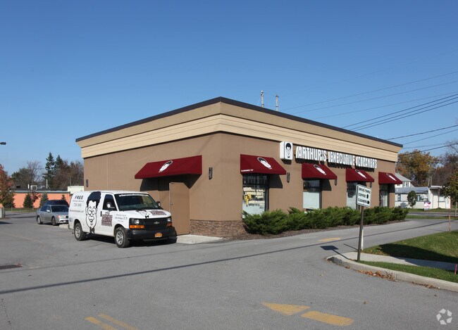
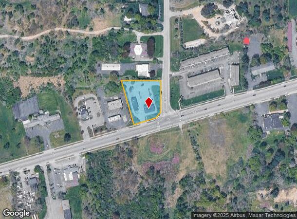
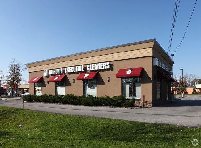
Property Record
9450 Main St, Clarence, NY 14031
NEARBY LISTINGS FOR SALE OR LEASE
Property Detail
9450 Main St
143200-071-140-0001-010-100
Erie
Storesoffices
New York
X
10.100
36029C0232H
1.10 AC
2025
Outlying Erie County
2024
Buffalo/Niagara Falls
014703
Buffalo-Cheektowaga-Niagara Falls, NY
1,890 SF
DEMOGRAPHICS near 9450 Main St
1 Mile
3 Mile
5 Mile
2024 Total Population
2,857
23,354
79,069
2029 Population
2,896
23,423
79,117
Pop Growth 2024-2029
+ 1.37%
+ 0.30%
+ 0.06%
Average Age
44
44
44
2024 Total Households
1,151
9,301
32,111
HH Growth 2024-2029
+ 1.22%
+ 0.19%
(0.03%)
Median Household Inc
$97,548
$101,471
$94,766
Avg Household Size
2.40
2.40
2.40
2024 Avg HH Vehicles
2.00
2.00
2.00
Median Home Value
$290,322
$300,442
$292,128
Median Year Built
1986
1982
1982
Nearby Places
- Restaurants
- Banks
- Shops
- Fitness
- Groceries
PUBLIC TRANSPORTATION
COMMUTER RAIL
DRIVE
WALK
Distance
16 min
8.4 mi
DRIVE
WALK
Distance
17 min
8.9 mi
AIRPORT
Buffalo Niagara International
DRIVE
WALK
Distance
Buffalo Niagara International
12 min
6.3 mi
Niagara Falls International
DRIVE
WALK
Distance
Niagara Falls International
38 min
20.8 mi
Nearby Properties
Address
Land Use
TOTAL SIZE
Lot Size
Zoning
Address
Land Use
TOTAL SIZE
Lot Size
Zoning
868,362 SF
135.20 AC
Address
Land Use
TOTAL SIZE
Lot Size
Zoning
12,576 SF
18.15 AC
Address
Land Use
TOTAL SIZE
Lot Size
Zoning
19,558 SF
11.07 AC
Address
Land Use
TOTAL SIZE
Lot Size
Zoning
11,439 SF
6.64 AC
Address
Land Use
TOTAL SIZE
Lot Size
Zoning
8,347 SF
14.04 AC
Address
Land Use
TOTAL SIZE
Lot Size
Zoning
163,016 SF
14.07 AC
Address
Land Use
TOTAL SIZE
Lot Size
Zoning
123,868 SF
25.41 AC
RB
Address
Land Use
TOTAL SIZE
Lot Size
Zoning
206,912 SF
26.41 AC
Address
Land Use
TOTAL SIZE
Lot Size
Zoning
71,739 SF
7.58 AC
Address
Land Use
TOTAL SIZE
Lot Size
Zoning
176,610 SF
23.40 AC
Address
Land Use
TOTAL SIZE
Lot Size
Zoning
175,268 SF
25.99 AC
N00
Address
Land Use
TOTAL SIZE
Lot Size
Zoning
157,468 SF
15.83 AC
MA
Address
Land Use
TOTAL SIZE
Lot Size
Zoning
84,940 SF
18.58 AC
RB
Address
Land Use
TOTAL SIZE
Lot Size
Zoning
126,152 SF
34.21 AC
Address
Land Use
TOTAL SIZE
Lot Size
Zoning
852 SF
4.23 AC
C
Address
Land Use
TOTAL SIZE
Lot Size
Zoning
195,246 SF
37.40 AC
Address
Land Use
TOTAL SIZE
Lot Size
Zoning
759,013 SF
71.44 AC
Address
Land Use
TOTAL SIZE
Lot Size
Zoning
18,228 SF
13.55 AC
GC
Address
Land Use
TOTAL SIZE
Lot Size
Zoning
1,800 SF
25.90 AC
Address
Land Use
TOTAL SIZE
Lot Size
Zoning
83,662 SF
11.30 AC
Address
Land Use
TOTAL SIZE
Lot Size
Zoning
47,722 SF
5.90 AC
Address
Land Use
TOTAL SIZE
Lot Size
Zoning
6,720 SF
56.70 AC
Address
Land Use
TOTAL SIZE
Lot Size
Zoning
107,606 SF
14.92 AC
MA
Address
Land Use
TOTAL SIZE
Lot Size
Zoning
106,593 SF
28 AC
Address
Land Use
TOTAL SIZE
Lot Size
Zoning
43,611 SF
4.72 AC
C
Address
Land Use
TOTAL SIZE
Lot Size
Zoning
120,425 SF
15.50 AC
Address
Land Use
TOTAL SIZE
Lot Size
Zoning
100 SF
38.45 AC
RB
Address
Land Use
TOTAL SIZE
Lot Size
Zoning
13,685 SF
50.10 AC
Address
Land Use
TOTAL SIZE
Lot Size
Zoning
38,110 SF
5.67 AC
C
Address
Land Use
TOTAL SIZE
Lot Size
Zoning
26,168 SF
3.97 AC
The World's #1 Commercial Real Estate Marketplace
Connect with us
© 2025 CoStar Group
The information above has been obtained from sources believed reliable. While we do not doubt its accuracy we have not verified it and make no guarantee, warranty or representation about it. It is your responsibility to independently confirm its accuracy and completeness. Any projections, opinions, assumptions, or estimates used are for example only and do not represent the current or future performance of the property. The value of this transaction to you depends on tax and other factors which should be evaluated by your tax, financial, and legal advisors. You and your advisors should conduct a careful, independent investigation of the property to determine to your satisfaction the suitability of the property for your needs.