Property Record
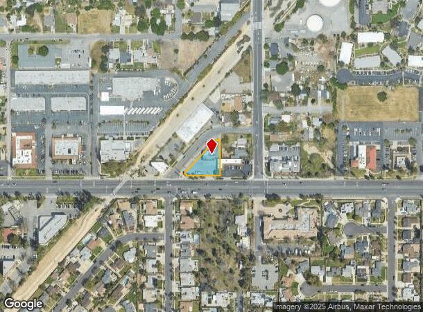
9464 Base Line Rd, Rancho Cucamonga, CA 91701


NEARBY LISTINGS FOR SALE OR LEASE
Property Detail
9464 Base Line Rd
Riverside-San Bernardino-Ontario, CA
Cucamonga Homestead Assn Lands
0202-092-05
CUCAMONGA HOMESTEAD ASSN PTN LOT 12 BLK 12 COM AT PT IN S LI SD LOT BEING ALSO PT ON N LI BASE LINE RD 66 FT WIDE 160 FT W FROM SE COR SD LOT TH N PARALLEL WITH W LI AMETHYST ST 66 FT WIDE 214.4 FT TO PT IN NLY LI LAND CONVEYED BY DEED DATED O1/18/22
Storebuilding
San Bernardino
X
California
06071C8630J
12
2025
0.31 AC
2025
Airport Area
002013
Inland Empire (California)
2,400 SF
DEMOGRAPHICS near 9464 Base Line Rd
1 mile
3 mile
5 mile
2024 Total Population
21,680
153,939
308,605
2029 Population
21,941
156,104
313,221
Pop Growth 2024-2029
+ 1.20%
+ 1.41%
+ 1.50%
Average Age
41
39
38
2024 Total Households
7,937
52,677
102,345
HH Growth 2024-2029
+ 1.20%
+ 1.44%
+ 1.56%
Median Household Inc
$78,806
$94,475
$92,966
Avg Household Size
2.70
2.90
2.90
2024 Avg HH Vehicles
2.00
2.00
2.00
Median Home Value
$569,804
$639,327
$653,231
Median Year Built
1979
1983
1982
Nearby Places
Map Layers
Map Styles
 Street
 Aerial
Transit
 Traffic
 Biking
Places
Listings with unknown addresses are not visible on the map
- Restaurants
- Banks
- Shops
- Fitness
- Groceries
PUBLIC TRANSPORTATION
COMMUTER RAIL
Upland (San Bernardino Line - Southern California Regional Rail Authority (Metrolink))
Drive
Walk
Distance
Upland (San Bernardino Line - Southern California Regional Rail Authority (Metrolink))
10 min
4.3 mi
Rancho Cucamonga (San Bernardino Line - Southern California Regional Rail Authority (Metrolink))
Drive
Walk
Distance
Rancho Cucamonga (San Bernardino Line - Southern California Regional Rail Authority (Metrolink))
9 min
4.6 mi
AIRPORT
Ontario International
Drive
Walk
Distance
Ontario International
15 min
8.0 mi
John Wayne/Orange County
Drive
Walk
Distance
John Wayne/Orange County
58 min
45.4 mi
Freight Ports
Port of Long Beach
Drive
Walk
Distance
Port of Long Beach
72 min
57.0 mi
Nearby Properties
Address
Land Use
TOTAL SIZE
Lot Size
Zoning
Address
Land Use
TOTAL SIZE
Lot Size
Zoning
376,610 SF
25.22 AC
Address
Land Use
TOTAL SIZE
Lot Size
Zoning
293,860 SF
16.10 AC
Address
Land Use
TOTAL SIZE
Lot Size
Zoning
447,119 SF
17.34 AC
Address
Land Use
TOTAL SIZE
Lot Size
Zoning
830,300 SF
39.99 AC
Address
Land Use
TOTAL SIZE
Lot Size
Zoning
190,724 SF
10.69 AC
Address
Land Use
TOTAL SIZE
Lot Size
Zoning
282,040 SF
13.07 AC
Address
Land Use
TOTAL SIZE
Lot Size
Zoning
295,512 SF
11.44 AC
Address
Land Use
TOTAL SIZE
Lot Size
Zoning
468,682 SF
19.40 AC
Address
Land Use
TOTAL SIZE
Lot Size
Zoning
174,092 SF
4.42 AC
Address
Land Use
TOTAL SIZE
Lot Size
Zoning
418,941 SF
11.07 AC
Address
Land Use
TOTAL SIZE
Lot Size
Zoning
251,645 SF
4.50 AC
Address
Land Use
TOTAL SIZE
Lot Size
Zoning
212,503 SF
10.36 AC
Address
Land Use
TOTAL SIZE
Lot Size
Zoning
401,226 SF
17.62 AC
Address
Land Use
TOTAL SIZE
Lot Size
Zoning
320,926 SF
15.72 AC
Address
Land Use
TOTAL SIZE
Lot Size
Zoning
502,917 SF
35.94 AC
Address
Land Use
TOTAL SIZE
Lot Size
Zoning
340,104 SF
8.95 AC
Address
Land Use
TOTAL SIZE
Lot Size
Zoning
249,672 SF
13.80 AC
Address
Land Use
TOTAL SIZE
Lot Size
Zoning
405,970 SF
19.23 AC
Address
Land Use
TOTAL SIZE
Lot Size
Zoning
139,059 SF
20.83 AC
Address
Land Use
TOTAL SIZE
Lot Size
Zoning
122,563 SF
5.76 AC
Address
Land Use
TOTAL SIZE
Lot Size
Zoning
225,727 SF
7.18 AC
Address
Land Use
TOTAL SIZE
Lot Size
Zoning
354,616 SF
20.07 AC
Address
Land Use
TOTAL SIZE
Lot Size
Zoning
131,190 SF
6.71 AC
Address
Land Use
TOTAL SIZE
Lot Size
Zoning
150,003 SF
7.81 AC
Address
Land Use
TOTAL SIZE
Lot Size
Zoning
468,410 SF
22.71 AC
Address
Land Use
TOTAL SIZE
Lot Size
Zoning
443,300 SF
23.06 AC
Address
Land Use
TOTAL SIZE
Lot Size
Zoning
441,970 SF
20.58 AC
Address
Land Use
TOTAL SIZE
Lot Size
Zoning
156,900 SF
7.39 AC
Address
Land Use
TOTAL SIZE
Lot Size
Zoning
127,559 SF
5.63 AC
Address
Land Use
TOTAL SIZE
Lot Size
Zoning
324,131 SF
19.81 AC
The World's #1 Commercial Real Estate Marketplace
Connect with us
© 2026 CoStar Group
The information above has been obtained from sources believed reliable. While we do not doubt its accuracy we have not verified it and make no guarantee, warranty or representation about it. It is your responsibility to independently confirm its accuracy and completeness. Any projections, opinions, assumptions, or estimates used are for example only and do not represent the current or future performance of the property. The value of this transaction to you depends on tax and other factors which should be evaluated by your tax, financial, and legal advisors. You and your advisors should conduct a careful, independent investigation of the property to determine to your satisfaction the suitability of the property for your needs.