Property Record
959 W 8Th Pl, Mesa, AZ 85201


NEARBY LISTINGS FOR SALE OR LEASE
Property Detail
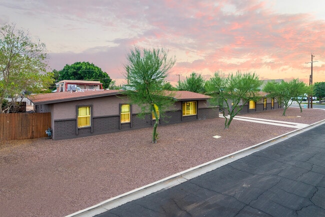
959 W 8Th Pl
Phoenix-Mesa-Scottsdale, AZ
Country Club Village Replat Lot 1-5, 13-
135-22-059
Maricopa
Triplex
Arizona
X
0.20 AC
04013C2265M
Country Club
2,216 SF
Phoenix
DEMOGRAPHICS near 959 W 8Th Pl
1 Mile
3 Mile
5 Mile
2024 Total Population
18,936
142,087
347,321
2029 Population
20,508
153,728
375,166
Pop Growth 2024-2029
+ 8.30%
+ 8.19%
+ 8.02%
Average Age
35
35
35
2024 Total Households
7,162
54,932
133,946
HH Growth 2024-2029
+ 8.49%
+ 8.36%
+ 8.32%
Median Household Inc
$50,626
$49,623
$59,443
Avg Household Size
2.50
2.50
2.40
2024 Avg HH Vehicles
2.00
2.00
2.00
Median Home Value
$335,135
$274,775
$332,627
Median Year Built
1977
1980
1979
Nearby Places
Map Layers
Map Styles
 Street
 Aerial
- Restaurants
- Banks
- Shops
- Fitness
- Groceries
PUBLIC TRANSPORTATION
AIRPORT
Phoenix Sky Harbor International
DRIVE
WALK
Distance
Phoenix Sky Harbor International
16 min
10.6 mi
Phoenix-Mesa Gateway
DRIVE
WALK
Distance
Phoenix-Mesa Gateway
30 min
19.2 mi
Freight Ports
Port of San Diego
DRIVE
WALK
Distance
Port of San Diego
411 min
374.2 mi
SALE & LEASE HISTORY
LISTING DATE
SALE/LEASE

Jun 07, 2025
For Sale
Nearby Properties
Address
Land Use
TOTAL SIZE
Lot Size
Zoning
Address
Land Use
TOTAL SIZE
Lot Size
Zoning
439,211 SF
77.92 AC
C-G
Address
Land Use
TOTAL SIZE
Lot Size
Zoning
805,814 SF
115.19 AC
C-G
Address
Land Use
TOTAL SIZE
Lot Size
Zoning
8.79 AC
PF
Address
Land Use
TOTAL SIZE
Lot Size
Zoning
197,454 SF
18.97 AC
PF
Address
Land Use
TOTAL SIZE
Lot Size
Zoning
377,442 SF
0.21 AC
C-DT
Address
Land Use
TOTAL SIZE
Lot Size
Zoning
564,649 SF
7.19 AC
RCC
Address
Land Use
TOTAL SIZE
Lot Size
Zoning
448,308 SF
6.30 AC
GID
Address
Land Use
TOTAL SIZE
Lot Size
Zoning
267,023 SF
19.58 AC
PEP
Address
Land Use
TOTAL SIZE
Lot Size
Zoning
485,625 SF
45.99 AC
PF
Address
Land Use
TOTAL SIZE
Lot Size
Zoning
32,619 SF
2.40 AC
C-G
Address
Land Use
TOTAL SIZE
Lot Size
Zoning
435,896 SF
3.40 AC
PCC2
Address
Land Use
TOTAL SIZE
Lot Size
Zoning
501,927 SF
8.13 AC
GC
Address
Land Use
TOTAL SIZE
Lot Size
Zoning
579,506 SF
17.78 AC
PF
Address
Land Use
TOTAL SIZE
Lot Size
Zoning
418,678 SF
18.63 AC
C-G
Address
Land Use
TOTAL SIZE
Lot Size
Zoning
407,570 SF
6.22 AC
PEP
Address
Land Use
TOTAL SIZE
Lot Size
Zoning
23,030 SF
0.99 AC
M-H
Address
Land Use
TOTAL SIZE
Lot Size
Zoning
454,015 SF
10.03 AC
DB1
Address
Land Use
TOTAL SIZE
Lot Size
Zoning
322,662 SF
9.29 AC
R-6
Address
Land Use
TOTAL SIZE
Lot Size
Zoning
1.46 AC
C-G
Address
Land Use
TOTAL SIZE
Lot Size
Zoning
632,909 SF
5.83 AC
C-G
Address
Land Use
TOTAL SIZE
Lot Size
Zoning
302,962 SF
6.58 AC
HID
Address
Land Use
TOTAL SIZE
Lot Size
Zoning
160,533 SF
7.59 AC
GC
Address
Land Use
TOTAL SIZE
Lot Size
Zoning
239,532 SF
9.94 AC
PCC-1
Address
Land Use
TOTAL SIZE
Lot Size
Zoning
387,531 SF
18.47 AC
M-H
Address
Land Use
TOTAL SIZE
Lot Size
Zoning
478,411 SF
4.07 AC
CDT
Address
Land Use
TOTAL SIZE
Lot Size
Zoning
247,808 SF
5.85 AC
MU4
Address
Land Use
TOTAL SIZE
Lot Size
Zoning
210,613 SF
15.50 AC
I-1
Address
Land Use
TOTAL SIZE
Lot Size
Zoning
337,024 SF
5.93 AC
GID
Address
Land Use
TOTAL SIZE
Lot Size
Zoning
199,472 SF
4.79 AC
C-DT
Address
Land Use
TOTAL SIZE
Lot Size
Zoning
152,199 SF
21.96 AC
C-G
The World's #1 Commercial Real Estate Marketplace
Connect with us
© 2025 CoStar Group
The information above has been obtained from sources believed reliable. While we do not doubt its accuracy we have not verified it and make no guarantee, warranty or representation about it. It is your responsibility to independently confirm its accuracy and completeness. Any projections, opinions, assumptions, or estimates used are for example only and do not represent the current or future performance of the property. The value of this transaction to you depends on tax and other factors which should be evaluated by your tax, financial, and legal advisors. You and your advisors should conduct a careful, independent investigation of the property to determine to your satisfaction the suitability of the property for your needs.