Property Record
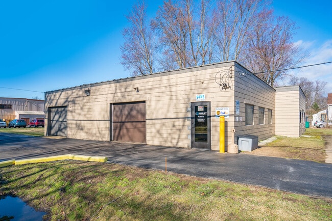
9485 Stone Rd, Clay, MI 48001


NEARBY LISTINGS FOR SALE OR LEASE
Property Detail
9485 Stone Rd
Detroit-Warren-Dearborn, MI
Supervisor Roy T Gilberts Plat #8
14-469-0037-000
N 305 FT LOT 762 SUP ROY T GILBERTS PLAT NO 8 SEC 3 T2N R16E
Manufacturinglight
St. Clair
X
Michigan
26147C0518D
762
2025
0.97 AC
2025
St Clair & Lapeer Counties
646000
Detroit
5,019 SF
DEMOGRAPHICS near 9485 Stone Rd
1 Mile
3 Mile
5 Mile
2024 Total Population
4,772
10,143
15,485
2029 Population
4,807
10,280
15,715
Pop Growth 2024-2029
+ 0.73%
+ 1.35%
+ 1.49%
Average Age
44
45
47
2024 Total Households
2,124
4,461
6,981
HH Growth 2024-2029
+ 0.61%
+ 1.34%
+ 1.53%
Median Household Inc
$53,458
$56,928
$59,962
Avg Household Size
2.20
2.20
2.20
2024 Avg HH Vehicles
2.00
2.00
2.00
Median Home Value
$168,262
$189,325
$226,523
Median Year Built
1970
1972
1972
Nearby Places
Map Layers
Map Styles
 Street
 Aerial
- Restaurants
- Banks
- Shops
- Fitness
- Groceries
SALE & LEASE HISTORY
LISTING DATE
SALE/LEASE

Apr 19, 2022
For Sale
Nearby Properties
Address
Land Use
TOTAL SIZE
Lot Size
Zoning
Address
Land Use
TOTAL SIZE
Lot Size
Zoning
695.65 AC
RS-1
Address
Land Use
TOTAL SIZE
Lot Size
Zoning
69,306 SF
13.25 AC
C-3
Address
Land Use
TOTAL SIZE
Lot Size
Zoning
Address
Land Use
TOTAL SIZE
Lot Size
Zoning
Address
Land Use
TOTAL SIZE
Lot Size
Zoning
1,904 SF
98.63 AC
MHP
Address
Land Use
TOTAL SIZE
Lot Size
Zoning
48,036 SF
4.07 AC
CBD
Address
Land Use
TOTAL SIZE
Lot Size
Zoning
54,976 SF
6.83 AC
R-3
Address
Land Use
TOTAL SIZE
Lot Size
Zoning
9.71 AC
R-1
Address
Land Use
TOTAL SIZE
Lot Size
Zoning
68,193 SF
3.38 AC
R-2
Address
Land Use
TOTAL SIZE
Lot Size
Zoning
464.30 AC
R-1 RES
Address
Land Use
TOTAL SIZE
Lot Size
Zoning
9,553 SF
0.55 AC
R-3
Address
Land Use
TOTAL SIZE
Lot Size
Zoning
492 AC
RS-1
Address
Land Use
TOTAL SIZE
Lot Size
Zoning
37,823 SF
1.77 AC
C-3
Address
Land Use
TOTAL SIZE
Lot Size
Zoning
11,052 SF
1.73 AC
CBD
Address
Land Use
TOTAL SIZE
Lot Size
Zoning
48,646 SF
2.95 AC
C-3
Address
Land Use
TOTAL SIZE
Lot Size
Zoning
12,936 SF
1.47 AC
CBD
Address
Land Use
TOTAL SIZE
Lot Size
Zoning
4,023 SF
1.50 AC
GB
Address
Land Use
TOTAL SIZE
Lot Size
Zoning
19,140 SF
2.72 AC
R-3
Address
Land Use
TOTAL SIZE
Lot Size
Zoning
42,914 SF
6.56 AC
C-3
Address
Land Use
TOTAL SIZE
Lot Size
Zoning
18,069 SF
2.73 AC
R-3
Address
Land Use
TOTAL SIZE
Lot Size
Zoning
5,160 SF
7.74 AC
RS-1
Address
Land Use
TOTAL SIZE
Lot Size
Zoning
7,100 SF
1.23 AC
CBD
Address
Land Use
TOTAL SIZE
Lot Size
Zoning
3,915 SF
8.29 AC
C-3
Address
Land Use
TOTAL SIZE
Lot Size
Zoning
3,216 SF
0.71 AC
CBD
Address
Land Use
TOTAL SIZE
Lot Size
Zoning
17,589 SF
3.27 AC
R-3
Address
Land Use
TOTAL SIZE
Lot Size
Zoning
4,556 SF
1.79 AC
GB
Address
Land Use
TOTAL SIZE
Lot Size
Zoning
4,088 SF
49.56 AC
R-1
Address
Land Use
TOTAL SIZE
Lot Size
Zoning
47,032 SF
3.78 AC
I-1
Address
Land Use
TOTAL SIZE
Lot Size
Zoning
0.39 AC
R-3
Address
Land Use
TOTAL SIZE
Lot Size
Zoning
3,123 SF
0.89 AC
GB
The World's #1 Commercial Real Estate Marketplace
Connect with us
© 2025 CoStar Group
The information above has been obtained from sources believed reliable. While we do not doubt its accuracy we have not verified it and make no guarantee, warranty or representation about it. It is your responsibility to independently confirm its accuracy and completeness. Any projections, opinions, assumptions, or estimates used are for example only and do not represent the current or future performance of the property. The value of this transaction to you depends on tax and other factors which should be evaluated by your tax, financial, and legal advisors. You and your advisors should conduct a careful, independent investigation of the property to determine to your satisfaction the suitability of the property for your needs.