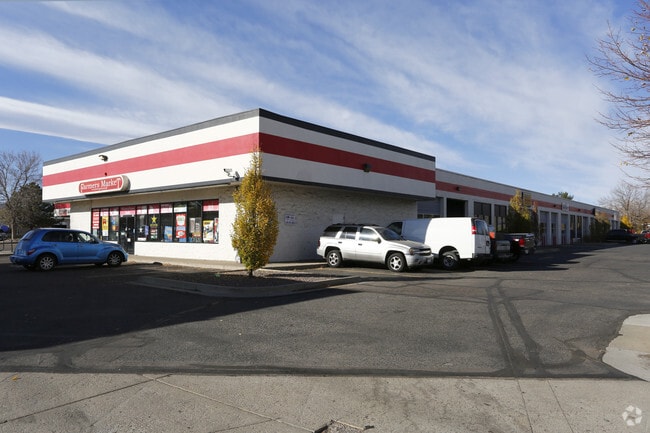
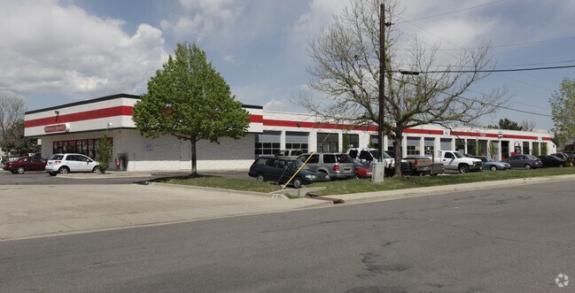
Property Record
9491 W 44Th Ave, Wheat Ridge, CO 80033

Current Lease Availabilities
NEARBY LISTINGS FOR SALE OR LEASE
Property Detail
9491 W 44Th Ave
Denver-Aurora-Centennial, CO
Bonita Minor Replat Of
39-222-08-002
SECTION 22 TOWNSHIP 03 RANGE 69 QTR NW SUBDIVISIONCD 084700 SUBDIVISIONNAME BONITA MINOR REPLAT OF BLOCK LOT 0001 SIZE: 11631 TRACT VALUE: .267
Vacantlanddestroyeduninhabitableimprovement
Jefferson
X
Colorado
08059C0213F
1
2023
0.27 AC
2024
West Denver
010403
Denver
DEMOGRAPHICS near 9491 W 44Th Ave
1 mile
3 mile
5 mile
2024 Total Population
12,460
108,809
308,303
2029 Population
12,521
108,356
308,564
Pop Growth 2024-2029
+ 0.49%
(0.42%)
+ 0.08%
Average Age
41
42
40
2024 Total Households
5,572
48,265
132,432
HH Growth 2024-2029
+ 0.36%
(0.50%)
+ 0.06%
Median Household Inc
$71,578
$78,960
$84,851
Avg Household Size
2.10
2.20
2.20
2024 Avg HH Vehicles
2.00
2.00
2.00
Median Home Value
$479,869
$549,494
$568,909
Median Year Built
1970
1969
1972
Nearby Places
Map Layers
Map Styles
 Street
 Aerial
Transit
 Traffic
 Biking
Places
Listings with unknown addresses are not visible on the map
- Restaurants
- Banks
- Shops
- Fitness
- Groceries
PUBLIC TRANSPORTATION
COMMUTER RAIL
Arvada Ridge Station Track 1 (Union Station to Wheat Ridge Ward Station - Regional Transportation District)
Drive
Walk
Distance
Arvada Ridge Station Track 1 (Union Station to Wheat Ridge Ward Station - Regional Transportation District)
4 min
1.9 mi
Arvada Ridge Station Track 2 (Union Station to Wheat Ridge Ward Station - Regional Transportation District)
Drive
Walk
Distance
Arvada Ridge Station Track 2 (Union Station to Wheat Ridge Ward Station - Regional Transportation District)
4 min
2.0 mi
AIRPORT
Denver International
Drive
Walk
Distance
Denver International
37 min
29.5 mi
Freight Ports
Tulsa Port Of Catoosa
Drive
Walk
Distance
Tulsa Port Of Catoosa
734 min
715.0 mi
Nearby Properties
Address
Land Use
TOTAL SIZE
Lot Size
Zoning
Address
Land Use
TOTAL SIZE
Lot Size
Zoning
830,160 SF
26.93 AC
Address
Land Use
TOTAL SIZE
Lot Size
Zoning
269,013 SF
31.89 AC
Address
Land Use
TOTAL SIZE
Lot Size
Zoning
111,673 SF
29.06 AC
Address
Land Use
TOTAL SIZE
Lot Size
Zoning
298,150 SF
24.21 AC
Address
Land Use
TOTAL SIZE
Lot Size
Zoning
187,095 SF
23.42 AC
Address
Land Use
TOTAL SIZE
Lot Size
Zoning
187,745 SF
16.25 AC
Address
Land Use
TOTAL SIZE
Lot Size
Zoning
436,238 SF
13.94 AC
Address
Land Use
TOTAL SIZE
Lot Size
Zoning
365,230 SF
12.51 AC
Address
Land Use
TOTAL SIZE
Lot Size
Zoning
167,420 SF
5.84 AC
Address
Land Use
TOTAL SIZE
Lot Size
Zoning
389,561 SF
10.73 AC
Address
Land Use
TOTAL SIZE
Lot Size
Zoning
131,135 SF
2.83 AC
Address
Land Use
TOTAL SIZE
Lot Size
Zoning
262,699 SF
13.10 AC
A2
Address
Land Use
TOTAL SIZE
Lot Size
Zoning
330,357 SF
15.16 AC
Address
Land Use
TOTAL SIZE
Lot Size
Zoning
241,243 SF
9.08 AC
Address
Land Use
TOTAL SIZE
Lot Size
Zoning
101,761 SF
4.34 AC
Address
Land Use
TOTAL SIZE
Lot Size
Zoning
115,719 SF
5.93 AC
Address
Land Use
TOTAL SIZE
Lot Size
Zoning
142,200 SF
9.82 AC
Address
Land Use
TOTAL SIZE
Lot Size
Zoning
7,826 SF
0.48 AC
Address
Land Use
TOTAL SIZE
Lot Size
Zoning
2,997 SF
5.28 AC
Address
Land Use
TOTAL SIZE
Lot Size
Zoning
163,361 SF
17.09 AC
Address
Land Use
TOTAL SIZE
Lot Size
Zoning
125,884 SF
8.88 AC
Address
Land Use
TOTAL SIZE
Lot Size
Zoning
91,734 SF
9.69 AC
Address
Land Use
TOTAL SIZE
Lot Size
Zoning
84,061 SF
9.08 AC
Address
Land Use
TOTAL SIZE
Lot Size
Zoning
144,325 SF
13.22 AC
Address
Land Use
TOTAL SIZE
Lot Size
Zoning
109,401 SF
12.19 AC
Address
Land Use
TOTAL SIZE
Lot Size
Zoning
114,348 SF
3 AC
Address
Land Use
TOTAL SIZE
Lot Size
Zoning
139,913 SF
2.87 AC
Address
Land Use
TOTAL SIZE
Lot Size
Zoning
121,389 SF
3.58 AC
Address
Land Use
TOTAL SIZE
Lot Size
Zoning
177,075 SF
8.71 AC
Address
Land Use
TOTAL SIZE
Lot Size
Zoning
130,662 SF
9.67 AC
The World's #1 Commercial Real Estate Marketplace
Connect with us
© 2026 CoStar Group
The information above has been obtained from sources believed reliable. While we do not doubt its accuracy we have not verified it and make no guarantee, warranty or representation about it. It is your responsibility to independently confirm its accuracy and completeness. Any projections, opinions, assumptions, or estimates used are for example only and do not represent the current or future performance of the property. The value of this transaction to you depends on tax and other factors which should be evaluated by your tax, financial, and legal advisors. You and your advisors should conduct a careful, independent investigation of the property to determine to your satisfaction the suitability of the property for your needs.