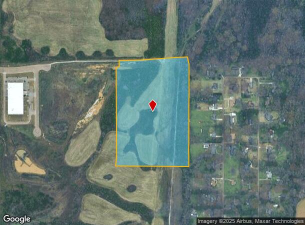
Property Record
Highway 72 N Of, Collierville, TN 38017
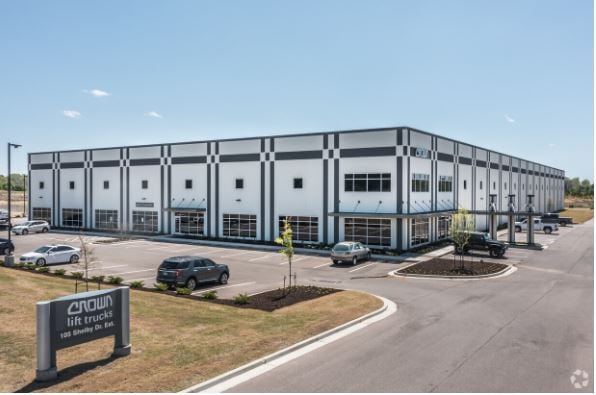
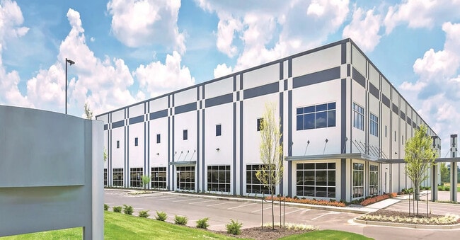

Current Lease Availabilities
NEARBY LISTINGS FOR SALE OR LEASE
Property Detail
Highway 72 N Of
Memphis, TN-MS-AR
Macduff Family Farm Llc Prop
183-058.00
DISTRICT: 10, COUNTY AREA: N51
Agriculturalland
Fayette
X
Tennessee
47157C0495G
36.62 AC
2024
Fayette County
2025
Memphis
021611
DEMOGRAPHICS near Highway 72 N Of
1 Mile
3 Mile
5 Mile
2024 Total Population
262
12,909
40,555
2029 Population
288
12,867
40,087
Pop Growth 2024-2029
+ 9.92%
(0.33%)
(1.15%)
Average Age
47
41
41
2024 Total Households
102
4,547
14,738
HH Growth 2024-2029
+ 9.80%
(0.18%)
(1.19%)
Median Household Inc
$113,333
$110,494
$113,798
Avg Household Size
2.60
2.80
2.70
2024 Avg HH Vehicles
3.00
2.00
2.00
Median Home Value
$486,363
$372,588
$357,821
Median Year Built
2000
1989
1994
Nearby Places
- Restaurants
- Banks
- Shops
- Fitness
- Groceries
PUBLIC TRANSPORTATION
AIRPORT
Memphis International
DRIVE
WALK
Distance
Memphis International
37 min
23.0 mi
Freight Ports
Port of Shreveport
DRIVE
WALK
Distance
Port of Shreveport
439 min
396.8 mi
Nearby Properties
Address
Land Use
TOTAL SIZE
Lot Size
Zoning
Address
Land Use
TOTAL SIZE
Lot Size
Zoning
241,626 SF
19.59 AC
Address
Land Use
TOTAL SIZE
Lot Size
Zoning
98,107 SF
10.09 AC
RI
Address
Land Use
TOTAL SIZE
Lot Size
Zoning
963,300 SF
52.78 AC
B3
Address
Land Use
TOTAL SIZE
Lot Size
Zoning
630,028 SF
40.74 AC
B3
Address
Land Use
TOTAL SIZE
Lot Size
Zoning
256,456 SF
51.05 AC
M2
Address
Land Use
TOTAL SIZE
Lot Size
Zoning
36,800 SF
18.50 AC
Address
Land Use
TOTAL SIZE
Lot Size
Zoning
155.29 AC
CA
Address
Land Use
TOTAL SIZE
Lot Size
Zoning
111,730 SF
11.30 AC
RI
Address
Land Use
TOTAL SIZE
Lot Size
Zoning
49,377 SF
17.50 AC
Address
Land Use
TOTAL SIZE
Lot Size
Zoning
125,993 SF
9.08 AC
RI
Address
Land Use
TOTAL SIZE
Lot Size
Zoning
160,180 SF
12.88 AC
GI
Address
Land Use
TOTAL SIZE
Lot Size
Zoning
125,846 SF
10.02 AC
M1
Address
Land Use
TOTAL SIZE
Lot Size
Zoning
130,000 SF
11.98 AC
RI
Address
Land Use
TOTAL SIZE
Lot Size
Zoning
27,642 SF
5.38 AC
Address
Land Use
TOTAL SIZE
Lot Size
Zoning
31,956 SF
10.64 AC
Address
Land Use
TOTAL SIZE
Lot Size
Zoning
525,656 SF
14.10 AC
RI
Address
Land Use
TOTAL SIZE
Lot Size
Zoning
22,272 SF
3.26 AC
RI
Address
Land Use
TOTAL SIZE
Lot Size
Zoning
5.62 AC
R-1
Address
Land Use
TOTAL SIZE
Lot Size
Zoning
86,918 SF
4.98 AC
GI
Address
Land Use
TOTAL SIZE
Lot Size
Zoning
1,305 SF
30.30 AC
AG
Address
Land Use
TOTAL SIZE
Lot Size
Zoning
3.46 AC
R-1
Address
Land Use
TOTAL SIZE
Lot Size
Zoning
11,967 SF
3.48 AC
GI
Address
Land Use
TOTAL SIZE
Lot Size
Zoning
80,000 SF
6.66 AC
Address
Land Use
TOTAL SIZE
Lot Size
Zoning
85,538 SF
4.72 AC
R-4
Address
Land Use
TOTAL SIZE
Lot Size
Zoning
205,418 SF
6.83 AC
GI
Address
Land Use
TOTAL SIZE
Lot Size
Zoning
12,728 SF
5 AC
Address
Land Use
TOTAL SIZE
Lot Size
Zoning
76,134 SF
17.02 AC
M2
Address
Land Use
TOTAL SIZE
Lot Size
Zoning
36,156 SF
4 AC
RI
The World's #1 Commercial Real Estate Marketplace
Connect with us
© 2025 CoStar Group
The information above has been obtained from sources believed reliable. While we do not doubt its accuracy we have not verified it and make no guarantee, warranty or representation about it. It is your responsibility to independently confirm its accuracy and completeness. Any projections, opinions, assumptions, or estimates used are for example only and do not represent the current or future performance of the property. The value of this transaction to you depends on tax and other factors which should be evaluated by your tax, financial, and legal advisors. You and your advisors should conduct a careful, independent investigation of the property to determine to your satisfaction the suitability of the property for your needs.