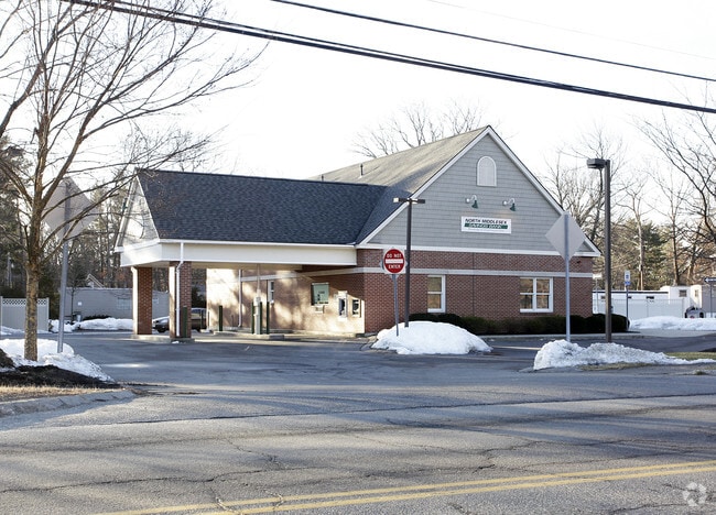
Property Record
95 Front St, Hopkinton, MA 01748

NEARBY LISTINGS FOR SALE OR LEASE
Property Detail
95 Front St
HOPK-000025R-000019-F000000
Ashbrook Village
Sfr
Middlesex
X
Massachusetts
25017C0628G
12
2025
0.94 AC
2025
Groton/Townsend
388200
Boston
1,872 SF
Boston-Cambridge-Newton, MA-NH
DEMOGRAPHICS near 95 Front St
1 Mile
3 Mile
5 Mile
2024 Total Population
3,730
11,789
31,866
2029 Population
3,703
11,745
31,792
Pop Growth 2024-2029
(0.72%)
(0.37%)
(0.23%)
Average Age
43
43
43
2024 Total Households
1,104
3,573
11,133
HH Growth 2024-2029
(0.45%)
(0.14%)
(0.20%)
Median Household Inc
$98,664
$112,938
$118,173
Avg Household Size
2.40
2.50
2.50
2024 Avg HH Vehicles
2.00
2.00
2.00
Median Home Value
$364,830
$406,858
$419,841
Median Year Built
1958
1973
1976
Nearby Places
Map Layers
Map Styles
 Street
 Aerial
- Restaurants
- Banks
- Shops
- Fitness
- Groceries
PUBLIC TRANSPORTATION
COMMUTER RAIL
Southborough (Framingham/Worcester Line - Massachusetts Bay Transportation Authority Commuter Rail (Purple Line))
DRIVE
WALK
Distance
Southborough (Framingham/Worcester Line - Massachusetts Bay Transportation Authority Commuter Rail (Purple Line))
10 min
4.9 mi
Ashland (Framingham/Worcester Line - Massachusetts Bay Transportation Authority Commuter Rail (Purple Line))
DRIVE
WALK
Distance
Ashland (Framingham/Worcester Line - Massachusetts Bay Transportation Authority Commuter Rail (Purple Line))
15 min
5.8 mi
AIRPORT
Worcester Regional
DRIVE
WALK
Distance
Worcester Regional
45 min
26.3 mi
General Edward Lawrence Logan International
DRIVE
WALK
Distance
General Edward Lawrence Logan International
55 min
35.9 mi
Freight Ports
Port of Boston
DRIVE
WALK
Distance
Port of Boston
53 min
34.2 mi
SALE & LEASE HISTORY
LISTING DATE
SALE/LEASE

Mar 01, 2022
For Sale
Nearby Properties
Address
Land Use
TOTAL SIZE
Lot Size
Zoning
Address
Land Use
TOTAL SIZE
Lot Size
Zoning
35.54 AC
Address
Land Use
TOTAL SIZE
Lot Size
Zoning
51.50 AC
A2
Address
Land Use
TOTAL SIZE
Lot Size
Zoning
18.22 AC
OSMU
Address
Land Use
TOTAL SIZE
Lot Size
Zoning
97.74 AC
IA
Address
Land Use
TOTAL SIZE
Lot Size
Zoning
143,464 SF
108.03 AC
RB
Address
Land Use
TOTAL SIZE
Lot Size
Zoning
29.43 AC
IA
Address
Land Use
TOTAL SIZE
Lot Size
Zoning
25.20 AC
A
Address
Land Use
TOTAL SIZE
Lot Size
Zoning
133,897 SF
11.17 AC
RB1
Address
Land Use
TOTAL SIZE
Lot Size
Zoning
94,399 SF
28.70 AC
RB1
Address
Land Use
TOTAL SIZE
Lot Size
Zoning
7.81 AC
BR
Address
Land Use
TOTAL SIZE
Lot Size
Zoning
90,256 SF
14.48 AC
R4
Address
Land Use
TOTAL SIZE
Lot Size
Zoning
113,540 SF
5.89 AC
CS
Address
Land Use
TOTAL SIZE
Lot Size
Zoning
169,461 SF
32.30 AC
40
Address
Land Use
TOTAL SIZE
Lot Size
Zoning
162,890 SF
15.47 AC
Address
Land Use
TOTAL SIZE
Lot Size
Zoning
8.17 AC
B
Address
Land Use
TOTAL SIZE
Lot Size
Zoning
134.63 AC
A
Address
Land Use
TOTAL SIZE
Lot Size
Zoning
129,520 SF
19.42 AC
IA
Address
Land Use
TOTAL SIZE
Lot Size
Zoning
40,000 SF
26.63 AC
30
Address
Land Use
TOTAL SIZE
Lot Size
Zoning
141,100 SF
20.53 AC
IA
Address
Land Use
TOTAL SIZE
Lot Size
Zoning
36.90 AC
RA
Address
Land Use
TOTAL SIZE
Lot Size
Zoning
48,269 SF
9.22 AC
Address
Land Use
TOTAL SIZE
Lot Size
Zoning
101,450 SF
11.46 AC
Address
Land Use
TOTAL SIZE
Lot Size
Zoning
1,100 SF
796.20 AC
A
Address
Land Use
TOTAL SIZE
Lot Size
Zoning
63,600 SF
4.93 AC
IA
Address
Land Use
TOTAL SIZE
Lot Size
Zoning
53,945 SF
11.47 AC
C
Address
Land Use
TOTAL SIZE
Lot Size
Zoning
100,000 SF
2.86 AC
30
Address
Land Use
TOTAL SIZE
Lot Size
Zoning
68,722 SF
10.29 AC
Address
Land Use
TOTAL SIZE
Lot Size
Zoning
57,744 SF
10.49 AC
BD
Address
Land Use
TOTAL SIZE
Lot Size
Zoning
87,706 SF
7.61 AC
A
Address
Land Use
TOTAL SIZE
Lot Size
Zoning
154,604 SF
10.38 AC
IA
The World's #1 Commercial Real Estate Marketplace
Connect with us
© 2026 CoStar Group
The information above has been obtained from sources believed reliable. While we do not doubt its accuracy we have not verified it and make no guarantee, warranty or representation about it. It is your responsibility to independently confirm its accuracy and completeness. Any projections, opinions, assumptions, or estimates used are for example only and do not represent the current or future performance of the property. The value of this transaction to you depends on tax and other factors which should be evaluated by your tax, financial, and legal advisors. You and your advisors should conduct a careful, independent investigation of the property to determine to your satisfaction the suitability of the property for your needs.