Property Record
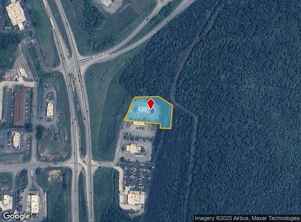
95 Us Highway 27 Byp, Bremen, GA 30110
NEARBY LISTINGS FOR SALE OR LEASE
Property Detail
95 Us Highway 27 Byp
Z69-0080
TR-4 (1.08AC) ALABAMA AVE
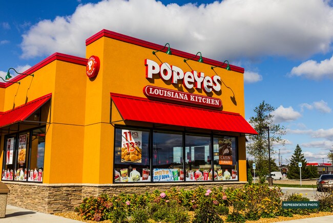
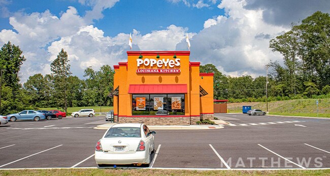
Restaurantdrivein
Carroll
X
Georgia
13143C0235B
1.08 AC
2025
W Carroll County
2025
Atlanta
910301
Atlanta-Sandy Springs-Roswell, GA
2,860 SF
DEMOGRAPHICS near 95 Us Highway 27 Byp
1 Mile
3 Mile
5 Mile
2024 Total Population
272
10,102
18,225
2029 Population
304
11,390
20,504
Pop Growth 2024-2029
+ 11.76%
+ 12.75%
+ 12.50%
Average Age
39
38
38
2024 Total Households
100
3,655
6,636
HH Growth 2024-2029
+ 12.00%
+ 12.78%
+ 12.54%
Median Household Inc
$56,666
$63,491
$62,741
Avg Household Size
2.70
2.70
2.70
2024 Avg HH Vehicles
2.00
2.00
2.00
Median Home Value
$188,094
$202,385
$204,964
Median Year Built
1979
1990
1990
Nearby Places
Map Layers
Map Styles
 Street
 Aerial
- Restaurants
- Banks
- Shops
- Fitness
- Groceries
SALE & LEASE HISTORY
LISTING DATE
SALE/LEASE

Mar 26, 2019
For Sale
Jul 09, 2024
For Sale
Nearby Properties
Address
Land Use
TOTAL SIZE
Lot Size
Zoning
Address
Land Use
TOTAL SIZE
Lot Size
Zoning
3,910 SF
19.13 AC
002
Address
Land Use
TOTAL SIZE
Lot Size
Zoning
95,160 SF
21.58 AC
001
Address
Land Use
TOTAL SIZE
Lot Size
Zoning
57,551 SF
3.71 AC
001
Address
Land Use
TOTAL SIZE
Lot Size
Zoning
256,320 SF
38.83 AC
003
Address
Land Use
TOTAL SIZE
Lot Size
Zoning
14,983 SF
23.74 AC
002
Address
Land Use
TOTAL SIZE
Lot Size
Zoning
6,363 SF
13.29 AC
001
Address
Land Use
TOTAL SIZE
Lot Size
Zoning
157,011 SF
20.75 AC
002
Address
Land Use
TOTAL SIZE
Lot Size
Zoning
86,316 SF
12.85 AC
C2
Address
Land Use
TOTAL SIZE
Lot Size
Zoning
156,806 SF
29.02 AC
003
Address
Land Use
TOTAL SIZE
Lot Size
Zoning
27,355 SF
3.19 AC
001
Address
Land Use
TOTAL SIZE
Lot Size
Zoning
36,250 SF
72.32 AC
001
Address
Land Use
TOTAL SIZE
Lot Size
Zoning
22,780 SF
1.36 AC
C2
Address
Land Use
TOTAL SIZE
Lot Size
Zoning
9,315 SF
25.99 AC
A-1
Address
Land Use
TOTAL SIZE
Lot Size
Zoning
16,840 SF
2.04 AC
002
Address
Land Use
TOTAL SIZE
Lot Size
Zoning
29,574 SF
10.44 AC
A-1
Address
Land Use
TOTAL SIZE
Lot Size
Zoning
6,448 SF
21.50 AC
001
Address
Land Use
TOTAL SIZE
Lot Size
Zoning
39,050 SF
6.75 AC
001
Address
Land Use
TOTAL SIZE
Lot Size
Zoning
2,274 SF
11.20 AC
004
Address
Land Use
TOTAL SIZE
Lot Size
Zoning
22,883 SF
3.50 AC
001
Address
Land Use
TOTAL SIZE
Lot Size
Zoning
142,133 SF
13.87 AC
002
Address
Land Use
TOTAL SIZE
Lot Size
Zoning
28,186 SF
8 AC
C
Address
Land Use
TOTAL SIZE
Lot Size
Zoning
11,900 SF
2.48 AC
C
Address
Land Use
TOTAL SIZE
Lot Size
Zoning
29,600 SF
11.24 AC
001
Address
Land Use
TOTAL SIZE
Lot Size
Zoning
17,583 SF
2.82 AC
001
Address
Land Use
TOTAL SIZE
Lot Size
Zoning
49,976 SF
3.75 AC
C
Address
Land Use
TOTAL SIZE
Lot Size
Zoning
29,600 SF
3.73 AC
C
Address
Land Use
TOTAL SIZE
Lot Size
Zoning
12,172 SF
1.03 AC
002
Address
Land Use
TOTAL SIZE
Lot Size
Zoning
44,244 SF
5.20 AC
001
Address
Land Use
TOTAL SIZE
Lot Size
Zoning
22,552 SF
3.74 AC
002
Address
Land Use
TOTAL SIZE
Lot Size
Zoning
22,572 SF
2.62 AC
C
The World's #1 Commercial Real Estate Marketplace
Connect with us
© 2026 CoStar Group
The information above has been obtained from sources believed reliable. While we do not doubt its accuracy we have not verified it and make no guarantee, warranty or representation about it. It is your responsibility to independently confirm its accuracy and completeness. Any projections, opinions, assumptions, or estimates used are for example only and do not represent the current or future performance of the property. The value of this transaction to you depends on tax and other factors which should be evaluated by your tax, financial, and legal advisors. You and your advisors should conduct a careful, independent investigation of the property to determine to your satisfaction the suitability of the property for your needs.