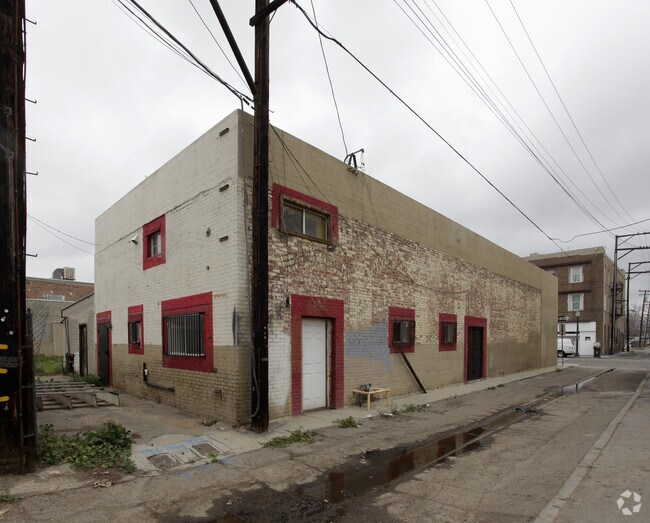
Property Record
950 Baker St, Bakersfield, CA 93305


NEARBY LISTINGS FOR SALE OR LEASE
Property Detail
950 Baker St
Bakersfield, CA
Bakersfield
014-320-10-00-3
CITY KERN , BLOCK 73 , LOT P1-4
Retailwithmorethanonenonretailuse
Kern
X
California
06029C1840E
p1
2024
0.07 AC
2025
Northeast Bakersfield
001302
Bakersfield
2,700 SF
DEMOGRAPHICS near 950 Baker St
1 Mile
3 Mile
5 Mile
2024 Total Population
20,328
138,646
288,181
2029 Population
20,287
138,564
288,445
Pop Growth 2024-2029
(0.20%)
(0.06%)
+ 0.09%
Average Age
32
33
34
2024 Total Households
5,986
43,267
91,897
HH Growth 2024-2029
(0.13%)
(0.03%)
+ 0.09%
Median Household Inc
$28,895
$39,191
$43,518
Avg Household Size
3.20
3.10
3.00
2024 Avg HH Vehicles
1.00
2.00
2.00
Median Home Value
$162,435
$210,880
$230,688
Median Year Built
1964
1963
1970
Nearby Places
Map Layers
Map Styles
 Street
 Aerial
- Restaurants
- Banks
- Shops
- Fitness
- Groceries
PUBLIC TRANSPORTATION
COMMUTER RAIL
Bakersfield (San Joaquins - Amtrak)
DRIVE
WALK
Distance
Bakersfield (San Joaquins - Amtrak)
4 min
1.4 mi
AIRPORT
Meadows Field
DRIVE
WALK
Distance
Meadows Field
16 min
7.2 mi
Freight Ports
The Port of Hueneme
DRIVE
WALK
Distance
The Port of Hueneme
157 min
125.8 mi
SALE & LEASE HISTORY
LISTING DATE
SALE/LEASE

Sep 25, 2016
For Lease
Jun 26, 2017
For Sale
Nearby Properties
Address
Land Use
TOTAL SIZE
Lot Size
Zoning
Address
Land Use
TOTAL SIZE
Lot Size
Zoning
402,037 SF
17.72 AC
R1
Address
Land Use
TOTAL SIZE
Lot Size
Zoning
104,693 SF
2.09 AC
HOSP
Address
Land Use
TOTAL SIZE
Lot Size
Zoning
Address
Land Use
TOTAL SIZE
Lot Size
Zoning
85,971 SF
5.31 AC
C-2
Address
Land Use
TOTAL SIZE
Lot Size
Zoning
59,242 SF
3.01 AC
C2
Address
Land Use
TOTAL SIZE
Lot Size
Zoning
112,849 SF
5.31 AC
C-2
Address
Land Use
TOTAL SIZE
Lot Size
Zoning
16.64 AC
Address
Land Use
TOTAL SIZE
Lot Size
Zoning
825 SF
9.60 AC
M-3
Address
Land Use
TOTAL SIZE
Lot Size
Zoning
188,976 SF
4.92 AC
Address
Land Use
TOTAL SIZE
Lot Size
Zoning
87,389 SF
1.76 AC
M1
Address
Land Use
TOTAL SIZE
Lot Size
Zoning
112,052 SF
3.14 AC
R3
Address
Land Use
TOTAL SIZE
Lot Size
Zoning
127,308 SF
8.25 AC
R-2
Address
Land Use
TOTAL SIZE
Lot Size
Zoning
161,946 SF
17.84 AC
C2 PD
Address
Land Use
TOTAL SIZE
Lot Size
Zoning
78,140 SF
2.52 AC
CC
Address
Land Use
TOTAL SIZE
Lot Size
Zoning
8 AC
M-3
Address
Land Use
TOTAL SIZE
Lot Size
Zoning
105,513 SF
1.60 AC
C-B
Address
Land Use
TOTAL SIZE
Lot Size
Zoning
79,987 SF
3.22 AC
SP
Address
Land Use
TOTAL SIZE
Lot Size
Zoning
102,262 SF
3.93 AC
Address
Land Use
TOTAL SIZE
Lot Size
Zoning
0.96 AC
Address
Land Use
TOTAL SIZE
Lot Size
Zoning
37,784 SF
0.76 AC
PCD
Address
Land Use
TOTAL SIZE
Lot Size
Zoning
141,662 SF
9.39 AC
R-2
Address
Land Use
TOTAL SIZE
Lot Size
Zoning
2.14 AC
C2
Address
Land Use
TOTAL SIZE
Lot Size
Zoning
127,504 SF
1.46 AC
CB
Address
Land Use
TOTAL SIZE
Lot Size
Zoning
43,124 SF
0.44 AC
C2
Address
Land Use
TOTAL SIZE
Lot Size
Zoning
17,567 SF
19.39 AC
M2
Address
Land Use
TOTAL SIZE
Lot Size
Zoning
154,142 SF
8.04 AC
C2
Address
Land Use
TOTAL SIZE
Lot Size
Zoning
30,854 SF
12.17 AC
M1
Address
Land Use
TOTAL SIZE
Lot Size
Zoning
137,900 SF
15.69 AC
C2
Address
Land Use
TOTAL SIZE
Lot Size
Zoning
19,350 SF
2.05 AC
Address
Land Use
TOTAL SIZE
Lot Size
Zoning
115,058 SF
13.02 AC
C2
The World's #1 Commercial Real Estate Marketplace
Connect with us
© 2025 CoStar Group
The information above has been obtained from sources believed reliable. While we do not doubt its accuracy we have not verified it and make no guarantee, warranty or representation about it. It is your responsibility to independently confirm its accuracy and completeness. Any projections, opinions, assumptions, or estimates used are for example only and do not represent the current or future performance of the property. The value of this transaction to you depends on tax and other factors which should be evaluated by your tax, financial, and legal advisors. You and your advisors should conduct a careful, independent investigation of the property to determine to your satisfaction the suitability of the property for your needs.