Property Record
950 Campbell Blvd, Buffalo, NY 14228

NEARBY LISTINGS FOR SALE OR LEASE
Property Detail
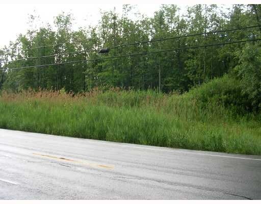
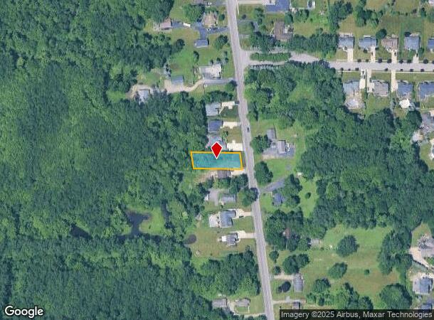
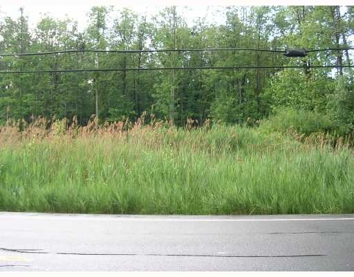
950 Campbell Blvd
Buffalo-Cheektowaga-Niagara Falls, NY
3048 4 CAMPBELL PARK 71 12 7
142289-027-110-0002-005-000
Erie
Residentialacreage
New York
X
5.000
36029C0067H
0.30 AC
2025
North
2024
Buffalo/Niagara Falls
009106
DEMOGRAPHICS near 950 Campbell Blvd
1 Mile
3 Mile
5 Mile
2024 Total Population
2,674
39,414
139,262
2029 Population
2,578
39,183
138,810
Pop Growth 2024-2029
(3.59%)
(0.59%)
(0.32%)
Average Age
41
42
42
2024 Total Households
1,072
15,863
55,643
HH Growth 2024-2029
(3.82%)
(0.46%)
(0.29%)
Median Household Inc
$110,156
$85,886
$81,389
Avg Household Size
2.40
2.40
2.30
2024 Avg HH Vehicles
2.00
2.00
2.00
Median Home Value
$457,391
$291,541
$252,802
Median Year Built
1996
1982
1974
Nearby Places
- Restaurants
- Banks
- Shops
- Fitness
- Groceries
PUBLIC TRANSPORTATION
AIRPORT
Buffalo Niagara International
DRIVE
WALK
Distance
Buffalo Niagara International
18 min
8.7 mi
Niagara Falls International
DRIVE
WALK
Distance
Niagara Falls International
20 min
11.6 mi
Freight Ports
Albany, NY Port
DRIVE
WALK
Distance
Albany, NY Port
340 min
289.9 mi
Nearby Properties
Address
Land Use
TOTAL SIZE
Lot Size
Zoning
Address
Land Use
TOTAL SIZE
Lot Size
Zoning
5,472 SF
70.10 AC
Address
Land Use
TOTAL SIZE
Lot Size
Zoning
283,706 SF
68.90 AC
Address
Land Use
TOTAL SIZE
Lot Size
Zoning
41,104 SF
27.52 AC
Address
Land Use
TOTAL SIZE
Lot Size
Zoning
2,592 SF
22.75 AC
NCD
Address
Land Use
TOTAL SIZE
Lot Size
Zoning
16,065 SF
19.75 AC
Address
Land Use
TOTAL SIZE
Lot Size
Zoning
213,943 SF
5.50 AC
Address
Land Use
TOTAL SIZE
Lot Size
Zoning
403,248 SF
53.50 AC
Address
Land Use
TOTAL SIZE
Lot Size
Zoning
83,256 SF
8.01 AC
NCD
Address
Land Use
TOTAL SIZE
Lot Size
Zoning
253,920 SF
22.83 AC
RD
Address
Land Use
TOTAL SIZE
Lot Size
Zoning
6,384 SF
13.40 AC
Address
Land Use
TOTAL SIZE
Lot Size
Zoning
11,248 SF
21.70 AC
MFR-5
Address
Land Use
TOTAL SIZE
Lot Size
Zoning
154,296 SF
7.90 AC
RD
Address
Land Use
TOTAL SIZE
Lot Size
Zoning
28,530 SF
30.20 AC
NCD
Address
Land Use
TOTAL SIZE
Lot Size
Zoning
2,135 SF
11.96 AC
Address
Land Use
TOTAL SIZE
Lot Size
Zoning
286,288 SF
50.90 AC
Address
Land Use
TOTAL SIZE
Lot Size
Zoning
12,132 SF
12.30 AC
Address
Land Use
TOTAL SIZE
Lot Size
Zoning
112,256 SF
38.33 AC
00000
Address
Land Use
TOTAL SIZE
Lot Size
Zoning
96,554 SF
10.90 AC
Address
Land Use
TOTAL SIZE
Lot Size
Zoning
110,243 SF
19.06 AC
Address
Land Use
TOTAL SIZE
Lot Size
Zoning
87,718 SF
1.26 AC
RD
Address
Land Use
TOTAL SIZE
Lot Size
Zoning
49,478 SF
4 AC
NCD
Address
Land Use
TOTAL SIZE
Lot Size
Zoning
112,666 SF
3.39 AC
MFR-5
Address
Land Use
TOTAL SIZE
Lot Size
Zoning
128,867 SF
9.42 AC
RD
Address
Land Use
TOTAL SIZE
Lot Size
Zoning
106,676 SF
8.90 AC
RD
Address
Land Use
TOTAL SIZE
Lot Size
Zoning
270,320 SF
12.20 AC
Address
Land Use
TOTAL SIZE
Lot Size
Zoning
136,200 SF
4.10 AC
Address
Land Use
TOTAL SIZE
Lot Size
Zoning
131,200 SF
16.90 AC
Address
Land Use
TOTAL SIZE
Lot Size
Zoning
39,454 SF
4.81 AC
GC
Address
Land Use
TOTAL SIZE
Lot Size
Zoning
131,128 SF
15.48 AC
RD
Address
Land Use
TOTAL SIZE
Lot Size
Zoning
81,920 SF
3.82 AC
The World's #1 Commercial Real Estate Marketplace
Connect with us
© 2025 CoStar Group
The information above has been obtained from sources believed reliable. While we do not doubt its accuracy we have not verified it and make no guarantee, warranty or representation about it. It is your responsibility to independently confirm its accuracy and completeness. Any projections, opinions, assumptions, or estimates used are for example only and do not represent the current or future performance of the property. The value of this transaction to you depends on tax and other factors which should be evaluated by your tax, financial, and legal advisors. You and your advisors should conduct a careful, independent investigation of the property to determine to your satisfaction the suitability of the property for your needs.