Property Record
Lakeside Dr Ne, Atlanta, GA


Current Lease Availabilities
NEARBY LISTINGS FOR SALE OR LEASE
Property Detail
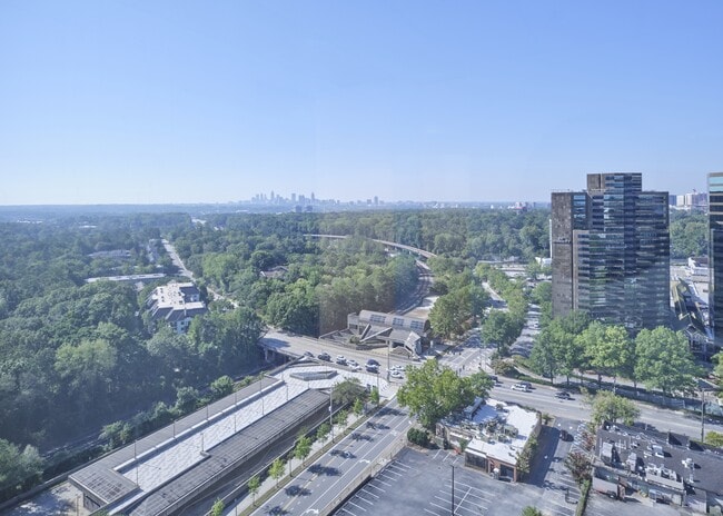
Lakeside Dr Ne
17-0009-0005-064-6
Fulton
Vacantlandnec
Georgia
X
6.74 AC
13089C0051K
Upper Buckhead
2023
Atlanta
2025
Atlanta-Sandy Springs-Roswell, GA
009602
DEMOGRAPHICS near Lakeside Dr Ne
1 mile
3 mile
5 mile
2024 Total Population
25,324
146,198
336,361
2029 Population
26,179
149,477
342,096
Pop Growth 2024-2029
+ 3.38%
+ 2.24%
+ 1.71%
Average Age
41
38
38
2024 Total Households
14,407
74,097
162,581
HH Growth 2024-2029
+ 3.72%
+ 2.55%
+ 2.00%
Median Household Inc
$108,505
$102,410
$105,101
Avg Household Size
1.70
1.90
2.00
2024 Avg HH Vehicles
1.00
1.00
2.00
Median Home Value
$605,953
$660,993
$645,688
Median Year Built
2000
1994
1991
Nearby Places
Map Layers
Map Styles
 Street
 Aerial
Transit
 Traffic
 Biking
Places
Listings with unknown addresses are not visible on the map
- Restaurants
- Banks
- Shops
- Fitness
- Groceries
PUBLIC TRANSPORTATION
TRANSIT/SUBWAY
Lenox (Gold Line - Metropolitan Atlanta Rapid Transit Authority (MARTA))
Drive
Walk
Distance
Lenox (Gold Line - Metropolitan Atlanta Rapid Transit Authority (MARTA))
0 min
7 min
0.3 mi
Buckhead (Red Line - Metropolitan Atlanta Rapid Transit Authority (MARTA))
Drive
Walk
Distance
Buckhead (Red Line - Metropolitan Atlanta Rapid Transit Authority (MARTA))
7 min
16 min
0.9 mi
COMMUTER RAIL
Atlanta (Crescent - Amtrak)
Drive
Walk
Distance
Atlanta (Crescent - Amtrak)
8 min
4.9 mi
AIRPORT
Hartsfield - Jackson Atlanta International
Drive
Walk
Distance
Hartsfield - Jackson Atlanta International
28 min
17.7 mi
Freight Ports
Georgia Ports - Savannah
Drive
Walk
Distance
Georgia Ports - Savannah
291 min
257.0 mi
Nearby Properties
Address
Land Use
TOTAL SIZE
Lot Size
Zoning
Address
Land Use
TOTAL SIZE
Lot Size
Zoning
11,126,925 SF
43.33 AC
C3
Address
Land Use
TOTAL SIZE
Lot Size
Zoning
3,356,268 SF
14.72 AC
C3
Address
Land Use
TOTAL SIZE
Lot Size
Zoning
1,572,131 SF
25.12 AC
RG3
Address
Land Use
TOTAL SIZE
Lot Size
Zoning
654,394 SF
2.27 AC
C1C
Address
Land Use
TOTAL SIZE
Lot Size
Zoning
844,000 SF
2.33 AC
PDMU
Address
Land Use
TOTAL SIZE
Lot Size
Zoning
702,901 SF
3.72 AC
PDOC
Address
Land Use
TOTAL SIZE
Lot Size
Zoning
169,435 SF
76.18 AC
M
Address
Land Use
TOTAL SIZE
Lot Size
Zoning
1,242,520 SF
3.38 AC
PDMU
Address
Land Use
TOTAL SIZE
Lot Size
Zoning
1,233,815 SF
2.18 AC
PDMU
Address
Land Use
TOTAL SIZE
Lot Size
Zoning
687,016 SF
4.21 AC
R4
Address
Land Use
TOTAL SIZE
Lot Size
Zoning
1,021,058 SF
2.89 AC
C3
Address
Land Use
TOTAL SIZE
Lot Size
Zoning
598,962 SF
4.50 AC
PDOC
Address
Land Use
TOTAL SIZE
Lot Size
Zoning
835,636 SF
5.63 AC
PDOC
Address
Land Use
TOTAL SIZE
Lot Size
Zoning
899,673 SF
2.15 AC
PDMU
Address
Land Use
TOTAL SIZE
Lot Size
Zoning
188,648 SF
4.39 AC
X
Address
Land Use
TOTAL SIZE
Lot Size
Zoning
1,006,124 SF
2.97 AC
RG4C
Address
Land Use
TOTAL SIZE
Lot Size
Zoning
589,761 SF
22.67 AC
RM-HD
Address
Land Use
TOTAL SIZE
Lot Size
Zoning
32.79 AC
R3
Address
Land Use
TOTAL SIZE
Lot Size
Zoning
2,820,296 SF
9.58 AC
RG5
Address
Land Use
TOTAL SIZE
Lot Size
Zoning
458,822 SF
2.86 AC
RG2
Address
Land Use
TOTAL SIZE
Lot Size
Zoning
793,823 SF
1.89 AC
C3
Address
Land Use
TOTAL SIZE
Lot Size
Zoning
863,826 SF
3.79 AC
C4
Address
Land Use
TOTAL SIZE
Lot Size
Zoning
1,092,973 SF
4.11 AC
C1C
Address
Land Use
TOTAL SIZE
Lot Size
Zoning
664,442 SF
4.76 AC
RG3
Address
Land Use
TOTAL SIZE
Lot Size
Zoning
754,619 SF
27.30 AC
RG3C
Address
Land Use
TOTAL SIZE
Lot Size
Zoning
527,188 SF
2.06 AC
PDOC
Address
Land Use
TOTAL SIZE
Lot Size
Zoning
619,288 SF
3.51 AC
OI
Address
Land Use
TOTAL SIZE
Lot Size
Zoning
645,419 SF
1.11 AC
C3
Address
Land Use
TOTAL SIZE
Lot Size
Zoning
389,560 SF
4.01 AC
C1
Address
Land Use
TOTAL SIZE
Lot Size
Zoning
703,243 SF
1.17 AC
PDOC
The World's #1 Commercial Real Estate Marketplace
Connect with us
© 2026 CoStar Group
The information above has been obtained from sources believed reliable. While we do not doubt its accuracy we have not verified it and make no guarantee, warranty or representation about it. It is your responsibility to independently confirm its accuracy and completeness. Any projections, opinions, assumptions, or estimates used are for example only and do not represent the current or future performance of the property. The value of this transaction to you depends on tax and other factors which should be evaluated by your tax, financial, and legal advisors. You and your advisors should conduct a careful, independent investigation of the property to determine to your satisfaction the suitability of the property for your needs.