Property Record
950 Harter Pkwy, Yuba City, CA 95993

NEARBY LISTINGS FOR SALE OR LEASE
Property Detail
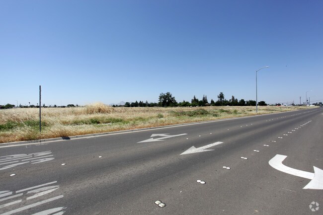
950 Harter Pkwy
Sacramento
River Valley Commercial Center
Yuba City, CA
RIVER VALLEY COMMERCIAL CENTER FORMERLY A PORTION OF 63-010-092 LOT 009 AS SHOWN UPON THE SUBDIVISION MAP RECORDED 08-07-06 IN BOOK 19 OF SURVEYS PAGE 100
63-010-101
Sutter
Commercialnec
California
2024
11
2025
4.85 AC
050501
Sutter County
42,986 SF
DEMOGRAPHICS near 950 Harter Pkwy
1 Mile
3 Mile
5 Mile
2024 Total Population
7,491
68,818
97,678
2029 Population
7,408
68,060
98,530
Pop Growth 2024-2029
(1.11%)
(1.10%)
+ 0.87%
Average Age
40
39
39
2024 Total Households
2,522
23,258
32,884
HH Growth 2024-2029
(1.11%)
(1.11%)
+ 1.08%
Median Household Inc
$59,938
$61,633
$60,754
Avg Household Size
2.90
2.90
2.90
2024 Avg HH Vehicles
2.00
2.00
2.00
Median Home Value
$383,171
$356,520
$347,444
Median Year Built
1986
1980
1979
Nearby Places
Map Layers
Map Styles
 Street
 Aerial
- Restaurants
- Banks
- Shops
- Fitness
- Groceries
PUBLIC TRANSPORTATION
AIRPORT
Sacramento International
DRIVE
WALK
Distance
Sacramento International
52 min
39.7 mi
SALE & LEASE HISTORY
LISTING DATE
SALE/LEASE

Sep 24, 2016
For Sale
Nearby Properties
Address
Land Use
TOTAL SIZE
Lot Size
Zoning
Address
Land Use
TOTAL SIZE
Lot Size
Zoning
25,580 SF
9.48 AC
C3
Address
Land Use
TOTAL SIZE
Lot Size
Zoning
1,028,560 SF
52.30 AC
M1
Address
Land Use
TOTAL SIZE
Lot Size
Zoning
48,348 SF
3.25 AC
Address
Land Use
TOTAL SIZE
Lot Size
Zoning
143,368 SF
11.40 AC
Address
Land Use
TOTAL SIZE
Lot Size
Zoning
92,312 SF
17.04 AC
Address
Land Use
TOTAL SIZE
Lot Size
Zoning
120,622 SF
2.25 AC
Address
Land Use
TOTAL SIZE
Lot Size
Zoning
259,011 SF
14.20 AC
M1
Address
Land Use
TOTAL SIZE
Lot Size
Zoning
147,546 SF
7.55 AC
R3
Address
Land Use
TOTAL SIZE
Lot Size
Zoning
49,817 SF
2.81 AC
C3
Address
Land Use
TOTAL SIZE
Lot Size
Zoning
55,702 SF
3.16 AC
Address
Land Use
TOTAL SIZE
Lot Size
Zoning
18,675 SF
2.98 AC
C3
Address
Land Use
TOTAL SIZE
Lot Size
Zoning
176,181 SF
6.99 AC
CM
Address
Land Use
TOTAL SIZE
Lot Size
Zoning
74,040 SF
5.97 AC
R3
Address
Land Use
TOTAL SIZE
Lot Size
Zoning
53,600 SF
8.15 AC
Address
Land Use
TOTAL SIZE
Lot Size
Zoning
50,270 SF
4.16 AC
CO
Address
Land Use
TOTAL SIZE
Lot Size
Zoning
137,178 SF
11.01 AC
C3
Address
Land Use
TOTAL SIZE
Lot Size
Zoning
140,846 SF
12.98 AC
C3
Address
Land Use
TOTAL SIZE
Lot Size
Zoning
138,490 SF
18.72 AC
C3
Address
Land Use
TOTAL SIZE
Lot Size
Zoning
48,117 SF
1.81 AC
R1
Address
Land Use
TOTAL SIZE
Lot Size
Zoning
115,058 SF
13.03 AC
Address
Land Use
TOTAL SIZE
Lot Size
Zoning
37,854 SF
6 AC
C3
Address
Land Use
TOTAL SIZE
Lot Size
Zoning
105,160 SF
8.99 AC
Address
Land Use
TOTAL SIZE
Lot Size
Zoning
56,257 SF
1.73 AC
Address
Land Use
TOTAL SIZE
Lot Size
Zoning
203,184 SF
17.82 AC
C3
Address
Land Use
TOTAL SIZE
Lot Size
Zoning
39,340 SF
6.51 AC
Address
Land Use
TOTAL SIZE
Lot Size
Zoning
1.67 AC
Address
Land Use
TOTAL SIZE
Lot Size
Zoning
2.53 AC
Address
Land Use
TOTAL SIZE
Lot Size
Zoning
193,952 SF
9.93 AC
C3
Address
Land Use
TOTAL SIZE
Lot Size
Zoning
47,686 SF
2 AC
R2
The World's #1 Commercial Real Estate Marketplace
Connect with us
© 2026 CoStar Group
The information above has been obtained from sources believed reliable. While we do not doubt its accuracy we have not verified it and make no guarantee, warranty or representation about it. It is your responsibility to independently confirm its accuracy and completeness. Any projections, opinions, assumptions, or estimates used are for example only and do not represent the current or future performance of the property. The value of this transaction to you depends on tax and other factors which should be evaluated by your tax, financial, and legal advisors. You and your advisors should conduct a careful, independent investigation of the property to determine to your satisfaction the suitability of the property for your needs.