Property Record
950 N Airport Rd, Williams, AZ 86046
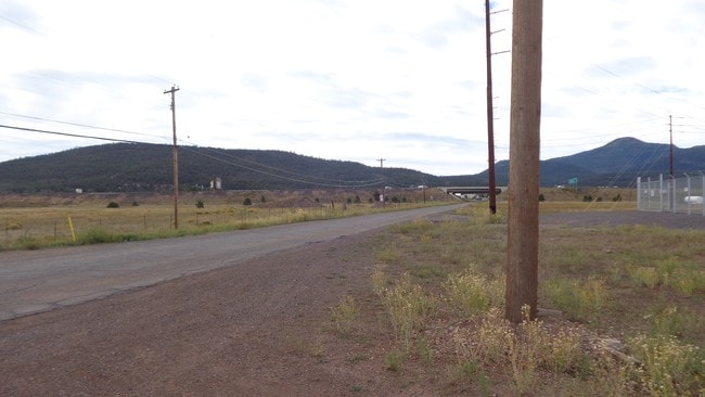

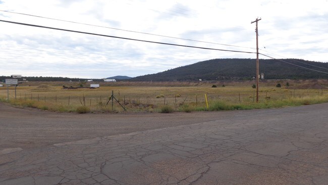
Property Detail
950 N Airport Rd
Flagstaff, AZ
SIXTEENTH: NW QUARTER: NE SECTION: 28 TOWNSHIP: 22N RANGE: 02E PART NW4NE4, BEG N4 COR OF SEC 28; TH S 00-37-54 E 10; TH N 89-58-00 E 33.00; TPOB TH N 89-58-00 E 965.89; TH S 00-02-00 E 417.30; NORTH RIGHT OF WAY LINE OF INTERSTATE HWY 40; TH SWLY AL
200-12-004B
COCONINO
Commercialacreage
Arizona
C and X Area of minimal flood hazard, usually depicted on FIRMs as above the 500-year flood level.
12.85 AC
2024
Grand Canyon Area
2025
Other Market Areas
001700
NEARBY LISTINGS FOR SALE OR LEASE
DEMOGRAPHICS near 950 N Airport Rd
1 mile
3 mile
5 mile
2024 Total Population
1,291
2,998
3,736
2029 Population
1,288
3,023
3,787
Pop Growth 2024-2029
(0.23%)
+ 0.83%
+ 1.37%
Average Age
39
41
42
2024 Total Households
493
1,204
1,500
HH Growth 2024-2029
(0.81%)
+ 0.25%
+ 0.80%
Median Household Inc
$49,772
$52,884
$58,333
Avg Household Size
2.60
2.50
2.50
2024 Avg HH Vehicles
2.00
2.00
2.00
Median Home Value
$572,917
$494,285
$490,195
Median Year Built
1989
1977
1983
Nearby Places
Map Layers
Map Styles
 Street
 Aerial
Transit
 Traffic
 Biking
Places
Listings with unknown addresses are not visible on the map
- Restaurants
- Banks
- Shops
- Fitness
- Groceries
SALE & LEASE HISTORY
LISTING DATE
SALE/LEASE

Jun 09, 2017
For Sale
Nearby Properties
Address
Land Use
TOTAL SIZE
Lot Size
Zoning
Address
Land Use
TOTAL SIZE
Lot Size
Zoning
147,647 SF
5 AC
Address
Land Use
TOTAL SIZE
Lot Size
Zoning
92,603 SF
29.92 AC
Address
Land Use
TOTAL SIZE
Lot Size
Zoning
76,853 SF
7.90 AC
Address
Land Use
TOTAL SIZE
Lot Size
Zoning
2.33 AC
Address
Land Use
TOTAL SIZE
Lot Size
Zoning
48,695 SF
2.48 AC
Address
Land Use
TOTAL SIZE
Lot Size
Zoning
38,946 SF
155.67 AC
Address
Land Use
TOTAL SIZE
Lot Size
Zoning
40,045 SF
3.30 AC
Address
Land Use
TOTAL SIZE
Lot Size
Zoning
49,528 SF
9.51 AC
Address
Land Use
TOTAL SIZE
Lot Size
Zoning
40,436 SF
1.83 AC
Address
Land Use
TOTAL SIZE
Lot Size
Zoning
35,734 SF
4.26 AC
Address
Land Use
TOTAL SIZE
Lot Size
Zoning
20,155 SF
14.60 AC
Address
Land Use
TOTAL SIZE
Lot Size
Zoning
49,991 SF
4.65 AC
Address
Land Use
TOTAL SIZE
Lot Size
Zoning
32,269 SF
1.72 AC
Address
Land Use
TOTAL SIZE
Lot Size
Zoning
32,638 SF
3.66 AC
Address
Land Use
TOTAL SIZE
Lot Size
Zoning
42,772 SF
1.39 AC
Address
Land Use
TOTAL SIZE
Lot Size
Zoning
6,216 SF
6.12 AC
Address
Land Use
TOTAL SIZE
Lot Size
Zoning
27,684 SF
12.50 AC
Address
Land Use
TOTAL SIZE
Lot Size
Zoning
19,100 SF
0.60 AC
Address
Land Use
TOTAL SIZE
Lot Size
Zoning
27,499 SF
0.48 AC
Address
Land Use
TOTAL SIZE
Lot Size
Zoning
19,839 SF
2.43 AC
Address
Land Use
TOTAL SIZE
Lot Size
Zoning
14,280 SF
1.50 AC
Address
Land Use
TOTAL SIZE
Lot Size
Zoning
2,724 SF
0.30 AC
Address
Land Use
TOTAL SIZE
Lot Size
Zoning
8,055 SF
39.61 AC
Address
Land Use
TOTAL SIZE
Lot Size
Zoning
1,667 SF
0.36 AC
Address
Land Use
TOTAL SIZE
Lot Size
Zoning
10,701 SF
10 AC
Address
Land Use
TOTAL SIZE
Lot Size
Zoning
34,832 SF
0.50 AC
Address
Land Use
TOTAL SIZE
Lot Size
Zoning
14,064 SF
0.69 AC
Address
Land Use
TOTAL SIZE
Lot Size
Zoning
41,018 SF
2.52 AC
Address
Land Use
TOTAL SIZE
Lot Size
Zoning
13,801 SF
0.76 AC
Address
Land Use
TOTAL SIZE
Lot Size
Zoning
13,303 SF
1.44 AC
The World's #1 Commercial Real Estate Marketplace
Connect with us
© 2026 CoStar Group
The information above has been obtained from sources believed reliable. While we do not doubt its accuracy we have not verified it and make no guarantee, warranty or representation about it. It is your responsibility to independently confirm its accuracy and completeness. Any projections, opinions, assumptions, or estimates used are for example only and do not represent the current or future performance of the property. The value of this transaction to you depends on tax and other factors which should be evaluated by your tax, financial, and legal advisors. You and your advisors should conduct a careful, independent investigation of the property to determine to your satisfaction the suitability of the property for your needs.