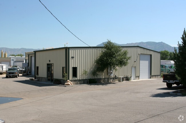
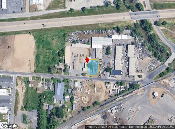
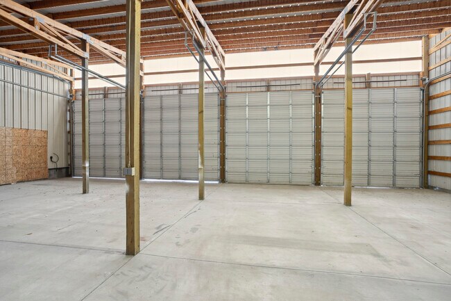
Property Record
950 W 20Th St S, Ogden, UT 84401

NEARBY LISTINGS FOR SALE OR LEASE
Property Detail
950 W 20Th St S
14-013-0022
Ogden City Surv A
Publicstorage
PART OF THE NORTHWEST QUARTER OF SECTION 30, TOWNSHIP 6 NORTH RANGE 1 WEST, SALT LAKE MERIDIAN, U. S. SURVEY: BEGINNING AT A
X
Weber
49057C0407F
Utah
2025
0.53 AC
2025
Davis North
200800
Salt Lake City
4,560 SF
Ogden, UT
DEMOGRAPHICS near 950 W 20Th St S
1 mile
3 mile
5 mile
2024 Total Population
3,264
66,001
174,490
2029 Population
3,536
71,047
187,828
Pop Growth 2024-2029
+ 8.33%
+ 7.65%
+ 7.64%
Average Age
35
35
36
2024 Total Households
1,064
24,423
61,862
HH Growth 2024-2029
+ 8.74%
+ 7.89%
+ 7.82%
Median Household Inc
$69,802
$52,359
$63,661
Avg Household Size
2.90
2.60
2.70
2024 Avg HH Vehicles
2.00
2.00
2.00
Median Home Value
$359,574
$284,767
$330,275
Median Year Built
1998
1972
1977
Nearby Places
Map Layers
Map Styles
 Street
 Aerial
Transit
 Traffic
 Biking
Places
Listings with unknown addresses are not visible on the map
- Restaurants
- Banks
- Shops
- Fitness
- Groceries
PUBLIC TRANSPORTATION
COMMUTER RAIL
Ogden (FrontRunner North - Utah Transit Authority (UTA))
Drive
Walk
Distance
Ogden (FrontRunner North - Utah Transit Authority (UTA))
5 min
1.9 mi
Roy (FrontRunner North - Utah Transit Authority (UTA))
Drive
Walk
Distance
Roy (FrontRunner North - Utah Transit Authority (UTA))
9 min
4.7 mi
AIRPORT
Salt Lake City International
Drive
Walk
Distance
Salt Lake City International
48 min
39.8 mi
SALE & LEASE HISTORY
LISTING DATE
SALE/LEASE

Jul 14, 2025
For Lease
Nearby Properties
Address
Land Use
TOTAL SIZE
Lot Size
Zoning
Address
Land Use
TOTAL SIZE
Lot Size
Zoning
841,756 SF
45.79 AC
Address
Land Use
TOTAL SIZE
Lot Size
Zoning
111,832 SF
24.92 AC
Address
Land Use
TOTAL SIZE
Lot Size
Zoning
128,867 SF
3.36 AC
Address
Land Use
TOTAL SIZE
Lot Size
Zoning
97,932 SF
3.07 AC
Address
Land Use
TOTAL SIZE
Lot Size
Zoning
52,200 SF
9.95 AC
Address
Land Use
TOTAL SIZE
Lot Size
Zoning
305,444 SF
1.58 AC
Address
Land Use
TOTAL SIZE
Lot Size
Zoning
152,877 SF
4.96 AC
Address
Land Use
TOTAL SIZE
Lot Size
Zoning
9,464 SF
6.82 AC
Address
Land Use
TOTAL SIZE
Lot Size
Zoning
21,684 SF
8.38 AC
Address
Land Use
TOTAL SIZE
Lot Size
Zoning
48,177 SF
5.54 AC
Address
Land Use
TOTAL SIZE
Lot Size
Zoning
106,752 SF
10.35 AC
Address
Land Use
TOTAL SIZE
Lot Size
Zoning
8,580 SF
6.40 AC
Address
Land Use
TOTAL SIZE
Lot Size
Zoning
66,896 SF
7.50 AC
Address
Land Use
TOTAL SIZE
Lot Size
Zoning
101,191 SF
4.14 AC
Address
Land Use
TOTAL SIZE
Lot Size
Zoning
119,043 SF
2.05 AC
Address
Land Use
TOTAL SIZE
Lot Size
Zoning
95,949 SF
3.29 AC
Address
Land Use
TOTAL SIZE
Lot Size
Zoning
149,400 SF
26.88 AC
Address
Land Use
TOTAL SIZE
Lot Size
Zoning
166,800 SF
0.12 AC
The World's #1 Commercial Real Estate Marketplace
Connect with us
© 2026 CoStar Group
The information above has been obtained from sources believed reliable. While we do not doubt its accuracy we have not verified it and make no guarantee, warranty or representation about it. It is your responsibility to independently confirm its accuracy and completeness. Any projections, opinions, assumptions, or estimates used are for example only and do not represent the current or future performance of the property. The value of this transaction to you depends on tax and other factors which should be evaluated by your tax, financial, and legal advisors. You and your advisors should conduct a careful, independent investigation of the property to determine to your satisfaction the suitability of the property for your needs.