Property Record
9500 Osuna Rd Ne, Albuquerque, NM 87111


NEARBY LISTINGS FOR SALE OR LEASE
-
-
View all Albuquerque listings for sale on LoopNet.com
Property Detail
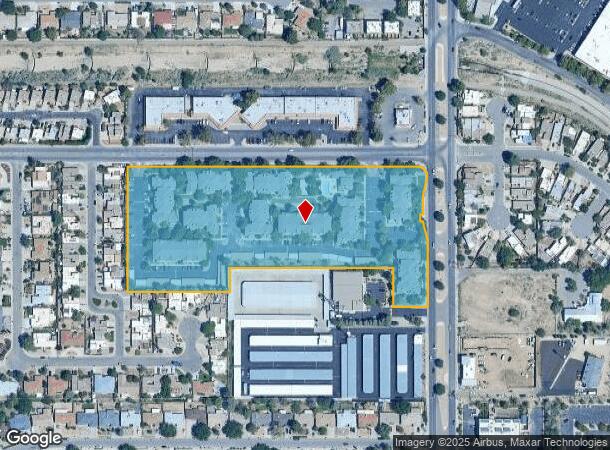
9500 Osuna Rd Ne
Albuquerque, NM
Calmat Subd
1-020-061-473187-4-11-28
LT 1-A PLAT OF LOT 1-A CALMAT SUBD BEING A REPL OF LTS 1 & 2 CONT 7.9953 AC M/L
Apartment
Bernalillo
X
New Mexico
35001C0143G
1-2
2024
8 AC
2025
Mesa Del Oso/Promenade
003718
Albuquerque
34,788 SF
DEMOGRAPHICS near 9500 Osuna Rd Ne
1 Mile
3 Mile
5 Mile
2024 Total Population
19,253
136,213
266,958
2029 Population
19,308
136,165
267,032
Pop Growth 2024-2029
+ 0.29%
(0.04%)
+ 0.03%
Average Age
44
44
42
2024 Total Households
9,381
61,949
119,219
HH Growth 2024-2029
+ 0.42%
(0.05%)
0.00%
Median Household Inc
$65,798
$70,376
$62,289
Avg Household Size
2.00
2.10
2.20
2024 Avg HH Vehicles
2.00
2.00
2.00
Median Home Value
$289,519
$285,942
$276,283
Median Year Built
1981
1977
1977
Nearby Places
Map Layers
Map Styles
 Street
 Aerial
- Restaurants
- Banks
- Shops
- Fitness
- Groceries
PUBLIC TRANSPORTATION
COMMUTER RAIL
Montaño Station (NMRX - Rio Metro Regional Transit District)
DRIVE
WALK
Distance
Montaño Station (NMRX - Rio Metro Regional Transit District)
14 min
6.5 mi
Los Ranchos-Journal Center (NMRX - Rio Metro Regional Transit District, Rail Runner Express - Rio Metro Regional Transit District)
DRIVE
WALK
Distance
Los Ranchos-Journal Center (NMRX - Rio Metro Regional Transit District, Rail Runner Express - Rio Metro Regional Transit District)
16 min
7.0 mi
AIRPORT
Albuquerque International Sunport
DRIVE
WALK
Distance
Albuquerque International Sunport
27 min
11.2 mi
Freight Ports
Tulsa Port Of Catoosa
DRIVE
WALK
Distance
Tulsa Port Of Catoosa
687 min
659.2 mi
Nearby Properties
Address
Land Use
TOTAL SIZE
Lot Size
Zoning
Address
Land Use
TOTAL SIZE
Lot Size
Zoning
33,920 SF
14.96 AC
Address
Land Use
TOTAL SIZE
Lot Size
Zoning
254,392 SF
40.71 AC
Address
Land Use
TOTAL SIZE
Lot Size
Zoning
23,063 SF
15.99 AC
Address
Land Use
TOTAL SIZE
Lot Size
Zoning
7,100 SF
19 AC
Address
Land Use
TOTAL SIZE
Lot Size
Zoning
424,854 SF
20.23 AC
Address
Land Use
TOTAL SIZE
Lot Size
Zoning
34,585 SF
10.16 AC
Address
Land Use
TOTAL SIZE
Lot Size
Zoning
Address
Land Use
TOTAL SIZE
Lot Size
Zoning
106,944 SF
33.10 AC
Address
Land Use
TOTAL SIZE
Lot Size
Zoning
15,610 SF
17.67 AC
Address
Land Use
TOTAL SIZE
Lot Size
Zoning
249,387 SF
16.89 AC
Address
Land Use
TOTAL SIZE
Lot Size
Zoning
326,965 SF
51.32 AC
Address
Land Use
TOTAL SIZE
Lot Size
Zoning
94,696 SF
4.34 AC
Address
Land Use
TOTAL SIZE
Lot Size
Zoning
59,072 SF
17.86 AC
Address
Land Use
TOTAL SIZE
Lot Size
Zoning
293,896 SF
52.96 AC
Address
Land Use
TOTAL SIZE
Lot Size
Zoning
37,448 SF
10 AC
Address
Land Use
TOTAL SIZE
Lot Size
Zoning
173,169 SF
45.75 AC
Address
Land Use
TOTAL SIZE
Lot Size
Zoning
20,680 SF
13.99 AC
Address
Land Use
TOTAL SIZE
Lot Size
Zoning
219,132 SF
3.27 AC
Address
Land Use
TOTAL SIZE
Lot Size
Zoning
47,232 SF
15.93 AC
Address
Land Use
TOTAL SIZE
Lot Size
Zoning
53,200 SF
21.77 AC
Address
Land Use
TOTAL SIZE
Lot Size
Zoning
66,816 SF
10.89 AC
Address
Land Use
TOTAL SIZE
Lot Size
Zoning
37,771 SF
7.71 AC
Address
Land Use
TOTAL SIZE
Lot Size
Zoning
35,757 SF
10.16 AC
Address
Land Use
TOTAL SIZE
Lot Size
Zoning
127,980 SF
17.72 AC
Address
Land Use
TOTAL SIZE
Lot Size
Zoning
91,360 SF
2.84 AC
Address
Land Use
TOTAL SIZE
Lot Size
Zoning
212,280 SF
14.79 AC
Address
Land Use
TOTAL SIZE
Lot Size
Zoning
20,999 SF
6.53 AC
Address
Land Use
TOTAL SIZE
Lot Size
Zoning
14.40 AC
Address
Land Use
TOTAL SIZE
Lot Size
Zoning
199,298 SF
22.21 AC
Address
Land Use
TOTAL SIZE
Lot Size
Zoning
23,264 SF
9.27 AC
The World's #1 Commercial Real Estate Marketplace
Connect with us
© 2025 CoStar Group
The information above has been obtained from sources believed reliable. While we do not doubt its accuracy we have not verified it and make no guarantee, warranty or representation about it. It is your responsibility to independently confirm its accuracy and completeness. Any projections, opinions, assumptions, or estimates used are for example only and do not represent the current or future performance of the property. The value of this transaction to you depends on tax and other factors which should be evaluated by your tax, financial, and legal advisors. You and your advisors should conduct a careful, independent investigation of the property to determine to your satisfaction the suitability of the property for your needs.