Property Record
9500 Se Crain Hwy, Upper Marlboro, MD 20772


NEARBY LISTINGS FOR SALE OR LEASE
-
-
View all Upper Marlboro listings for sale on LoopNet.com
Property Detail
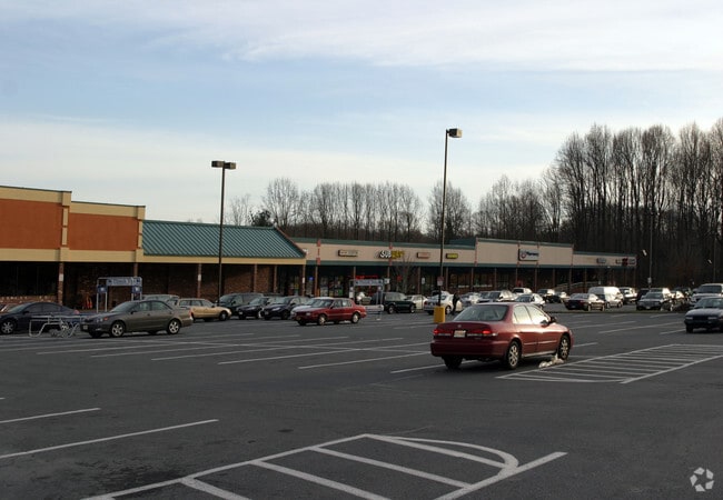
9500 Se Crain Hwy
15-1752617
PARCEL A-1
Regionalshoppingcenterormallwithanchorstore
Prince George's
X
Maryland
24033C0270E
5.93 AC
2024
Outlying PG County South
2025
Washington, DC
800707
Washington-Arlington-Alexandria, DC-VA-MD-WV
76,336 SF
DEMOGRAPHICS near 9500 Se Crain Hwy
1 Mile
3 Mile
5 Mile
2024 Total Population
4,232
24,791
59,221
2029 Population
4,100
24,120
57,783
Pop Growth 2024-2029
(3.12%)
(2.71%)
(2.43%)
Average Age
43
42
43
2024 Total Households
1,497
8,739
20,762
HH Growth 2024-2029
(3.27%)
(2.80%)
(2.52%)
Median Household Inc
$121,658
$126,385
$130,257
Avg Household Size
2.80
2.80
2.80
2024 Avg HH Vehicles
2.00
2.00
2.00
Median Home Value
$391,795
$405,942
$422,874
Median Year Built
1990
1991
1992
Nearby Places
Map Layers
Map Styles
 Street
 Aerial
- Restaurants
- Banks
- Shops
- Fitness
- Groceries
PUBLIC TRANSPORTATION
AIRPORT
Ronald Reagan Washington Ntl
DRIVE
WALK
Distance
Ronald Reagan Washington Ntl
39 min
22.0 mi
Baltimore/Washington International Thurgood Marshall
DRIVE
WALK
Distance
Baltimore/Washington International Thurgood Marshall
55 min
37.0 mi
Freight Ports
Port of Baltimore
DRIVE
WALK
Distance
Port of Baltimore
63 min
42.6 mi
SALE & LEASE HISTORY
LISTING DATE
SALE/LEASE

Sep 24, 2016
For Lease
Nov 20, 2017
For Sale
Nov 04, 2016
For Sale
Nearby Properties
Address
Land Use
TOTAL SIZE
Lot Size
Zoning
Address
Land Use
TOTAL SIZE
Lot Size
Zoning
939.06 AC
RR
Address
Land Use
TOTAL SIZE
Lot Size
Zoning
190,603 SF
16.08 AC
RMF20
Address
Land Use
TOTAL SIZE
Lot Size
Zoning
55,450 SF
7.76 AC
CGO
Address
Land Use
TOTAL SIZE
Lot Size
Zoning
132,574 SF
25 AC
AR
Address
Land Use
TOTAL SIZE
Lot Size
Zoning
94,295 SF
10.02 AC
RR
Address
Land Use
TOTAL SIZE
Lot Size
Zoning
106,182 SF
7.07 AC
RMF20
Address
Land Use
TOTAL SIZE
Lot Size
Zoning
2.49 AC
CGO
Address
Land Use
TOTAL SIZE
Lot Size
Zoning
29,206 SF
4.57 AC
CGO
Address
Land Use
TOTAL SIZE
Lot Size
Zoning
55,547 SF
10 AC
RR
Address
Land Use
TOTAL SIZE
Lot Size
Zoning
44,710 SF
10.05 AC
ROS
Address
Land Use
TOTAL SIZE
Lot Size
Zoning
10,662 SF
1.72 AC
CGO
Address
Land Use
TOTAL SIZE
Lot Size
Zoning
1,400 SF
4.27 AC
CGO
Address
Land Use
TOTAL SIZE
Lot Size
Zoning
35,125 SF
21.47 AC
RR
Address
Land Use
TOTAL SIZE
Lot Size
Zoning
34,226 SF
21.72 AC
AR
Address
Land Use
TOTAL SIZE
Lot Size
Zoning
341.03 AC
ROS
Address
Land Use
TOTAL SIZE
Lot Size
Zoning
398.62 AC
ROS
Address
Land Use
TOTAL SIZE
Lot Size
Zoning
8,076 SF
99.98 AC
AG
Address
Land Use
TOTAL SIZE
Lot Size
Zoning
19.16 AC
RR
Address
Land Use
TOTAL SIZE
Lot Size
Zoning
20,858 SF
5.12 AC
RR
Address
Land Use
TOTAL SIZE
Lot Size
Zoning
2,280 SF
0.83 AC
CGO
Address
Land Use
TOTAL SIZE
Lot Size
Zoning
180.78 AC
AR
Address
Land Use
TOTAL SIZE
Lot Size
Zoning
3,570 SF
1.11 AC
CGO
Address
Land Use
TOTAL SIZE
Lot Size
Zoning
25,062 SF
24.02 AC
RR
Address
Land Use
TOTAL SIZE
Lot Size
Zoning
28,855 SF
10.19 AC
RR
Address
Land Use
TOTAL SIZE
Lot Size
Zoning
2,882 SF
1.27 AC
CS
Address
Land Use
TOTAL SIZE
Lot Size
Zoning
7,000 SF
0.49 AC
CGO
Address
Land Use
TOTAL SIZE
Lot Size
Zoning
15,100 SF
8.82 AC
AR
Address
Land Use
TOTAL SIZE
Lot Size
Zoning
12,422 SF
12.60 AC
AR
Address
Land Use
TOTAL SIZE
Lot Size
Zoning
403.77 AC
ROS
The World's #1 Commercial Real Estate Marketplace
Connect with us
© 2026 CoStar Group
The information above has been obtained from sources believed reliable. While we do not doubt its accuracy we have not verified it and make no guarantee, warranty or representation about it. It is your responsibility to independently confirm its accuracy and completeness. Any projections, opinions, assumptions, or estimates used are for example only and do not represent the current or future performance of the property. The value of this transaction to you depends on tax and other factors which should be evaluated by your tax, financial, and legal advisors. You and your advisors should conduct a careful, independent investigation of the property to determine to your satisfaction the suitability of the property for your needs.