Property Record
9500 W Sam Houston Pkwy S, Houston, TX 77099

NEARBY LISTINGS FOR SALE OR LEASE
Property Detail
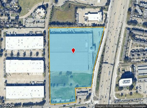
9500 W Sam Houston Pkwy S
1253530010001
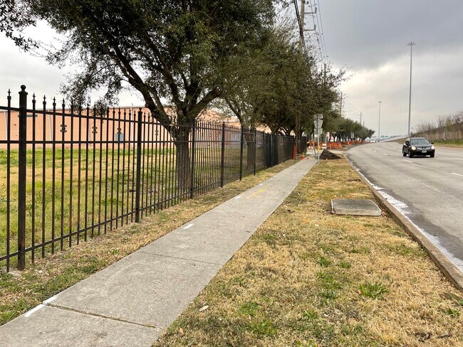
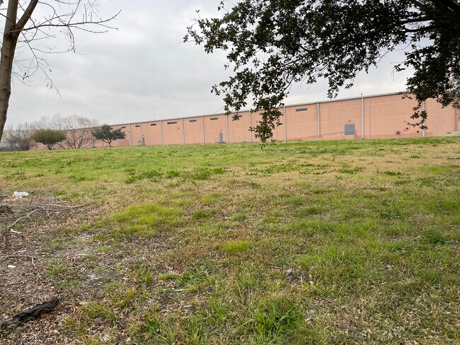
Yuan Tai Distribution Center
Outdoorrecreationbeachmountaindesert
RES A BLK 1 YUAN TAI DISTRIBUTION CENTER
X
Harris
48201C0845M
Texas
2024
15.10 AC
2025
Southwest Beltway 8
453202
Houston
307,200 SF
Houston-The Woodlands-Sugar Land, TX
DEMOGRAPHICS near 9500 W Sam Houston Pkwy S
1 Mile
3 Mile
5 Mile
2024 Total Population
33,669
203,318
512,343
2029 Population
34,382
209,770
535,140
Pop Growth 2024-2029
+ 2.12%
+ 3.17%
+ 4.45%
Average Age
32
36
36
2024 Total Households
12,084
70,077
187,175
HH Growth 2024-2029
+ 1.98%
+ 3.38%
+ 4.43%
Median Household Inc
$32,048
$40,770
$44,575
Avg Household Size
2.70
2.80
2.70
2024 Avg HH Vehicles
1.00
2.00
2.00
Median Home Value
$157,386
$173,759
$206,187
Median Year Built
1982
1978
1981
Nearby Places
- Restaurants
- Banks
- Shops
- Fitness
- Groceries
PUBLIC TRANSPORTATION
AIRPORT
William P Hobby
DRIVE
WALK
Distance
William P Hobby
35 min
22.5 mi
George Bush Intcntl/Houston
DRIVE
WALK
Distance
George Bush Intcntl/Houston
42 min
34.7 mi
Freight Ports
Port of Houston
DRIVE
WALK
Distance
Port of Houston
36 min
21.8 mi
SALE & LEASE HISTORY
LISTING DATE
SALE/LEASE

Sep 24, 2016
For Sale
Feb 11, 2022
For Sale
Nearby Properties
Address
Land Use
TOTAL SIZE
Lot Size
Zoning
Address
Land Use
TOTAL SIZE
Lot Size
Zoning
7.46 AC
Address
Land Use
TOTAL SIZE
Lot Size
Zoning
12.98 AC
Address
Land Use
TOTAL SIZE
Lot Size
Zoning
11.58 AC
Address
Land Use
TOTAL SIZE
Lot Size
Zoning
12.08 AC
Address
Land Use
TOTAL SIZE
Lot Size
Zoning
627,632 SF
24.12 AC
Address
Land Use
TOTAL SIZE
Lot Size
Zoning
816,006 SF
40.26 AC
Address
Land Use
TOTAL SIZE
Lot Size
Zoning
422,123 SF
39.85 AC
Address
Land Use
TOTAL SIZE
Lot Size
Zoning
188,178 SF
18.49 AC
Address
Land Use
TOTAL SIZE
Lot Size
Zoning
771,720 SF
19.28 AC
Address
Land Use
TOTAL SIZE
Lot Size
Zoning
539,308 SF
21 AC
Address
Land Use
TOTAL SIZE
Lot Size
Zoning
76,385 SF
17.48 AC
Address
Land Use
TOTAL SIZE
Lot Size
Zoning
12.22 AC
Address
Land Use
TOTAL SIZE
Lot Size
Zoning
183,015 SF
9.91 AC
Address
Land Use
TOTAL SIZE
Lot Size
Zoning
322,894 SF
17.51 AC
Address
Land Use
TOTAL SIZE
Lot Size
Zoning
304,006 SF
11.14 AC
Address
Land Use
TOTAL SIZE
Lot Size
Zoning
725,466 SF
9.69 AC
Address
Land Use
TOTAL SIZE
Lot Size
Zoning
574,191 SF
8.32 AC
Address
Land Use
TOTAL SIZE
Lot Size
Zoning
355,887 SF
13.89 AC
Address
Land Use
TOTAL SIZE
Lot Size
Zoning
269,067 SF
17.98 AC
Address
Land Use
TOTAL SIZE
Lot Size
Zoning
52,502 SF
13.60 AC
XYS
Address
Land Use
TOTAL SIZE
Lot Size
Zoning
329,954 SF
15.55 AC
SH
Address
Land Use
TOTAL SIZE
Lot Size
Zoning
364,674 SF
13.79 AC
Address
Land Use
TOTAL SIZE
Lot Size
Zoning
307,488 SF
11 AC
Address
Land Use
TOTAL SIZE
Lot Size
Zoning
256,810 SF
22.65 AC
Address
Land Use
TOTAL SIZE
Lot Size
Zoning
274,158 SF
10.51 AC
Address
Land Use
TOTAL SIZE
Lot Size
Zoning
349,982 SF
18.44 AC
Address
Land Use
TOTAL SIZE
Lot Size
Zoning
240,853 SF
19.07 AC
Address
Land Use
TOTAL SIZE
Lot Size
Zoning
280,309 SF
9.98 AC
Address
Land Use
TOTAL SIZE
Lot Size
Zoning
282,636 SF
4.18 AC
Address
Land Use
TOTAL SIZE
Lot Size
Zoning
20.82 AC
The World's #1 Commercial Real Estate Marketplace
Connect with us
© 2025 CoStar Group
The information above has been obtained from sources believed reliable. While we do not doubt its accuracy we have not verified it and make no guarantee, warranty or representation about it. It is your responsibility to independently confirm its accuracy and completeness. Any projections, opinions, assumptions, or estimates used are for example only and do not represent the current or future performance of the property. The value of this transaction to you depends on tax and other factors which should be evaluated by your tax, financial, and legal advisors. You and your advisors should conduct a careful, independent investigation of the property to determine to your satisfaction the suitability of the property for your needs.