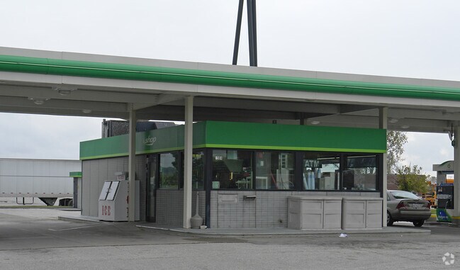
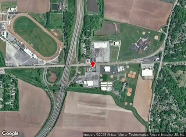
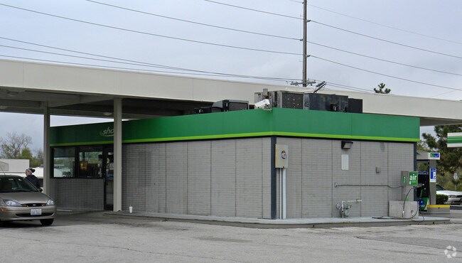
Property Record
9500 Collinsville Rd, Collinsville, IL 62234
NEARBY LISTINGS FOR SALE OR LEASE
Property Detail
9500 Collinsville Rd
St. Louis, MO-IL
Collinsville Bluffs Sub
13-1-21-31-00-000-011
PT S PT SE
Commercialnec
Madison
2024
Illinois
2024
8.63 AC
403403
Metro East Illinois
2,428 SF
St. Louis
DEMOGRAPHICS near 9500 Collinsville Rd
1 Mile
3 Mile
5 Mile
2024 Total Population
1,828
26,668
62,044
2029 Population
1,825
26,457
61,618
Pop Growth 2024-2029
(0.16%)
(0.79%)
(0.69%)
Average Age
39
40
41
2024 Total Households
722
10,920
24,966
HH Growth 2024-2029
(0.28%)
(0.81%)
(0.70%)
Median Household Inc
$58,395
$58,050
$59,315
Avg Household Size
2.40
2.30
2.40
2024 Avg HH Vehicles
2.00
2.00
2.00
Median Home Value
$140,035
$133,338
$137,457
Median Year Built
1956
1966
1970
Nearby Places
Map Layers
Map Styles
 Street
 Aerial
- Restaurants
- Banks
- Shops
- Fitness
- Groceries
PUBLIC TRANSPORTATION
COMMUTER RAIL
Fairview Heights (Lambert Airport Shiloh-Scott - St. Louis MetroLink (MetroLink), Shrewsbury-Lansdowne I-44 Emerson Park - St. Louis MetroLink (MetroLink))
DRIVE
WALK
Distance
Fairview Heights (Lambert Airport Shiloh-Scott - St. Louis MetroLink (MetroLink), Shrewsbury-Lansdowne I-44 Emerson Park - St. Louis MetroLink (MetroLink))
11 min
6.1 mi
Washington Park (Lambert Airport Shiloh-Scott - St. Louis MetroLink (MetroLink), Shrewsbury-Lansdowne I-44 Emerson Park - St. Louis MetroLink (MetroLink))
DRIVE
WALK
Distance
Washington Park (Lambert Airport Shiloh-Scott - St. Louis MetroLink (MetroLink), Shrewsbury-Lansdowne I-44 Emerson Park - St. Louis MetroLink (MetroLink))
10 min
6.6 mi
AIRPORT
Scott AFB/Midamerica St Louis
DRIVE
WALK
Distance
Scott AFB/Midamerica St Louis
33 min
21.0 mi
St Louis Lambert International
DRIVE
WALK
Distance
St Louis Lambert International
35 min
23.9 mi
Freight Ports
Port Milwaukee
DRIVE
WALK
Distance
Port Milwaukee
406 min
360.1 mi
Nearby Properties
Address
Land Use
TOTAL SIZE
Lot Size
Zoning
Address
Land Use
TOTAL SIZE
Lot Size
Zoning
148,997 SF
10 AC
Address
Land Use
TOTAL SIZE
Lot Size
Zoning
216,370 SF
23.25 AC
Address
Land Use
TOTAL SIZE
Lot Size
Zoning
48,640 SF
3.84 AC
Address
Land Use
TOTAL SIZE
Lot Size
Zoning
Address
Land Use
TOTAL SIZE
Lot Size
Zoning
25,743 SF
3.49 AC
Address
Land Use
TOTAL SIZE
Lot Size
Zoning
57,825 SF
2.68 AC
Address
Land Use
TOTAL SIZE
Lot Size
Zoning
32,331 SF
14.98 AC
Address
Land Use
TOTAL SIZE
Lot Size
Zoning
57,342 SF
Address
Land Use
TOTAL SIZE
Lot Size
Zoning
8,176 SF
61.11 AC
Address
Land Use
TOTAL SIZE
Lot Size
Zoning
3,868 SF
0.22 AC
Address
Land Use
TOTAL SIZE
Lot Size
Zoning
40,168 SF
1.08 AC
Address
Land Use
TOTAL SIZE
Lot Size
Zoning
40,430 SF
Address
Land Use
TOTAL SIZE
Lot Size
Zoning
2,880 SF
16.14 AC
Address
Land Use
TOTAL SIZE
Lot Size
Zoning
84,816 SF
0.89 AC
Address
Land Use
TOTAL SIZE
Lot Size
Zoning
Address
Land Use
TOTAL SIZE
Lot Size
Zoning
35,940 SF
1.50 AC
Address
Land Use
TOTAL SIZE
Lot Size
Zoning
50,400 SF
6.67 AC
Address
Land Use
TOTAL SIZE
Lot Size
Zoning
1,600 SF
67.01 AC
Address
Land Use
TOTAL SIZE
Lot Size
Zoning
46,660 SF
3.50 AC
Address
Land Use
TOTAL SIZE
Lot Size
Zoning
39,750 SF
3.90 AC
Address
Land Use
TOTAL SIZE
Lot Size
Zoning
31,041 SF
1.62 AC
Address
Land Use
TOTAL SIZE
Lot Size
Zoning
31,240 SF
5.63 AC
Address
Land Use
TOTAL SIZE
Lot Size
Zoning
35,900 SF
3.28 AC
Address
Land Use
TOTAL SIZE
Lot Size
Zoning
40,994 SF
4 AC
Address
Land Use
TOTAL SIZE
Lot Size
Zoning
30,670 SF
2.36 AC
Address
Land Use
TOTAL SIZE
Lot Size
Zoning
99,006 SF
9.78 AC
Address
Land Use
TOTAL SIZE
Lot Size
Zoning
7,929 SF
25.01 AC
Address
Land Use
TOTAL SIZE
Lot Size
Zoning
23,600 SF
4.89 AC
Address
Land Use
TOTAL SIZE
Lot Size
Zoning
39,166 SF
2.35 AC
Address
Land Use
TOTAL SIZE
Lot Size
Zoning
40,911 SF
3.08 AC
The World's #1 Commercial Real Estate Marketplace
Connect with us
© 2026 CoStar Group
The information above has been obtained from sources believed reliable. While we do not doubt its accuracy we have not verified it and make no guarantee, warranty or representation about it. It is your responsibility to independently confirm its accuracy and completeness. Any projections, opinions, assumptions, or estimates used are for example only and do not represent the current or future performance of the property. The value of this transaction to you depends on tax and other factors which should be evaluated by your tax, financial, and legal advisors. You and your advisors should conduct a careful, independent investigation of the property to determine to your satisfaction the suitability of the property for your needs.