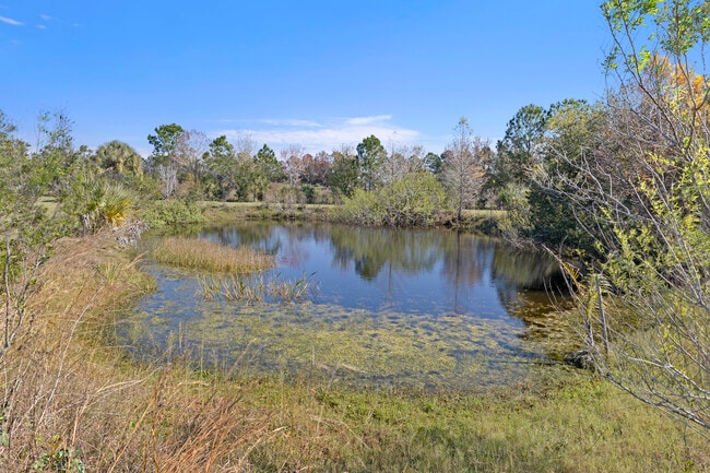
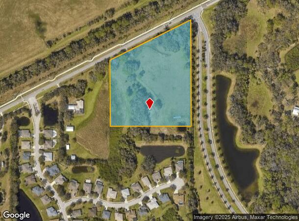
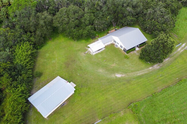
Property Record
9503 Erie Rd, Parrish, FL 34219
NEARBY LISTINGS FOR SALE OR LEASE
Property Detail
9503 Erie Rd
6552-2200-8
FROM THE SE COR OF SEC 26, TWP 33 S, RNG 18 E, RUN N 42 DEG 53 MIN 35 SEC W, A DIST OF 1174.81 FT TO THE SELY MAINTAINED R/W LN OF ERIE RD ALSO BEING THE POB; TH S 00 DEG 04 MIN 13
Countyproperty
Manatee
A
Florida
12081C0178E
8 AC
2021
Manatee
2025
Tampa/St Petersburg
001911
North Port-Bradenton-Sarasota, FL
1,728 SF
DEMOGRAPHICS near 9503 Erie Rd
1 mile
3 mile
5 mile
2024 Total Population
1,944
37,415
77,452
2029 Population
2,247
43,797
91,227
Pop Growth 2024-2029
+ 15.59%
+ 17.06%
+ 17.79%
Average Age
40
46
46
2024 Total Households
675
14,888
30,538
HH Growth 2024-2029
+ 14.67%
+ 16.23%
+ 16.97%
Median Household Inc
$106,632
$80,908
$79,435
Avg Household Size
2.80
2.40
2.40
2024 Avg HH Vehicles
2.00
2.00
2.00
Median Home Value
$318,166
$275,791
$293,216
Median Year Built
2006
2004
2005
Nearby Places
Map Layers
Map Styles
 Street
 Aerial
Transit
 Traffic
 Biking
Places
Listings with unknown addresses are not visible on the map
- Restaurants
- Banks
- Shops
- Fitness
- Groceries
PUBLIC TRANSPORTATION
AIRPORT
Sarasota/Bradenton International
Drive
Walk
Distance
Sarasota/Bradenton International
37 min
18.8 mi
St Pete-Clearwater International
Drive
Walk
Distance
St Pete-Clearwater International
58 min
37.4 mi
Tampa International
Drive
Walk
Distance
Tampa International
65 min
45.3 mi
SALE & LEASE HISTORY
LISTING DATE
SALE/LEASE

Aug 19, 2021
For Sale
Nearby Properties
Address
Land Use
TOTAL SIZE
Lot Size
Zoning
Address
Land Use
TOTAL SIZE
Lot Size
Zoning
294,300 SF
10.33 AC
PD-MU
Address
Land Use
TOTAL SIZE
Lot Size
Zoning
16,661 SF
132.10 AC
RSMH-6
Address
Land Use
TOTAL SIZE
Lot Size
Zoning
137.34 AC
Address
Land Use
TOTAL SIZE
Lot Size
Zoning
313,422 SF
47.93 AC
PD-C
Address
Land Use
TOTAL SIZE
Lot Size
Zoning
7,780 SF
176.54 AC
RSMH-6
Address
Land Use
TOTAL SIZE
Lot Size
Zoning
4,845 SF
82.48 AC
RSMH-6
Address
Land Use
TOTAL SIZE
Lot Size
Zoning
3,904 SF
94 AC
Address
Land Use
TOTAL SIZE
Lot Size
Zoning
312,546 SF
39.60 AC
A-1 SUBURB
Address
Land Use
TOTAL SIZE
Lot Size
Zoning
16,472 SF
67.82 AC
RSMH-6
Address
Land Use
TOTAL SIZE
Lot Size
Zoning
9,780 SF
68.64 AC
RSMH-6
Address
Land Use
TOTAL SIZE
Lot Size
Zoning
Address
Land Use
TOTAL SIZE
Lot Size
Zoning
60.41 AC
RSMH-6
Address
Land Use
TOTAL SIZE
Lot Size
Zoning
64,800 SF
8.19 AC
Address
Land Use
TOTAL SIZE
Lot Size
Zoning
75,001 SF
18.15 AC
PD-C
Address
Land Use
TOTAL SIZE
Lot Size
Zoning
58,569 SF
19.67 AC
A GENERAL
Address
Land Use
TOTAL SIZE
Lot Size
Zoning
61,770 SF
79.85 AC
A,A-1
Address
Land Use
TOTAL SIZE
Lot Size
Zoning
46.91 AC
RSMH-6
Address
Land Use
TOTAL SIZE
Lot Size
Zoning
40.84 AC
Address
Land Use
TOTAL SIZE
Lot Size
Zoning
66,063 SF
9.24 AC
PD-C
Address
Land Use
TOTAL SIZE
Lot Size
Zoning
158.58 AC
Address
Land Use
TOTAL SIZE
Lot Size
Zoning
21.19 AC
Address
Land Use
TOTAL SIZE
Lot Size
Zoning
89,799 SF
22.19 AC
PD-C
Address
Land Use
TOTAL SIZE
Lot Size
Zoning
43,464 SF
14.47 AC
VIL VILLAG
Address
Land Use
TOTAL SIZE
Lot Size
Zoning
161,245 SF
12.11 AC
PD-MU
Address
Land Use
TOTAL SIZE
Lot Size
Zoning
43.81 AC
Address
Land Use
TOTAL SIZE
Lot Size
Zoning
50,580 SF
5.97 AC
Address
Land Use
TOTAL SIZE
Lot Size
Zoning
56,442 SF
6.18 AC
GC GENERA
Address
Land Use
TOTAL SIZE
Lot Size
Zoning
5,628 SF
37.39 AC
RSMH-6
Address
Land Use
TOTAL SIZE
Lot Size
Zoning
61,721 SF
5.50 AC
PD-C
Address
Land Use
TOTAL SIZE
Lot Size
Zoning
2.73 AC
The World's #1 Commercial Real Estate Marketplace
Connect with us
© 2026 CoStar Group
The information above has been obtained from sources believed reliable. While we do not doubt its accuracy we have not verified it and make no guarantee, warranty or representation about it. It is your responsibility to independently confirm its accuracy and completeness. Any projections, opinions, assumptions, or estimates used are for example only and do not represent the current or future performance of the property. The value of this transaction to you depends on tax and other factors which should be evaluated by your tax, financial, and legal advisors. You and your advisors should conduct a careful, independent investigation of the property to determine to your satisfaction the suitability of the property for your needs.