Property Record
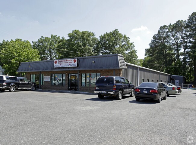
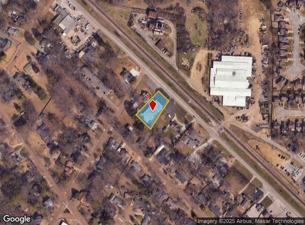
9503 Highway 178, Olive Branch, MS 38654
NEARBY LISTINGS FOR SALE OR LEASE
Property Detail
9503 Highway 178
Memphis, TN-MS-AR
City Olive Branch
1068340020011700
34-1-6 PT LOT 1 BLK 12 OLIVE BRANCH IN
Miscellaneous
DeSoto
X
Mississippi
28033C0104H
1
0
0.54 AC
2024
Olive Branch
070821
Memphis
7,392 SF
DEMOGRAPHICS near 9503 Highway 178
1 Mile
3 Mile
5 Mile
2024 Total Population
8,415
35,717
84,142
2029 Population
9,146
38,227
87,910
Pop Growth 2024-2029
+ 8.69%
+ 7.03%
+ 4.48%
Average Age
37
38
38
2024 Total Households
3,198
13,186
29,875
HH Growth 2024-2029
+ 8.72%
+ 7.03%
+ 4.45%
Median Household Inc
$77,336
$76,326
$79,613
Avg Household Size
2.60
2.70
2.80
2024 Avg HH Vehicles
2.00
2.00
2.00
Median Home Value
$174,266
$223,567
$230,959
Median Year Built
1995
1996
1996
Nearby Places
- Restaurants
- Banks
- Shops
- Fitness
- Groceries
PUBLIC TRANSPORTATION
AIRPORT
Memphis International
DRIVE
WALK
Distance
Memphis International
20 min
13.5 mi
Freight Ports
Port of Shreveport
DRIVE
WALK
Distance
Port of Shreveport
425 min
387.3 mi
SALE & LEASE HISTORY
LISTING DATE
SALE/LEASE

Oct 31, 2017
For Sale
Aug 30, 2018
For Lease
Nearby Properties
Address
Land Use
TOTAL SIZE
Lot Size
Zoning
Address
Land Use
TOTAL SIZE
Lot Size
Zoning
1,063,915 SF
74.33 AC
M-2
Address
Land Use
TOTAL SIZE
Lot Size
Zoning
1,151,180 SF
68.41 AC
M-1
Address
Land Use
TOTAL SIZE
Lot Size
Zoning
996,105 SF
60.30 AC
PUD
Address
Land Use
TOTAL SIZE
Lot Size
Zoning
865,146 SF
72.19 AC
M-1
Address
Land Use
TOTAL SIZE
Lot Size
Zoning
1,103,356 SF
60.98 AC
M-1
Address
Land Use
TOTAL SIZE
Lot Size
Zoning
1,299,800 SF
50.22 AC
M-1
Address
Land Use
TOTAL SIZE
Lot Size
Zoning
642,804 SF
67.55 AC
M-1
Address
Land Use
TOTAL SIZE
Lot Size
Zoning
728,940 SF
66.85 AC
M-1
Address
Land Use
TOTAL SIZE
Lot Size
Zoning
928,416 SF
42.73 AC
PB
Address
Land Use
TOTAL SIZE
Lot Size
Zoning
865,433 SF
54.55 AC
M-1
Address
Land Use
TOTAL SIZE
Lot Size
Zoning
814,637 SF
38.72 AC
PB
Address
Land Use
TOTAL SIZE
Lot Size
Zoning
617,288 SF
61.92 AC
PUD
Address
Land Use
TOTAL SIZE
Lot Size
Zoning
1,085,489 SF
57.74 AC
PB
Address
Land Use
TOTAL SIZE
Lot Size
Zoning
693,896 SF
47.15 AC
M-1
Address
Land Use
TOTAL SIZE
Lot Size
Zoning
81,018 SF
18.09 AC
CA
Address
Land Use
TOTAL SIZE
Lot Size
Zoning
395,779 SF
122.03 AC
M-1
Address
Land Use
TOTAL SIZE
Lot Size
Zoning
28.41 AC
PB
Address
Land Use
TOTAL SIZE
Lot Size
Zoning
69,571 SF
16.22 AC
CA
Address
Land Use
TOTAL SIZE
Lot Size
Zoning
606,459 SF
40.17 AC
M-1
Address
Land Use
TOTAL SIZE
Lot Size
Zoning
447,551 SF
32.34 AC
M-1
Address
Land Use
TOTAL SIZE
Lot Size
Zoning
596,400 SF
43.20 AC
M-2
Address
Land Use
TOTAL SIZE
Lot Size
Zoning
400,185 SF
19.97 AC
M-1
Address
Land Use
TOTAL SIZE
Lot Size
Zoning
340,555 SF
28.56 AC
M-2
Address
Land Use
TOTAL SIZE
Lot Size
Zoning
27,669 SF
34.27 AC
R-4
Address
Land Use
TOTAL SIZE
Lot Size
Zoning
480,000 SF
23.80 AC
M-2
Address
Land Use
TOTAL SIZE
Lot Size
Zoning
413,488 SF
28.15 AC
M-1
Address
Land Use
TOTAL SIZE
Lot Size
Zoning
22.08 AC
PB
Address
Land Use
TOTAL SIZE
Lot Size
Zoning
342,777 SF
33.28 AC
M-1
Address
Land Use
TOTAL SIZE
Lot Size
Zoning
406,004 SF
43.17 AC
M-2
Address
Land Use
TOTAL SIZE
Lot Size
Zoning
10,155 SF
26.43 AC
R-4
The World's #1 Commercial Real Estate Marketplace
Connect with us
© 2025 CoStar Group
The information above has been obtained from sources believed reliable. While we do not doubt its accuracy we have not verified it and make no guarantee, warranty or representation about it. It is your responsibility to independently confirm its accuracy and completeness. Any projections, opinions, assumptions, or estimates used are for example only and do not represent the current or future performance of the property. The value of this transaction to you depends on tax and other factors which should be evaluated by your tax, financial, and legal advisors. You and your advisors should conduct a careful, independent investigation of the property to determine to your satisfaction the suitability of the property for your needs.