Property Record
9509 89Th Dr E, Parrish, FL 34219

Property Detail
9509 89Th Dr E
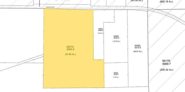
6507-0005-9
A PARCEL OF LAND LYING IN THE NE 1/4 OF SEC 23, TWN 33S, RNG 18E, BEING MORE PARTICULARY DESC AS FOLLOWS: COM AT THE NE COR OF SEC 23, TWN 33S, RNG 18E; TH S 89 DEG 37 MIN 55 SEC
Vacantlandnec
MANATEE
PD-R
Florida
A Areas with a 1% annual chance of flooding and a 26% chance of flooding over the life of a 30-year mortgage.
58.58 AC
2023
Manatee
2025
Tampa/St Petersburg
001913
North Port-Bradenton-Sarasota, FL
NEARBY LISTINGS FOR SALE OR LEASE
DEMOGRAPHICS near 9509 89Th Dr E
1 mile
3 mile
5 mile
2024 Total Population
539
15,895
60,019
2029 Population
655
18,603
70,663
Pop Growth 2024-2029
+ 21.52%
+ 17.04%
+ 17.73%
Average Age
38
42
46
2024 Total Households
168
5,717
23,200
HH Growth 2024-2029
+ 20.24%
+ 16.00%
+ 16.96%
Median Household Inc
$131,250
$104,285
$75,998
Avg Household Size
3.00
2.70
2.40
2024 Avg HH Vehicles
2.00
2.00
2.00
Median Home Value
$384,090
$304,930
$272,809
Median Year Built
2011
2009
2004
Nearby Places
Map Layers
Map Styles
 Street
 Aerial
Transit
 Traffic
 Biking
Places
Listings with unknown addresses are not visible on the map
- Restaurants
- Banks
- Shops
- Fitness
- Groceries
PUBLIC TRANSPORTATION
AIRPORT
Sarasota/Bradenton International
Drive
Walk
Distance
Sarasota/Bradenton International
34 min
19.7 mi
St Pete-Clearwater International
Drive
Walk
Distance
St Pete-Clearwater International
51 min
36.3 mi
Tampa International
Drive
Walk
Distance
Tampa International
57 min
45.8 mi
Freight Ports
Port Manatee
Drive
Walk
Distance
Port Manatee
14 min
7.4 mi
Nearby Properties
Address
Land Use
TOTAL SIZE
Lot Size
Zoning
Address
Land Use
TOTAL SIZE
Lot Size
Zoning
359,418 SF
16.36 AC
PD-C
Address
Land Use
TOTAL SIZE
Lot Size
Zoning
137.34 AC
Address
Land Use
TOTAL SIZE
Lot Size
Zoning
184,048 SF
21.11 AC
PD-MU
Address
Land Use
TOTAL SIZE
Lot Size
Zoning
165.96 AC
Address
Land Use
TOTAL SIZE
Lot Size
Zoning
96.46 AC
Address
Land Use
TOTAL SIZE
Lot Size
Zoning
3,904 SF
94 AC
Address
Land Use
TOTAL SIZE
Lot Size
Zoning
312,546 SF
39.60 AC
A-1 SUBURB
Address
Land Use
TOTAL SIZE
Lot Size
Zoning
136.89 AC
Address
Land Use
TOTAL SIZE
Lot Size
Zoning
Address
Land Use
TOTAL SIZE
Lot Size
Zoning
119.98 AC
Address
Land Use
TOTAL SIZE
Lot Size
Zoning
50.25 AC
Address
Land Use
TOTAL SIZE
Lot Size
Zoning
124,400 SF
4.05 AC
PD-MU
Address
Land Use
TOTAL SIZE
Lot Size
Zoning
3.09 AC
PD-R
Address
Land Use
TOTAL SIZE
Lot Size
Zoning
64,800 SF
8.19 AC
Address
Land Use
TOTAL SIZE
Lot Size
Zoning
75,001 SF
18.15 AC
PD-C
Address
Land Use
TOTAL SIZE
Lot Size
Zoning
58,569 SF
19.67 AC
A GENERAL
Address
Land Use
TOTAL SIZE
Lot Size
Zoning
98,574 SF
5.60 AC
PD-MU
Address
Land Use
TOTAL SIZE
Lot Size
Zoning
40.84 AC
Address
Land Use
TOTAL SIZE
Lot Size
Zoning
158.58 AC
Address
Land Use
TOTAL SIZE
Lot Size
Zoning
21.19 AC
Address
Land Use
TOTAL SIZE
Lot Size
Zoning
89,799 SF
22.19 AC
PD-C
Address
Land Use
TOTAL SIZE
Lot Size
Zoning
33.13 AC
Address
Land Use
TOTAL SIZE
Lot Size
Zoning
43.81 AC
Address
Land Use
TOTAL SIZE
Lot Size
Zoning
50,580 SF
5.97 AC
Address
Land Use
TOTAL SIZE
Lot Size
Zoning
2.73 AC
Address
Land Use
TOTAL SIZE
Lot Size
Zoning
Address
Land Use
TOTAL SIZE
Lot Size
Zoning
7.24 AC
Address
Land Use
TOTAL SIZE
Lot Size
Zoning
61.03 AC
Address
Land Use
TOTAL SIZE
Lot Size
Zoning
59.03 AC
Address
Land Use
TOTAL SIZE
Lot Size
Zoning
1,596 SF
106.35 AC
PD-R
The World's #1 Commercial Real Estate Marketplace
Connect with us
© 2026 CoStar Group
The information above has been obtained from sources believed reliable. While we do not doubt its accuracy we have not verified it and make no guarantee, warranty or representation about it. It is your responsibility to independently confirm its accuracy and completeness. Any projections, opinions, assumptions, or estimates used are for example only and do not represent the current or future performance of the property. The value of this transaction to you depends on tax and other factors which should be evaluated by your tax, financial, and legal advisors. You and your advisors should conduct a careful, independent investigation of the property to determine to your satisfaction the suitability of the property for your needs.