Property Record
951 S Westgate Way, Wylie, TX 75098
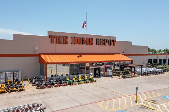

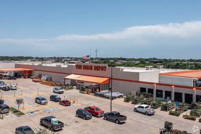

Property Detail
951 S Westgate Way
Dallas-Fort Worth-Arlington, TX
GREENWAY ADDITION, BLK A, LOT 3
R-8110-00A-0030-1
COLLIN
Commercialnec
Texas
B and X Area of moderate flood hazard, usually the area between the limits of the 100-year and 500-year floods.
3
2025
11.55 AC
2025
Murphy/Wylie
031319
Dallas/Ft Worth
94,981 SF
NEARBY LISTINGS FOR SALE OR LEASE
DEMOGRAPHICS near 951 S Westgate Way
1 mile
3 mile
5 mile
2025 Total Population
11,117
84,601
161,358
2030 Population
12,745
95,591
180,167
Pop Growth 2025-2030
+ 14.64%
+ 12.99%
+ 11.66%
Average Age
37
37
38
2025 Total Households
3,743
26,926
50,606
HH Growth 2025-2030
+ 14.83%
+ 13.19%
+ 11.69%
Median Household Inc
$90,713
$123,153
$132,059
Avg Household Size
2.90
3.10
3.20
2025 Avg HH Vehicles
2.00
2.00
2.00
Median Home Value
$392,830
$435,771
$468,859
Median Year Built
2002
2005
2005
Nearby Places
Map Layers
Map Styles
 Street
 Aerial
Transit
 Traffic
 Biking
Places
Listings with unknown addresses are not visible on the map
- Restaurants
- Banks
- Shops
- Fitness
- Groceries
PUBLIC TRANSPORTATION
AIRPORT
Dallas Love Field
Drive
Walk
Distance
Dallas Love Field
43 min
28.5 mi
Dallas-Fort Worth International
Drive
Walk
Distance
Dallas-Fort Worth International
48 min
36.6 mi
Nearby Properties
Address
Land Use
TOTAL SIZE
Lot Size
Zoning
Address
Land Use
TOTAL SIZE
Lot Size
Zoning
339,663 SF
95.04 AC
Address
Land Use
TOTAL SIZE
Lot Size
Zoning
350,553 SF
18.71 AC
MF-M
Address
Land Use
TOTAL SIZE
Lot Size
Zoning
367,458 SF
13.42 AC
Address
Land Use
TOTAL SIZE
Lot Size
Zoning
285,392 SF
19.44 AC
MF-M
Address
Land Use
TOTAL SIZE
Lot Size
Zoning
441,356 SF
74.94 AC
Address
Land Use
TOTAL SIZE
Lot Size
Zoning
385,735 SF
13.13 AC
Address
Land Use
TOTAL SIZE
Lot Size
Zoning
266,957 SF
11.34 AC
MFR
Address
Land Use
TOTAL SIZE
Lot Size
Zoning
393,054 SF
55.95 AC
Address
Land Use
TOTAL SIZE
Lot Size
Zoning
257,718 SF
13.10 AC
RESIDENTIA
Address
Land Use
TOTAL SIZE
Lot Size
Zoning
228,536 SF
10.54 AC
MF-M
Address
Land Use
TOTAL SIZE
Lot Size
Zoning
203,383 SF
11.91 AC
MF-M
Address
Land Use
TOTAL SIZE
Lot Size
Zoning
274,329 SF
44.89 AC
Address
Land Use
TOTAL SIZE
Lot Size
Zoning
746 SF
115.14 AC
Address
Land Use
TOTAL SIZE
Lot Size
Zoning
83,564 SF
10.81 AC
Address
Land Use
TOTAL SIZE
Lot Size
Zoning
140,130 SF
19.67 AC
Address
Land Use
TOTAL SIZE
Lot Size
Zoning
132,306 SF
7.85 AC
MF
Address
Land Use
TOTAL SIZE
Lot Size
Zoning
78,708 SF
9.55 AC
Address
Land Use
TOTAL SIZE
Lot Size
Zoning
77,225 SF
9.59 AC
Address
Land Use
TOTAL SIZE
Lot Size
Zoning
106,866 SF
15.69 AC
Address
Land Use
TOTAL SIZE
Lot Size
Zoning
97,898 SF
10.82 AC
Address
Land Use
TOTAL SIZE
Lot Size
Zoning
186,220 SF
13.64 AC
Address
Land Use
TOTAL SIZE
Lot Size
Zoning
203,192 SF
17.69 AC
Address
Land Use
TOTAL SIZE
Lot Size
Zoning
123,621 SF
12.22 AC
Address
Land Use
TOTAL SIZE
Lot Size
Zoning
128,849 SF
7.70 AC
Address
Land Use
TOTAL SIZE
Lot Size
Zoning
141,396 SF
8.40 AC
NS
Address
Land Use
TOTAL SIZE
Lot Size
Zoning
304,978 SF
81.51 AC
Address
Land Use
TOTAL SIZE
Lot Size
Zoning
145,268 SF
16.34 AC
Address
Land Use
TOTAL SIZE
Lot Size
Zoning
221,982 SF
17.21 AC
Address
Land Use
TOTAL SIZE
Lot Size
Zoning
51,878 SF
3.30 AC
PD
Address
Land Use
TOTAL SIZE
Lot Size
Zoning
134,050 SF
5.01 AC
Z335
The World's #1 Commercial Real Estate Marketplace
Connect with us
© 2026 CoStar Group
The information above has been obtained from sources believed reliable. While we do not doubt its accuracy we have not verified it and make no guarantee, warranty or representation about it. It is your responsibility to independently confirm its accuracy and completeness. Any projections, opinions, assumptions, or estimates used are for example only and do not represent the current or future performance of the property. The value of this transaction to you depends on tax and other factors which should be evaluated by your tax, financial, and legal advisors. You and your advisors should conduct a careful, independent investigation of the property to determine to your satisfaction the suitability of the property for your needs.