Property Record
951 Turner Rd, Grapevine, TX 76051
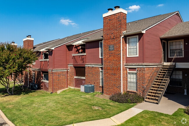


Property Detail
951 Turner Rd
Dallas-Fort Worth-Arlington, TX
COBBLESTONE VILLAGE ADDITION BLOCK 1 LOT 1
04971752
TARRANT
Multifamilydwelling
Texas
B and X Area of moderate flood hazard, usually the area between the limits of the 100-year and 500-year floods.
1
2024
9.98 AC
2025
Grapevine
113716
Dallas/Ft Worth
176,645 SF
NEARBY LISTINGS FOR SALE OR LEASE
-
-
View all Grapevine listings for sale on LoopNet.com
DEMOGRAPHICS near 951 Turner Rd
1 mile
3 mile
5 mile
2025 Total Population
7,603
30,716
120,525
2030 Population
8,019
32,566
128,388
Pop Growth 2025-2030
+ 5.47%
+ 6.02%
+ 6.52%
Average Age
40
39
39
2025 Total Households
3,487
13,628
45,246
HH Growth 2025-2030
+ 5.56%
+ 5.92%
+ 5.95%
Median Household Inc
$99,216
$103,293
$132,298
Avg Household Size
2.10
2.20
2.60
2025 Avg HH Vehicles
2.00
2.00
2.00
Median Home Value
$499,326
$486,542
$641,774
Median Year Built
1996
1993
1996
Nearby Places
Map Layers
Map Styles
 Street
 Aerial
Transit
 Traffic
 Biking
Places
Listings with unknown addresses are not visible on the map
- Restaurants
- Banks
- Shops
- Fitness
- Groceries
PUBLIC TRANSPORTATION
COMMUTER RAIL
Hebron Station (A-train - Denton County Transportation Authority)
Drive
Walk
Distance
Hebron Station (A-train - Denton County Transportation Authority)
17 min
9.4 mi
AIRPORT
Dallas-Fort Worth International
Drive
Walk
Distance
Dallas-Fort Worth International
10 min
5.6 mi
Dallas Love Field
Drive
Walk
Distance
Dallas Love Field
29 min
19.4 mi
Freight Ports
Port of Shreveport
Drive
Walk
Distance
Port of Shreveport
236 min
218.3 mi
Nearby Properties
Address
Land Use
TOTAL SIZE
Lot Size
Zoning
Address
Land Use
TOTAL SIZE
Lot Size
Zoning
7,321,782 SF
0.01 AC
Z392
Address
Land Use
TOTAL SIZE
Lot Size
Zoning
3,233,905 SF
51.24 AC
Address
Land Use
TOTAL SIZE
Lot Size
Zoning
2,545,604 SF
123.01 AC
Z402
Address
Land Use
TOTAL SIZE
Lot Size
Zoning
1,325,709 SF
124.50 AC
Address
Land Use
TOTAL SIZE
Lot Size
Zoning
680,063 SF
36.51 AC
Address
Land Use
TOTAL SIZE
Lot Size
Zoning
563,145 SF
Address
Land Use
TOTAL SIZE
Lot Size
Zoning
444,824 SF
19.08 AC
Address
Land Use
TOTAL SIZE
Lot Size
Zoning
527,463 SF
42.25 AC
Address
Land Use
TOTAL SIZE
Lot Size
Zoning
432,986 SF
10.57 AC
Address
Land Use
TOTAL SIZE
Lot Size
Zoning
500,000 SF
99.10 AC
Address
Land Use
TOTAL SIZE
Lot Size
Zoning
768,494 SF
10.42 AC
Address
Land Use
TOTAL SIZE
Lot Size
Zoning
332,665 SF
9.83 AC
Address
Land Use
TOTAL SIZE
Lot Size
Zoning
1,581,742 SF
53.48 AC
Z123
Address
Land Use
TOTAL SIZE
Lot Size
Zoning
190,223 SF
0.03 AC
Z392
Address
Land Use
TOTAL SIZE
Lot Size
Zoning
397,272 SF
12.35 AC
Address
Land Use
TOTAL SIZE
Lot Size
Zoning
457,738 SF
28.49 AC
Address
Land Use
TOTAL SIZE
Lot Size
Zoning
360,898 SF
5.51 AC
Address
Land Use
TOTAL SIZE
Lot Size
Zoning
464,476 SF
5.08 AC
Address
Land Use
TOTAL SIZE
Lot Size
Zoning
950,000 SF
45.32 AC
Z123
Address
Land Use
TOTAL SIZE
Lot Size
Zoning
389,286 SF
21.86 AC
Address
Land Use
TOTAL SIZE
Lot Size
Zoning
184,186 SF
34.74 AC
Z31
Address
Land Use
TOTAL SIZE
Lot Size
Zoning
397,935 SF
10.65 AC
Address
Land Use
TOTAL SIZE
Lot Size
Zoning
329,666 SF
19.76 AC
Address
Land Use
TOTAL SIZE
Lot Size
Zoning
321,993 SF
18.20 AC
Address
Land Use
TOTAL SIZE
Lot Size
Zoning
295,408 SF
10.33 AC
Address
Land Use
TOTAL SIZE
Lot Size
Zoning
263,119 SF
11.01 AC
Address
Land Use
TOTAL SIZE
Lot Size
Zoning
264,000 SF
15.06 AC
Address
Land Use
TOTAL SIZE
Lot Size
Zoning
329,353 SF
7.90 AC
Address
Land Use
TOTAL SIZE
Lot Size
Zoning
234,200 SF
274.75 AC
Address
Land Use
TOTAL SIZE
Lot Size
Zoning
270,453 SF
17.48 AC
The World's #1 Commercial Real Estate Marketplace
Connect with us
© 2026 CoStar Group
The information above has been obtained from sources believed reliable. While we do not doubt its accuracy we have not verified it and make no guarantee, warranty or representation about it. It is your responsibility to independently confirm its accuracy and completeness. Any projections, opinions, assumptions, or estimates used are for example only and do not represent the current or future performance of the property. The value of this transaction to you depends on tax and other factors which should be evaluated by your tax, financial, and legal advisors. You and your advisors should conduct a careful, independent investigation of the property to determine to your satisfaction the suitability of the property for your needs.