Property Record
951 Whipple Rd, Hayward, CA 94544


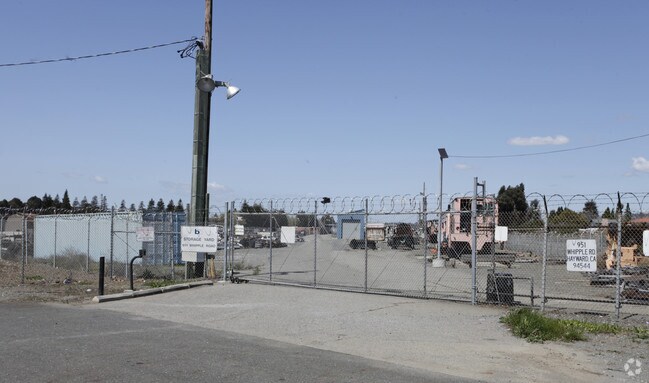
Property Detail
951 Whipple Rd
475-0050-001-01
ALAMEDA
Governmentalpublicusegeneral
California
B and X Area of moderate flood hazard, usually the area between the limits of the 100-year and 500-year floods.
77.41 AC
0
Hayward/Castro Valley
2025
East Bay/Oakland
438203
Oakland-Fremont-Berkeley, CA
NEARBY LISTINGS FOR SALE OR LEASE
-
-
View all Hayward listings for sale on LoopNet.com
DEMOGRAPHICS near 951 Whipple Rd
1 mile
3 mile
5 mile
2025 Total Population
15,715
140,702
329,852
2030 Population
15,636
140,292
329,527
Pop Growth 2025-2030
(0.50%)
(0.29%)
(0.10%)
Average Age
40
41
40
2025 Total Households
4,356
43,109
102,805
HH Growth 2025-2030
(0.62%)
(0.40%)
(0.20%)
Median Household Inc
$134,421
$140,156
$136,203
Avg Household Size
3.40
3.20
3.10
2025 Avg HH Vehicles
2.00
2.00
2.00
Median Home Value
$841,596
$1,024,202
$1,021,806
Median Year Built
1962
1977
1976
Nearby Places
Map Layers
Map Styles
 Street
 Aerial
Layers
 Traffic
 Biking
Places
Listings with unknown addresses are not visible on the map
- Restaurants
- Banks
- Shops
- Fitness
- Groceries
PUBLIC TRANSPORTATION
COMMUTER RAIL
Hayward (Capitol Corridor - Capitol Corridor Joint Powers Authority)
Drive
Walk
Distance
Hayward (Capitol Corridor - Capitol Corridor Joint Powers Authority)
12 min
6.4 mi
Hayward Amtrak (Capitol Corridor - Amtrak)
Drive
Walk
Distance
Hayward Amtrak (Capitol Corridor - Amtrak)
12 min
6.4 mi
AIRPORT
Metro Oakland International
Drive
Walk
Distance
Metro Oakland International
22 min
14.5 mi
San Francisco International
Drive
Walk
Distance
San Francisco International
34 min
25.1 mi
Norman Y Mineta San Jose International
Drive
Walk
Distance
Norman Y Mineta San Jose International
34 min
25.3 mi
Freight Ports
Port of Redwood City
Drive
Walk
Distance
Port of Redwood City
31 min
19.5 mi
Nearby Properties
Address
Land Use
TOTAL SIZE
Lot Size
Zoning
Address
Land Use
TOTAL SIZE
Lot Size
Zoning
29,436 SF
10.20 AC
Address
Land Use
TOTAL SIZE
Lot Size
Zoning
176,707 SF
2.47 AC
Address
Land Use
TOTAL SIZE
Lot Size
Zoning
312,244 SF
31.84 AC
Address
Land Use
TOTAL SIZE
Lot Size
Zoning
52,720 SF
4.21 AC
Address
Land Use
TOTAL SIZE
Lot Size
Zoning
203,984 SF
6.47 AC
Address
Land Use
TOTAL SIZE
Lot Size
Zoning
173,948 SF
6.10 AC
Address
Land Use
TOTAL SIZE
Lot Size
Zoning
175,325 SF
2.91 AC
Address
Land Use
TOTAL SIZE
Lot Size
Zoning
258,470 SF
11.64 AC
Address
Land Use
TOTAL SIZE
Lot Size
Zoning
58,991 SF
9.56 AC
Address
Land Use
TOTAL SIZE
Lot Size
Zoning
315,077 SF
3.35 AC
Address
Land Use
TOTAL SIZE
Lot Size
Zoning
234,858 SF
8.72 AC
I
Address
Land Use
TOTAL SIZE
Lot Size
Zoning
89,145 SF
5.12 AC
Address
Land Use
TOTAL SIZE
Lot Size
Zoning
146,599 SF
13.72 AC
Address
Land Use
TOTAL SIZE
Lot Size
Zoning
116,485 SF
1.81 AC
Address
Land Use
TOTAL SIZE
Lot Size
Zoning
Address
Land Use
TOTAL SIZE
Lot Size
Zoning
154,113 SF
14.10 AC
Address
Land Use
TOTAL SIZE
Lot Size
Zoning
124,292 SF
9.69 AC
Address
Land Use
TOTAL SIZE
Lot Size
Zoning
89,344 SF
4.36 AC
Address
Land Use
TOTAL SIZE
Lot Size
Zoning
214,200 SF
9.04 AC
Address
Land Use
TOTAL SIZE
Lot Size
Zoning
200,384 SF
10.26 AC
Address
Land Use
TOTAL SIZE
Lot Size
Zoning
266,149 SF
13.45 AC
I
Address
Land Use
TOTAL SIZE
Lot Size
Zoning
92,922 SF
5 AC
Address
Land Use
TOTAL SIZE
Lot Size
Zoning
189,244 SF
16.56 AC
Address
Land Use
TOTAL SIZE
Lot Size
Zoning
100,128 SF
0.98 AC
Address
Land Use
TOTAL SIZE
Lot Size
Zoning
79,075 SF
4.32 AC
Address
Land Use
TOTAL SIZE
Lot Size
Zoning
203,857 SF
2.62 AC
Address
Land Use
TOTAL SIZE
Lot Size
Zoning
128,700 SF
11.21 AC
Address
Land Use
TOTAL SIZE
Lot Size
Zoning
64,127 SF
5.34 AC
Address
Land Use
TOTAL SIZE
Lot Size
Zoning
131,486 SF
55.82 AC
Address
Land Use
TOTAL SIZE
Lot Size
Zoning
232,864 SF
12.23 AC
The World's #1 Commercial Real Estate Marketplace
Connect with us
© 2026 CoStar Group
The information above has been obtained from sources believed reliable. While we do not doubt its accuracy we have not verified it and make no guarantee, warranty or representation about it. It is your responsibility to independently confirm its accuracy and completeness. Any projections, opinions, assumptions, or estimates used are for example only and do not represent the current or future performance of the property. The value of this transaction to you depends on tax and other factors which should be evaluated by your tax, financial, and legal advisors. You and your advisors should conduct a careful, independent investigation of the property to determine to your satisfaction the suitability of the property for your needs.