Property Record
9511 N Ranch Rd 620 Rd, Austin, TX 78726
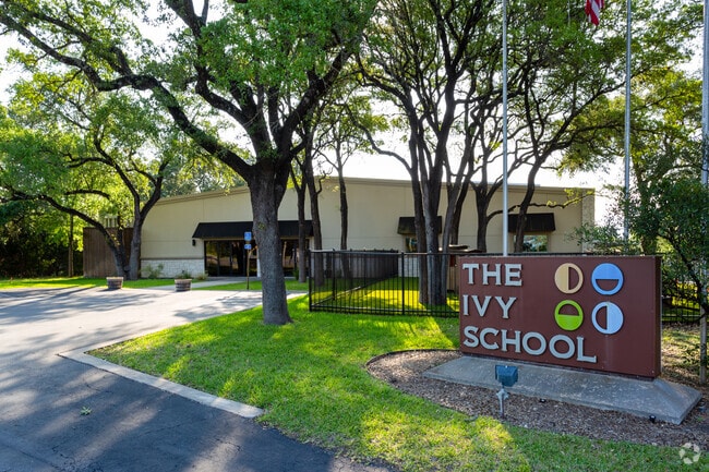

Property Detail
9511 N Ranch Rd 620 Rd
Austin-Round Rock-San Marcos, TX
LOT 1 BLK A ECO RESOURCES SUBD
170839
TRAVIS
Warehouse
Texas
B and X Area of moderate flood hazard, usually the area between the limits of the 100-year and 500-year floods.
1
2025
9.36 AC
2025
Far Northwest
034600
Austin
18,298 SF
NEARBY LISTINGS FOR SALE OR LEASE
DEMOGRAPHICS near 9511 N Ranch Rd 620 Rd
1 mile
3 mile
5 mile
2025 Total Population
7,431
52,755
151,283
2030 Population
7,696
56,270
165,040
Pop Growth 2025-2030
+ 3.57%
+ 6.66%
+ 9.09%
Average Age
37
39
39
2025 Total Households
3,180
20,582
62,203
HH Growth 2025-2030
+ 4.21%
+ 7.49%
+ 10.00%
Median Household Inc
$85,108
$124,784
$114,443
Avg Household Size
2.30
2.50
2.40
2025 Avg HH Vehicles
2.00
2.00
2.00
Median Home Value
$739,473
$651,789
$633,370
Median Year Built
2003
1997
1998
Nearby Places
Map Layers
Map Styles
 Street
 Aerial
Layers
 Traffic
 Biking
Places
Listings with unknown addresses are not visible on the map
- Restaurants
- Banks
- Shops
- Fitness
- Groceries
PUBLIC TRANSPORTATION
AIRPORT
Austin-Bergstrom International
Drive
Walk
Distance
Austin-Bergstrom International
45 min
30.0 mi
Nearby Properties
Address
Land Use
TOTAL SIZE
Lot Size
Zoning
Address
Land Use
TOTAL SIZE
Lot Size
Zoning
1,396,406 SF
107.21 AC
Address
Land Use
TOTAL SIZE
Lot Size
Zoning
525,852 SF
30.92 AC
Address
Land Use
TOTAL SIZE
Lot Size
Zoning
369,192 SF
78.87 AC
Address
Land Use
TOTAL SIZE
Lot Size
Zoning
411,288 SF
27.68 AC
Address
Land Use
TOTAL SIZE
Lot Size
Zoning
342,992 SF
17.53 AC
Address
Land Use
TOTAL SIZE
Lot Size
Zoning
576,996 SF
38.77 AC
Address
Land Use
TOTAL SIZE
Lot Size
Zoning
610,326 SF
43.30 AC
Address
Land Use
TOTAL SIZE
Lot Size
Zoning
468,870 SF
22 AC
4-GRMUCO
Address
Land Use
TOTAL SIZE
Lot Size
Zoning
388,673 SF
30.98 AC
Address
Land Use
TOTAL SIZE
Lot Size
Zoning
306,900 SF
34.50 AC
Address
Land Use
TOTAL SIZE
Lot Size
Zoning
323,718 SF
17.45 AC
Address
Land Use
TOTAL SIZE
Lot Size
Zoning
172,975 SF
33.88 AC
Address
Land Use
TOTAL SIZE
Lot Size
Zoning
349,600 SF
14.62 AC
Address
Land Use
TOTAL SIZE
Lot Size
Zoning
349,200 SF
28.91 AC
Address
Land Use
TOTAL SIZE
Lot Size
Zoning
341,389 SF
12.19 AC
4-GRMUCO
Address
Land Use
TOTAL SIZE
Lot Size
Zoning
276,728 SF
16.25 AC
Address
Land Use
TOTAL SIZE
Lot Size
Zoning
285,768 SF
23.77 AC
Address
Land Use
TOTAL SIZE
Lot Size
Zoning
262,480 SF
27.52 AC
Address
Land Use
TOTAL SIZE
Lot Size
Zoning
288,994 SF
13.58 AC
Address
Land Use
TOTAL SIZE
Lot Size
Zoning
270,504 SF
21.75 AC
Address
Land Use
TOTAL SIZE
Lot Size
Zoning
153,450 SF
14.70 AC
Address
Land Use
TOTAL SIZE
Lot Size
Zoning
173,608 SF
16.20 AC
Address
Land Use
TOTAL SIZE
Lot Size
Zoning
264,990 SF
17.44 AC
Address
Land Use
TOTAL SIZE
Lot Size
Zoning
141,164 SF
8.67 AC
Address
Land Use
TOTAL SIZE
Lot Size
Zoning
300,466 SF
27.55 AC
Address
Land Use
TOTAL SIZE
Lot Size
Zoning
196,610 SF
383.96 AC
Address
Land Use
TOTAL SIZE
Lot Size
Zoning
182,320 SF
13.67 AC
Address
Land Use
TOTAL SIZE
Lot Size
Zoning
155,600 SF
6.19 AC
Address
Land Use
TOTAL SIZE
Lot Size
Zoning
219,684 SF
3.97 AC
Address
Land Use
TOTAL SIZE
Lot Size
Zoning
2,500 SF
47.76 AC
The World's #1 Commercial Real Estate Marketplace
Connect with us
© 2026 CoStar Group
The information above has been obtained from sources believed reliable. While we do not doubt its accuracy we have not verified it and make no guarantee, warranty or representation about it. It is your responsibility to independently confirm its accuracy and completeness. Any projections, opinions, assumptions, or estimates used are for example only and do not represent the current or future performance of the property. The value of this transaction to you depends on tax and other factors which should be evaluated by your tax, financial, and legal advisors. You and your advisors should conduct a careful, independent investigation of the property to determine to your satisfaction the suitability of the property for your needs.