Property Record
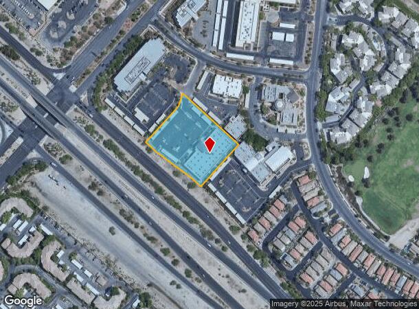
9525 Hillwood Dr, Las Vegas, NV 89134


NEARBY LISTINGS FOR SALE OR LEASE
Property Detail
9525 Hillwood Dr
Las Vegas-Henderson-Paradise, NV
Summerlin Village 1 South Parcel 1
138-30-510-014
SUMMERLIN VILLAGE 1 SOUTH PARCEL 1 PLAT BOOK 51 PAGE 26 PT LOT 3 BLOCK B
Commercialnec
Clark
X
Nevada
32003C2145F
3
2025
2.02 AC
2025
Northwest Las Vegas
003218
Las Vegas
23,740 SF
DEMOGRAPHICS near 9525 Hillwood Dr
1 Mile
3 Mile
5 Mile
2024 Total Population
11,478
148,222
363,118
2029 Population
12,361
159,592
390,637
Pop Growth 2024-2029
+ 7.69%
+ 7.67%
+ 7.58%
Average Age
44
44
42
2024 Total Households
4,786
62,800
143,490
HH Growth 2024-2029
+ 7.67%
+ 7.61%
+ 7.51%
Median Household Inc
$92,311
$72,968
$69,071
Avg Household Size
2.40
2.30
2.50
2024 Avg HH Vehicles
2.00
2.00
2.00
Median Home Value
$583,098
$403,744
$400,901
Median Year Built
1996
1995
1994
Nearby Places
Map Layers
Map Styles
 Street
 Aerial
- Restaurants
- Banks
- Shops
- Fitness
- Groceries
PUBLIC TRANSPORTATION
AIRPORT
Harry Reid International
DRIVE
WALK
Distance
Harry Reid International
27 min
16.3 mi
Boulder City Municipal
DRIVE
WALK
Distance
Boulder City Municipal
47 min
36.2 mi
SALE & LEASE HISTORY
LISTING DATE
SALE/LEASE

May 17, 2023
For Sale
Jun 29, 2021
For Lease
Jun 12, 2025
For Lease
Jul 27, 2017
For Lease
Jul 09, 2024
For Sale
Dec 20, 2019
For Lease
Apr 10, 2018
For Sale
Apr 05, 2018
For Lease
Nearby Properties
Address
Land Use
TOTAL SIZE
Lot Size
Zoning
Address
Land Use
TOTAL SIZE
Lot Size
Zoning
421,874 SF
59.43 AC
H1
Address
Land Use
TOTAL SIZE
Lot Size
Zoning
336,142 SF
39.99 AC
PC
Address
Land Use
TOTAL SIZE
Lot Size
Zoning
338,051 SF
49.13 AC
C1
Address
Land Use
TOTAL SIZE
Lot Size
Zoning
157,011 SF
31.41 AC
Address
Land Use
TOTAL SIZE
Lot Size
Zoning
974,131 SF
19.93 AC
Address
Land Use
TOTAL SIZE
Lot Size
Zoning
100.61 AC
Address
Land Use
TOTAL SIZE
Lot Size
Zoning
29,374 SF
7.06 AC
Address
Land Use
TOTAL SIZE
Lot Size
Zoning
40.55 AC
PC
Address
Land Use
TOTAL SIZE
Lot Size
Zoning
38.56 AC
PF
Address
Land Use
TOTAL SIZE
Lot Size
Zoning
157.50 AC
Address
Land Use
TOTAL SIZE
Lot Size
Zoning
408,908 SF
15.60 AC
Address
Land Use
TOTAL SIZE
Lot Size
Zoning
52,690 SF
17.65 AC
RU
Address
Land Use
TOTAL SIZE
Lot Size
Zoning
280,968 SF
1.45 AC
Address
Land Use
TOTAL SIZE
Lot Size
Zoning
41,331 SF
1.59 AC
Address
Land Use
TOTAL SIZE
Lot Size
Zoning
7,292 SF
24.24 AC
R3
Address
Land Use
TOTAL SIZE
Lot Size
Zoning
5,643 SF
10.29 AC
Address
Land Use
TOTAL SIZE
Lot Size
Zoning
9,840 SF
19.89 AC
PD
Address
Land Use
TOTAL SIZE
Lot Size
Zoning
37.31 AC
CV
Address
Land Use
TOTAL SIZE
Lot Size
Zoning
5,427 SF
17.57 AC
Address
Land Use
TOTAL SIZE
Lot Size
Zoning
259,832 SF
3.79 AC
Address
Land Use
TOTAL SIZE
Lot Size
Zoning
7,148 SF
7.26 AC
Address
Land Use
TOTAL SIZE
Lot Size
Zoning
2,754 SF
17.17 AC
RPD20
Address
Land Use
TOTAL SIZE
Lot Size
Zoning
223,030 SF
18.11 AC
C1
Address
Land Use
TOTAL SIZE
Lot Size
Zoning
246,947 SF
6.56 AC
RU
Address
Land Use
TOTAL SIZE
Lot Size
Zoning
3,895 SF
15.40 AC
PC
Address
Land Use
TOTAL SIZE
Lot Size
Zoning
12,031 SF
17.45 AC
PC
Address
Land Use
TOTAL SIZE
Lot Size
Zoning
5,979 SF
17.27 AC
RPD21
Address
Land Use
TOTAL SIZE
Lot Size
Zoning
7,191 SF
16.56 AC
PC
Address
Land Use
TOTAL SIZE
Lot Size
Zoning
450 SF
48.82 AC
Address
Land Use
TOTAL SIZE
Lot Size
Zoning
30.07 AC
The World's #1 Commercial Real Estate Marketplace
Connect with us
© 2026 CoStar Group
The information above has been obtained from sources believed reliable. While we do not doubt its accuracy we have not verified it and make no guarantee, warranty or representation about it. It is your responsibility to independently confirm its accuracy and completeness. Any projections, opinions, assumptions, or estimates used are for example only and do not represent the current or future performance of the property. The value of this transaction to you depends on tax and other factors which should be evaluated by your tax, financial, and legal advisors. You and your advisors should conduct a careful, independent investigation of the property to determine to your satisfaction the suitability of the property for your needs.