Property Record
955 Singleton Dr, Deland, FL 32724


NEARBY LISTINGS FOR SALE OR LEASE
Property Detail
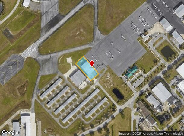
955 Singleton Dr
6034-00-00-0156
Center
Municipalproperty
34-16-30 PORTION OF DELAND MUNICIPAL AIRPORT LEASED TO DELAND JET CENTER LLC MEAS 257.25 FT ON SWLY/L & 120 FT ON SELY/L LYING N OF FLIGHTLINE BLVD
X
Volusia
12127C0470H
Florida
0
0.71 AC
2025
De Land
090303
Deltona/Daytona Beach
12,500 SF
Deltona-Daytona Beach-Ormond Beach, FL
DEMOGRAPHICS near 955 Singleton Dr
1 Mile
3 Mile
5 Mile
2024 Total Population
1,508
35,443
64,740
2029 Population
1,647
39,209
71,566
Pop Growth 2024-2029
+ 9.22%
+ 10.63%
+ 10.54%
Average Age
42
41
42
2024 Total Households
653
13,656
25,090
HH Growth 2024-2029
+ 9.49%
+ 10.82%
+ 10.70%
Median Household Inc
$45,238
$52,961
$59,905
Avg Household Size
2.30
2.30
2.40
2024 Avg HH Vehicles
2.00
2.00
2.00
Median Home Value
$177,488
$207,774
$242,403
Median Year Built
1987
1981
1984
Nearby Places
Map Layers
Map Styles
 Street
 Aerial
- Restaurants
- Banks
- Shops
- Fitness
- Groceries
PUBLIC TRANSPORTATION
COMMUTER RAIL
DRIVE
WALK
Distance
14 min
6.7 mi
AIRPORT
Daytona Beach International
DRIVE
WALK
Distance
Daytona Beach International
25 min
16.7 mi
Orlando Sanford International
DRIVE
WALK
Distance
Orlando Sanford International
45 min
29.1 mi
Freight Ports
Port Canaveral
DRIVE
WALK
Distance
Port Canaveral
96 min
77.6 mi
Nearby Properties
Address
Land Use
TOTAL SIZE
Lot Size
Zoning
Address
Land Use
TOTAL SIZE
Lot Size
Zoning
429,125 SF
8.24 AC
05C2
Address
Land Use
TOTAL SIZE
Lot Size
Zoning
493,551 SF
51.22 AC
05R4
Address
Land Use
TOTAL SIZE
Lot Size
Zoning
272,160 SF
21.70 AC
Address
Land Use
TOTAL SIZE
Lot Size
Zoning
292,755 SF
37.36 AC
01B1
Address
Land Use
TOTAL SIZE
Lot Size
Zoning
260,469 SF
9.97 AC
Address
Land Use
TOTAL SIZE
Lot Size
Zoning
167,670 SF
1.44 AC
05C2
Address
Land Use
TOTAL SIZE
Lot Size
Zoning
206,426 SF
4.10 AC
05C2
Address
Land Use
TOTAL SIZE
Lot Size
Zoning
130,484 SF
14.35 AC
Address
Land Use
TOTAL SIZE
Lot Size
Zoning
149,133 SF
1 AC
PUDC
Address
Land Use
TOTAL SIZE
Lot Size
Zoning
101,732 SF
25.47 AC
P
Address
Land Use
TOTAL SIZE
Lot Size
Zoning
238,812 SF
0.69 AC
05R12
Address
Land Use
TOTAL SIZE
Lot Size
Zoning
130,551 SF
7.28 AC
Address
Land Use
TOTAL SIZE
Lot Size
Zoning
299,124 SF
14.94 AC
Address
Land Use
TOTAL SIZE
Lot Size
Zoning
101,851 SF
17.98 AC
05R1AA
Address
Land Use
TOTAL SIZE
Lot Size
Zoning
221,179 SF
23.98 AC
Address
Land Use
TOTAL SIZE
Lot Size
Zoning
129,133 SF
2.01 AC
05C2
Address
Land Use
TOTAL SIZE
Lot Size
Zoning
3,364 SF
23 AC
01A1
Address
Land Use
TOTAL SIZE
Lot Size
Zoning
288,482 SF
26.14 AC
Address
Land Use
TOTAL SIZE
Lot Size
Zoning
406,163 SF
43.93 AC
I1
Address
Land Use
TOTAL SIZE
Lot Size
Zoning
388,366 SF
47.70 AC
Address
Land Use
TOTAL SIZE
Lot Size
Zoning
68,913 SF
7.98 AC
Address
Land Use
TOTAL SIZE
Lot Size
Zoning
70,209 SF
1.68 AC
05C2
Address
Land Use
TOTAL SIZE
Lot Size
Zoning
77,738 SF
9.20 AC
Address
Land Use
TOTAL SIZE
Lot Size
Zoning
8,078 SF
2.16 AC
R4
Address
Land Use
TOTAL SIZE
Lot Size
Zoning
264,819 SF
10 AC
05R4
Address
Land Use
TOTAL SIZE
Lot Size
Zoning
89,521 SF
12.40 AC
Address
Land Use
TOTAL SIZE
Lot Size
Zoning
147,318 SF
18.23 AC
B4
Address
Land Use
TOTAL SIZE
Lot Size
Zoning
64,514 SF
2.04 AC
05C2
Address
Land Use
TOTAL SIZE
Lot Size
Zoning
107,850 SF
2.22 AC
05R16
Address
Land Use
TOTAL SIZE
Lot Size
Zoning
119,831 SF
8.38 AC
The World's #1 Commercial Real Estate Marketplace
Connect with us
© 2025 CoStar Group
The information above has been obtained from sources believed reliable. While we do not doubt its accuracy we have not verified it and make no guarantee, warranty or representation about it. It is your responsibility to independently confirm its accuracy and completeness. Any projections, opinions, assumptions, or estimates used are for example only and do not represent the current or future performance of the property. The value of this transaction to you depends on tax and other factors which should be evaluated by your tax, financial, and legal advisors. You and your advisors should conduct a careful, independent investigation of the property to determine to your satisfaction the suitability of the property for your needs.