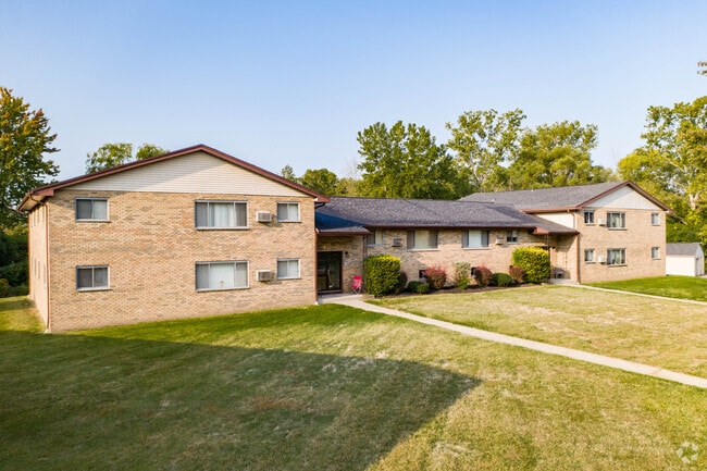
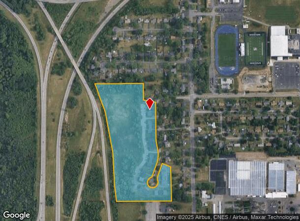
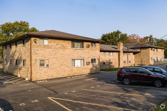
Property Record
955 Wegman Rd, Rochester, NY 14624
NEARBY LISTINGS FOR SALE OR LEASE
-
-
View all Rochester listings for sale on LoopNet.com
Property Detail
955 Wegman Rd
262600-119-090-0001-001-000
0130- 1-02 20000 AC
Apartment
Monroe
X
New York
36055C0189G
1.000
2025
18 AC
2024
Outer West/Southwest Monroe County
014202
Rochester
9,169 SF
Rochester, NY
DEMOGRAPHICS near 955 Wegman Rd
1 Mile
3 Mile
5 Mile
2024 Total Population
5,321
46,438
166,398
2029 Population
5,216
45,766
163,724
Pop Growth 2024-2029
(1.97%)
(1.45%)
(1.61%)
Average Age
43
43
39
2024 Total Households
2,125
19,906
68,208
HH Growth 2024-2029
(2.07%)
(1.58%)
(1.68%)
Median Household Inc
$71,409
$69,442
$55,242
Avg Household Size
2.50
2.30
2.30
2024 Avg HH Vehicles
2.00
2.00
2.00
Median Home Value
$149,440
$150,213
$143,031
Median Year Built
1969
1968
1961
Nearby Places
Map Layers
Map Styles
 Street
 Aerial
- Restaurants
- Banks
- Shops
- Fitness
- Groceries
PUBLIC TRANSPORTATION
COMMUTER RAIL
DRIVE
WALK
Distance
13 min
7.7 mi
AIRPORT
Frederick Douglass/Greater Rochester International
DRIVE
WALK
Distance
Frederick Douglass/Greater Rochester International
13 min
7.5 mi
Nearby Properties
Address
Land Use
TOTAL SIZE
Lot Size
Zoning
Address
Land Use
TOTAL SIZE
Lot Size
Zoning
796,051 SF
100.85 AC
06 - INDUS
Address
Land Use
TOTAL SIZE
Lot Size
Zoning
Address
Land Use
TOTAL SIZE
Lot Size
Zoning
Address
Land Use
TOTAL SIZE
Lot Size
Zoning
628,572 SF
134.14 AC
06 - INDUS
Address
Land Use
TOTAL SIZE
Lot Size
Zoning
200,000 SF
764.91 AC
Address
Land Use
TOTAL SIZE
Lot Size
Zoning
57,550 SF
46.61 AC
05 - COMME
Address
Land Use
TOTAL SIZE
Lot Size
Zoning
348,895 SF
76.07 AC
06 - INDUS
Address
Land Use
TOTAL SIZE
Lot Size
Zoning
11,408 SF
98.28 AC
02 - SINGL
Address
Land Use
TOTAL SIZE
Lot Size
Zoning
280,300 SF
71.39 AC
LI
Address
Land Use
TOTAL SIZE
Lot Size
Zoning
540,000 SF
39.70 AC
06 - INDUS
Address
Land Use
TOTAL SIZE
Lot Size
Zoning
1,440 SF
5.40 AC
02 - SINGL
Address
Land Use
TOTAL SIZE
Lot Size
Zoning
671,599 SF
33.10 AC
06 - INDUS
Address
Land Use
TOTAL SIZE
Lot Size
Zoning
109,772 SF
10.42 AC
06 - INDUS
Address
Land Use
TOTAL SIZE
Lot Size
Zoning
201,774 SF
17.17 AC
05 - COMME
Address
Land Use
TOTAL SIZE
Lot Size
Zoning
119,777 SF
14.38 AC
06 - INDUS
Address
Land Use
TOTAL SIZE
Lot Size
Zoning
391,478 SF
29.27 AC
Address
Land Use
TOTAL SIZE
Lot Size
Zoning
250,500 SF
18 AC
Address
Land Use
TOTAL SIZE
Lot Size
Zoning
119,983 SF
17.80 AC
03 - MULTI
Address
Land Use
TOTAL SIZE
Lot Size
Zoning
14,268 SF
36.20 AC
MFR
Address
Land Use
TOTAL SIZE
Lot Size
Zoning
149,541 SF
6.10 AC
03 - MULTI
Address
Land Use
TOTAL SIZE
Lot Size
Zoning
8.86 AC
Address
Land Use
TOTAL SIZE
Lot Size
Zoning
67,000 SF
3.86 AC
Address
Land Use
TOTAL SIZE
Lot Size
Zoning
206,603 SF
13.35 AC
Address
Land Use
TOTAL SIZE
Lot Size
Zoning
190,815 SF
14.75 AC
Address
Land Use
TOTAL SIZE
Lot Size
Zoning
6,960 SF
20.31 AC
02 - SINGL
Address
Land Use
TOTAL SIZE
Lot Size
Zoning
52,400 SF
114.60 AC
Address
Land Use
TOTAL SIZE
Lot Size
Zoning
119,706 SF
16.43 AC
05 - COMME
Address
Land Use
TOTAL SIZE
Lot Size
Zoning
290 AC
06 - INDUS
Address
Land Use
TOTAL SIZE
Lot Size
Zoning
23,940 SF
6.45 AC
05 - COMME
Address
Land Use
TOTAL SIZE
Lot Size
Zoning
94,806 SF
23.30 AC
The World's #1 Commercial Real Estate Marketplace
Connect with us
© 2025 CoStar Group
The information above has been obtained from sources believed reliable. While we do not doubt its accuracy we have not verified it and make no guarantee, warranty or representation about it. It is your responsibility to independently confirm its accuracy and completeness. Any projections, opinions, assumptions, or estimates used are for example only and do not represent the current or future performance of the property. The value of this transaction to you depends on tax and other factors which should be evaluated by your tax, financial, and legal advisors. You and your advisors should conduct a careful, independent investigation of the property to determine to your satisfaction the suitability of the property for your needs.