Property Record
9555 E 59Th St, Indianapolis, IN 46216
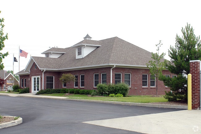

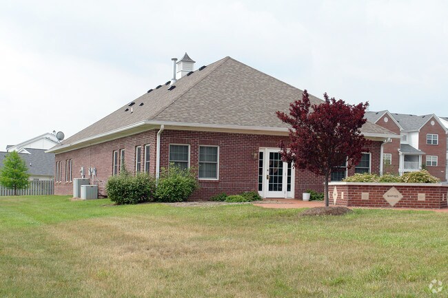
Property Detail
9555 E 59Th St
49-08-05-116-012.000-407
PT NW1/4 SE1/4 S5 T16 R5 BEG 576.74 E & 36.29 SOF NW COR S 230 SW 120.50 N 230 NE 120.5TO BEG .64AC
Taxexempt
Marion
B and X Area of moderate flood hazard, usually the area between the limits of the 100-year and 500-year floods.
Indiana
0
0.64 AC
2025
North Shadeland
390602
Indianapolis
2,736 SF
Indianapolis-Carmel-Greenwood, IN
NEARBY LISTINGS FOR SALE OR LEASE
DEMOGRAPHICS near 9555 E 59Th St
1 mile
3 mile
5 mile
2025 Total Population
6,840
73,580
173,921
2030 Population
6,842
74,265
175,776
Pop Growth 2025-2030
+ 0.03%
+ 0.93%
+ 1.07%
Average Age
39
36
38
2025 Total Households
2,781
28,095
68,095
HH Growth 2025-2030
+ 0.36%
+ 0.98%
+ 1.05%
Median Household Inc
$68,388
$65,164
$70,141
Avg Household Size
2.40
2.60
2.50
2025 Avg HH Vehicles
2.00
2.00
2.00
Median Home Value
$243,894
$248,626
$262,917
Median Year Built
1994
1982
1979
Nearby Places
Map Layers
Map Styles
 Street
 Aerial
Layers
 Traffic
 Biking
Places
Listings with unknown addresses are not visible on the map
- Restaurants
- Banks
- Shops
- Fitness
- Groceries
PUBLIC TRANSPORTATION
AIRPORT
Indianapolis International
Drive
Walk
Distance
Indianapolis International
47 min
26.2 mi
Nearby Properties
Address
Land Use
TOTAL SIZE
Lot Size
Zoning
Address
Land Use
TOTAL SIZE
Lot Size
Zoning
11,154 SF
21.99 AC
Address
Land Use
TOTAL SIZE
Lot Size
Zoning
532,932 SF
61.88 AC
ZO03
Address
Land Use
TOTAL SIZE
Lot Size
Zoning
4,217 SF
7.37 AC
ZO01
Address
Land Use
TOTAL SIZE
Lot Size
Zoning
125,958 SF
54.85 AC
ZO01
Address
Land Use
TOTAL SIZE
Lot Size
Zoning
2,556 SF
35.56 AC
ZO01
Address
Land Use
TOTAL SIZE
Lot Size
Zoning
136,336 SF
8.74 AC
ZO01
Address
Land Use
TOTAL SIZE
Lot Size
Zoning
13,087 SF
57.88 AC
Address
Land Use
TOTAL SIZE
Lot Size
Zoning
2,527 SF
23.16 AC
Address
Land Use
TOTAL SIZE
Lot Size
Zoning
65,095 SF
4.06 AC
ZO01
Address
Land Use
TOTAL SIZE
Lot Size
Zoning
6,770 SF
38.91 AC
Address
Land Use
TOTAL SIZE
Lot Size
Zoning
1,066 SF
24.93 AC
Address
Land Use
TOTAL SIZE
Lot Size
Zoning
293,952 SF
12.88 AC
ZO01
Address
Land Use
TOTAL SIZE
Lot Size
Zoning
167,808 SF
14.95 AC
ZO01
Address
Land Use
TOTAL SIZE
Lot Size
Zoning
109,200 SF
4.63 AC
ZO01
Address
Land Use
TOTAL SIZE
Lot Size
Zoning
206,080 SF
12.97 AC
ZO01
Address
Land Use
TOTAL SIZE
Lot Size
Zoning
128,126 SF
12.99 AC
ZO01
Address
Land Use
TOTAL SIZE
Lot Size
Zoning
16,160 SF
25.93 AC
ZO01
Address
Land Use
TOTAL SIZE
Lot Size
Zoning
203,720 SF
21.44 AC
Address
Land Use
TOTAL SIZE
Lot Size
Zoning
4,878 SF
25.65 AC
Address
Land Use
TOTAL SIZE
Lot Size
Zoning
640 SF
26.44 AC
Address
Land Use
TOTAL SIZE
Lot Size
Zoning
3,004 SF
13.79 AC
Address
Land Use
TOTAL SIZE
Lot Size
Zoning
175,046 SF
15.77 AC
ZO01
Address
Land Use
TOTAL SIZE
Lot Size
Zoning
81,928 SF
9.92 AC
ZO01
Address
Land Use
TOTAL SIZE
Lot Size
Zoning
65,541 SF
3.28 AC
ZO01
Address
Land Use
TOTAL SIZE
Lot Size
Zoning
4,205 SF
17.99 AC
Address
Land Use
TOTAL SIZE
Lot Size
Zoning
8,386 SF
19.85 AC
Address
Land Use
TOTAL SIZE
Lot Size
Zoning
2,970 SF
15.16 AC
ZO01
Address
Land Use
TOTAL SIZE
Lot Size
Zoning
53,987 SF
2.39 AC
ZO01
Address
Land Use
TOTAL SIZE
Lot Size
Zoning
175,610 SF
23.65 AC
ZO01
Address
Land Use
TOTAL SIZE
Lot Size
Zoning
4,152 SF
19.23 AC
ZO01
The World's #1 Commercial Real Estate Marketplace
Connect with us
© 2026 CoStar Group
The information above has been obtained from sources believed reliable. While we do not doubt its accuracy we have not verified it and make no guarantee, warranty or representation about it. It is your responsibility to independently confirm its accuracy and completeness. Any projections, opinions, assumptions, or estimates used are for example only and do not represent the current or future performance of the property. The value of this transaction to you depends on tax and other factors which should be evaluated by your tax, financial, and legal advisors. You and your advisors should conduct a careful, independent investigation of the property to determine to your satisfaction the suitability of the property for your needs.