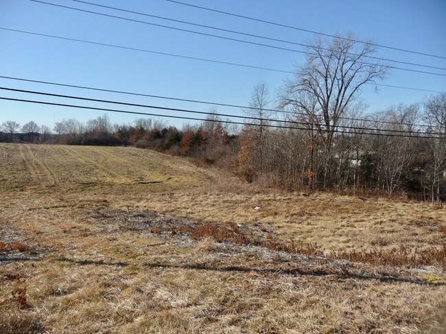
Property Record
Bicks Hill Rd, Ofallon, MO 63366

NEARBY LISTINGS FOR SALE OR LEASE
Property Detail
Bicks Hill Rd
St. Louis
Tanglewood 01
St. Louis, MO-IL
PT SUR 1780
4-0053-1780-00-0014.0000000
St. Charles
Vacantlandnec
Missouri
2024
14
2025
14.52 AC
311802
St Charles County
DEMOGRAPHICS near Bicks Hill Rd
1 Mile
3 Mile
5 Mile
2024 Total Population
7,985
65,355
146,790
2029 Population
8,440
69,518
155,828
Pop Growth 2024-2029
+ 5.70%
+ 6.37%
+ 6.16%
Average Age
40
40
40
2024 Total Households
3,233
24,830
54,170
HH Growth 2024-2029
+ 5.78%
+ 6.38%
+ 6.20%
Median Household Inc
$74,466
$96,677
$101,611
Avg Household Size
2.50
2.60
2.70
2024 Avg HH Vehicles
2.00
2.00
2.00
Median Home Value
$233,534
$285,849
$290,309
Median Year Built
1996
1997
1999
Nearby Places
Map Layers
Map Styles
 Street
 Aerial
- Restaurants
- Banks
- Shops
- Fitness
- Groceries
PUBLIC TRANSPORTATION
AIRPORT
St Louis Lambert International
DRIVE
WALK
Distance
St Louis Lambert International
34 min
24.2 mi
Freight Ports
Tulsa Port of Inola
DRIVE
WALK
Distance
Tulsa Port of Inola
430 min
376.8 mi
SALE & LEASE HISTORY
LISTING DATE
SALE/LEASE

Sep 25, 2016
For Lease
Sep 24, 2016
For Sale
May 15, 2019
For Sale
Nearby Properties
Address
Land Use
TOTAL SIZE
Lot Size
Zoning
Address
Land Use
TOTAL SIZE
Lot Size
Zoning
482.60 AC
AC7
Address
Land Use
TOTAL SIZE
Lot Size
Zoning
163,438 SF
5.76 AC
Address
Land Use
TOTAL SIZE
Lot Size
Zoning
420,705 SF
37.21 AC
Address
Land Use
TOTAL SIZE
Lot Size
Zoning
244,087 SF
7.24 AC
Address
Land Use
TOTAL SIZE
Lot Size
Zoning
Address
Land Use
TOTAL SIZE
Lot Size
Zoning
254,435 SF
16.57 AC
Address
Land Use
TOTAL SIZE
Lot Size
Zoning
235,876 SF
11.35 AC
Address
Land Use
TOTAL SIZE
Lot Size
Zoning
35,670 SF
1.12 AC
Address
Land Use
TOTAL SIZE
Lot Size
Zoning
36,607 SF
6.10 AC
AF0
Address
Land Use
TOTAL SIZE
Lot Size
Zoning
77.65 AC
AC7
Address
Land Use
TOTAL SIZE
Lot Size
Zoning
36,438 SF
2.08 AC
AC4
Address
Land Use
TOTAL SIZE
Lot Size
Zoning
167,090 SF
19.85 AC
Address
Land Use
TOTAL SIZE
Lot Size
Zoning
35,112 SF
0.88 AC
Address
Land Use
TOTAL SIZE
Lot Size
Zoning
49,680 SF
2.22 AC
Address
Land Use
TOTAL SIZE
Lot Size
Zoning
161,427 SF
8.80 AC
Address
Land Use
TOTAL SIZE
Lot Size
Zoning
251,169 SF
20.19 AC
Address
Land Use
TOTAL SIZE
Lot Size
Zoning
7,793 SF
26.43 AC
Address
Land Use
TOTAL SIZE
Lot Size
Zoning
111,573 SF
19.11 AC
Address
Land Use
TOTAL SIZE
Lot Size
Zoning
210,095 SF
12.29 AC
AE9
Address
Land Use
TOTAL SIZE
Lot Size
Zoning
140,826 SF
7.09 AC
Address
Land Use
TOTAL SIZE
Lot Size
Zoning
183,416 SF
40.46 AC
Address
Land Use
TOTAL SIZE
Lot Size
Zoning
48.76 AC
AF0
Address
Land Use
TOTAL SIZE
Lot Size
Zoning
375,136 SF
34.40 AC
Address
Land Use
TOTAL SIZE
Lot Size
Zoning
197,791 SF
18.58 AC
Address
Land Use
TOTAL SIZE
Lot Size
Zoning
147,526 SF
7.51 AC
AE8
Address
Land Use
TOTAL SIZE
Lot Size
Zoning
57.96 AC
Address
Land Use
TOTAL SIZE
Lot Size
Zoning
121,518 SF
3.40 AC
Address
Land Use
TOTAL SIZE
Lot Size
Zoning
127,764 SF
9.67 AC
Address
Land Use
TOTAL SIZE
Lot Size
Zoning
9,890 SF
1.51 AC
Address
Land Use
TOTAL SIZE
Lot Size
Zoning
The World's #1 Commercial Real Estate Marketplace
Connect with us
© 2026 CoStar Group
The information above has been obtained from sources believed reliable. While we do not doubt its accuracy we have not verified it and make no guarantee, warranty or representation about it. It is your responsibility to independently confirm its accuracy and completeness. Any projections, opinions, assumptions, or estimates used are for example only and do not represent the current or future performance of the property. The value of this transaction to you depends on tax and other factors which should be evaluated by your tax, financial, and legal advisors. You and your advisors should conduct a careful, independent investigation of the property to determine to your satisfaction the suitability of the property for your needs.