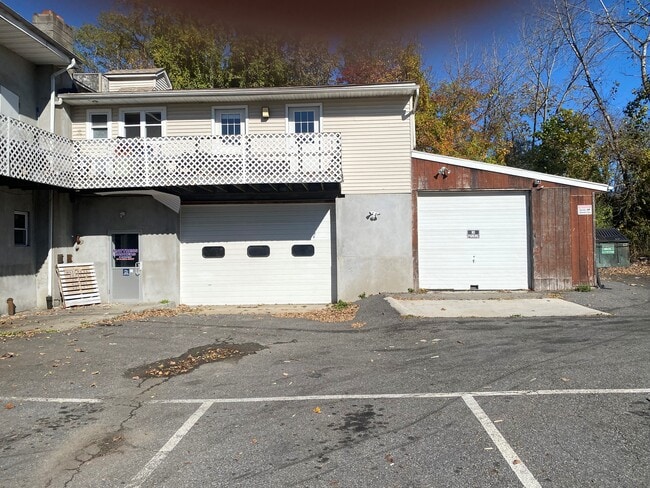
Property Record
957 Route 6, Mahopac, NY 10541


NEARBY LISTINGS FOR SALE OR LEASE
Property Detail
957 Route 6
372000-065-010-0001-052-000-0000
Putnam
Commercialnec
New York
X
52.00
36079C0140E
0.46 AC
2024
Carmel
2024
Westchester/So Connecticut
011600
New York-Jersey City-White Plains, NY-NJ
11,775 SF
DEMOGRAPHICS near 957 Route 6
1 Mile
3 Mile
5 Mile
2024 Total Population
2,671
21,380
55,961
2029 Population
2,668
21,405
55,837
Pop Growth 2024-2029
(0.11%)
+ 0.12%
(0.22%)
Average Age
42
43
45
2024 Total Households
909
7,576
21,280
HH Growth 2024-2029
(0.11%)
+ 0.09%
(0.24%)
Median Household Inc
$111,764
$112,924
$113,646
Avg Household Size
2.80
2.80
2.60
2024 Avg HH Vehicles
2.00
2.00
2.00
Median Home Value
$422,154
$430,557
$440,954
Median Year Built
1965
1968
1974
Nearby Places
Map Layers
Map Styles
 Street
 Aerial
- Restaurants
- Banks
- Shops
- Fitness
- Groceries
PUBLIC TRANSPORTATION
COMMUTER RAIL
Croton Falls Station (Harlem Line - Metro-North Commuter Railroad Company (Metro-North))
DRIVE
WALK
Distance
Croton Falls Station (Harlem Line - Metro-North Commuter Railroad Company (Metro-North))
12 min
5.5 mi
Purdy's Station (Harlem Line - Metro-North Commuter Railroad Company (Metro-North))
DRIVE
WALK
Distance
Purdy's Station (Harlem Line - Metro-North Commuter Railroad Company (Metro-North))
17 min
7.7 mi
AIRPORT
Westchester County
DRIVE
WALK
Distance
Westchester County
41 min
27.1 mi
New York Stewart International
DRIVE
WALK
Distance
New York Stewart International
56 min
38.3 mi
Freight Ports
Port of New Haven
DRIVE
WALK
Distance
Port of New Haven
82 min
54.9 mi
SALE & LEASE HISTORY
LISTING DATE
SALE/LEASE

Sep 25, 2016
For Lease
Nov 09, 2021
For Lease
May 19, 2017
For Lease
Mar 24, 2020
For Lease
Jun 09, 2020
For Lease
Nearby Properties
Address
Land Use
TOTAL SIZE
Lot Size
Zoning
Address
Land Use
TOTAL SIZE
Lot Size
Zoning
10,438 SF
261.04 AC
NW
Address
Land Use
TOTAL SIZE
Lot Size
Zoning
28,797 SF
146.83 AC
NW
Address
Land Use
TOTAL SIZE
Lot Size
Zoning
232,607 SF
61.47 AC
R
Address
Land Use
TOTAL SIZE
Lot Size
Zoning
108,614 SF
4.77 AC
R
Address
Land Use
TOTAL SIZE
Lot Size
Zoning
162,634 SF
23.76 AC
R
Address
Land Use
TOTAL SIZE
Lot Size
Zoning
160,274 SF
20.73 AC
C
Address
Land Use
TOTAL SIZE
Lot Size
Zoning
64,966 SF
20.82 AC
R
Address
Land Use
TOTAL SIZE
Lot Size
Zoning
14,817 SF
15.25 AC
NW
Address
Land Use
TOTAL SIZE
Lot Size
Zoning
51,648 SF
40 AC
CBP
Address
Land Use
TOTAL SIZE
Lot Size
Zoning
72,125 SF
20.35 AC
R
Address
Land Use
TOTAL SIZE
Lot Size
Zoning
426.60 AC
NW
Address
Land Use
TOTAL SIZE
Lot Size
Zoning
7,843 SF
1.07 AC
C
Address
Land Use
TOTAL SIZE
Lot Size
Zoning
72,482 SF
2.37 AC
C
Address
Land Use
TOTAL SIZE
Lot Size
Zoning
24,319 SF
133.03 AC
R
Address
Land Use
TOTAL SIZE
Lot Size
Zoning
9,768 SF
7.21 AC
R
Address
Land Use
TOTAL SIZE
Lot Size
Zoning
87,153 SF
12 AC
R
Address
Land Use
TOTAL SIZE
Lot Size
Zoning
515.36 AC
NW
Address
Land Use
TOTAL SIZE
Lot Size
Zoning
15,943 SF
154.84 AC
R
Address
Land Use
TOTAL SIZE
Lot Size
Zoning
593.73 AC
W
Address
Land Use
TOTAL SIZE
Lot Size
Zoning
54,918 SF
3.16 AC
C
Address
Land Use
TOTAL SIZE
Lot Size
Zoning
47,099 SF
2.04 AC
R
Address
Land Use
TOTAL SIZE
Lot Size
Zoning
8,697 SF
1.31 AC
R
Address
Land Use
TOTAL SIZE
Lot Size
Zoning
19,300 SF
1.50 AC
C
Address
Land Use
TOTAL SIZE
Lot Size
Zoning
265.56 AC
NM
Address
Land Use
TOTAL SIZE
Lot Size
Zoning
15,500 SF
1.21 AC
C
Address
Land Use
TOTAL SIZE
Lot Size
Zoning
218.91 AC
W
Address
Land Use
TOTAL SIZE
Lot Size
Zoning
15,196 SF
1.67 AC
R
Address
Land Use
TOTAL SIZE
Lot Size
Zoning
19,310 SF
107.91 AC
R
Address
Land Use
TOTAL SIZE
Lot Size
Zoning
6,889 SF
0.92 AC
R
Address
Land Use
TOTAL SIZE
Lot Size
Zoning
15,874 SF
2.70 AC
R
The World's #1 Commercial Real Estate Marketplace
Connect with us
© 2026 CoStar Group
The information above has been obtained from sources believed reliable. While we do not doubt its accuracy we have not verified it and make no guarantee, warranty or representation about it. It is your responsibility to independently confirm its accuracy and completeness. Any projections, opinions, assumptions, or estimates used are for example only and do not represent the current or future performance of the property. The value of this transaction to you depends on tax and other factors which should be evaluated by your tax, financial, and legal advisors. You and your advisors should conduct a careful, independent investigation of the property to determine to your satisfaction the suitability of the property for your needs.