Property Record
9570 Sw 62Nd Avenue Rd, Ocala, FL 34476

NEARBY LISTINGS FOR SALE OR LEASE
Property Detail
9570 Sw 62Nd Avenue Rd
Ocala, FL
Market At Cherrywood
35695-025112
SEC 20 TWP 16 RGE 21 PLAT BOOK 015 PAGE 009 MARKET AT CHERRYWOOD LOT 1
Regionalshoppingcenterormallwithanchorstore
Marion
X
Florida
12083C0703E
1
2021
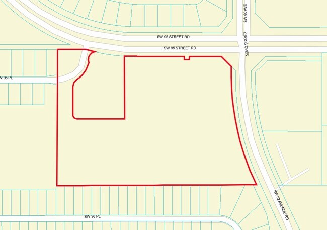
11.90 AC
2025
Outlying Marion County
001010
Ocala
70,400 SF
DEMOGRAPHICS near 9570 Sw 62Nd Avenue Rd
1 Mile
3 Mile
5 Mile
2024 Total Population
4,427
34,722
65,128
2029 Population
4,999
39,239
73,967
Pop Growth 2024-2029
+ 12.92%
+ 13.01%
+ 13.57%
Average Age
53
55
53
2024 Total Households
2,022
16,335
29,882
HH Growth 2024-2029
+ 12.61%
+ 12.81%
+ 13.41%
Median Household Inc
$60,063
$56,903
$59,768
Avg Household Size
2.20
2.10
2.10
2024 Avg HH Vehicles
2.00
2.00
2.00
Median Home Value
$218,255
$196,748
$207,297
Median Year Built
1999
1995
1999
Nearby Places
Map Layers
Map Styles
 Street
 Aerial
- Restaurants
- Banks
- Shops
- Fitness
- Groceries
Nearby Properties
Address
Land Use
TOTAL SIZE
Lot Size
Zoning
Address
Land Use
TOTAL SIZE
Lot Size
Zoning
380,749 SF
40.05 AC
PUD
Address
Land Use
TOTAL SIZE
Lot Size
Zoning
124,557 SF
39.04 AC
GU
Address
Land Use
TOTAL SIZE
Lot Size
Zoning
304,259 SF
31.62 AC
PUD
Address
Land Use
TOTAL SIZE
Lot Size
Zoning
96,094 SF
13.66 AC
B2
Address
Land Use
TOTAL SIZE
Lot Size
Zoning
62,253 SF
6.52 AC
PUD
Address
Land Use
TOTAL SIZE
Lot Size
Zoning
74,928 SF
7.80 AC
PUD
Address
Land Use
TOTAL SIZE
Lot Size
Zoning
18,035 SF
3.33 AC
B2
Address
Land Use
TOTAL SIZE
Lot Size
Zoning
139,728 SF
22.86 AC
B4
Address
Land Use
TOTAL SIZE
Lot Size
Zoning
84,004 SF
9.77 AC
SC
Address
Land Use
TOTAL SIZE
Lot Size
Zoning
65,060 SF
11.90 AC
B2
Address
Land Use
TOTAL SIZE
Lot Size
Zoning
98,205 SF
13.41 AC
B2
Address
Land Use
TOTAL SIZE
Lot Size
Zoning
77,877 SF
13.38 AC
B2
Address
Land Use
TOTAL SIZE
Lot Size
Zoning
42,673 SF
13.72 AC
A1
Address
Land Use
TOTAL SIZE
Lot Size
Zoning
42,159 SF
5.95 AC
B2
Address
Land Use
TOTAL SIZE
Lot Size
Zoning
82,465 SF
6.13 AC
B2
Address
Land Use
TOTAL SIZE
Lot Size
Zoning
82,904 SF
10.51 AC
B2
Address
Land Use
TOTAL SIZE
Lot Size
Zoning
286.80 AC
PUD
Address
Land Use
TOTAL SIZE
Lot Size
Zoning
58,381 SF
5.12 AC
R3
Address
Land Use
TOTAL SIZE
Lot Size
Zoning
16,214 SF
4.91 AC
B2
Address
Land Use
TOTAL SIZE
Lot Size
Zoning
25,128 SF
4.38 AC
PD
Address
Land Use
TOTAL SIZE
Lot Size
Zoning
38,062 SF
3.07 AC
B2
Address
Land Use
TOTAL SIZE
Lot Size
Zoning
35,280 SF
4.02 AC
B2
Address
Land Use
TOTAL SIZE
Lot Size
Zoning
13,943 SF
0.43 AC
B2
Address
Land Use
TOTAL SIZE
Lot Size
Zoning
45,364 SF
6.69 AC
B2
Address
Land Use
TOTAL SIZE
Lot Size
Zoning
34,618 SF
4.55 AC
PUD
Address
Land Use
TOTAL SIZE
Lot Size
Zoning
45,580 SF
6.14 AC
PUD
Address
Land Use
TOTAL SIZE
Lot Size
Zoning
21,753 SF
2.73 AC
PUD
Address
Land Use
TOTAL SIZE
Lot Size
Zoning
16,308 SF
1.74 AC
B2
Address
Land Use
TOTAL SIZE
Lot Size
Zoning
25,898 SF
4.13 AC
B4
Address
Land Use
TOTAL SIZE
Lot Size
Zoning
17,882 SF
2.14 AC
B4
The World's #1 Commercial Real Estate Marketplace
Connect with us
© 2026 CoStar Group
The information above has been obtained from sources believed reliable. While we do not doubt its accuracy we have not verified it and make no guarantee, warranty or representation about it. It is your responsibility to independently confirm its accuracy and completeness. Any projections, opinions, assumptions, or estimates used are for example only and do not represent the current or future performance of the property. The value of this transaction to you depends on tax and other factors which should be evaluated by your tax, financial, and legal advisors. You and your advisors should conduct a careful, independent investigation of the property to determine to your satisfaction the suitability of the property for your needs.