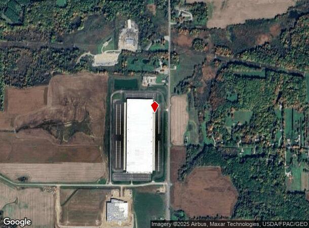
Property Record
9575 State Route 44, Mantua, OH 44255
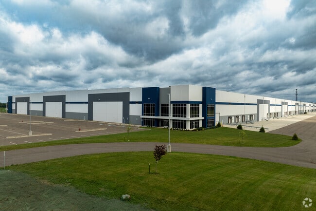
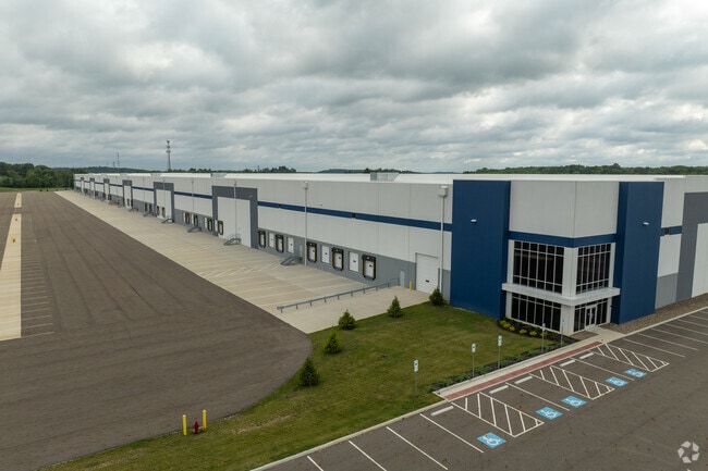
This Property Is For Sale
Current Lease Availabilities
NEARBY LISTINGS FOR SALE OR LEASE
Property Detail
9575 State Route 44
Akron, OH
Ne Div
33-048-00-00-005-000
LOTS 47 & 48 PENDING EZA AGREEMENT 15 YRS/100% N/C VALUE (2023-2037)
Warehouse
Portage
X
Ohio
39133C0063D
47,48
2023
77.58 AC
2023
Portage County
600500
Cleveland
8,168 SF
DEMOGRAPHICS near 9575 State Route 44
1 mile
3 mile
5 mile
2024 Total Population
453
5,364
14,033
2029 Population
453
5,389
14,106
Pop Growth 2024-2029
0.00%
+ 0.47%
+ 0.52%
Average Age
42
43
43
2024 Total Households
160
2,101
5,678
HH Growth 2024-2029
0.00%
+ 0.43%
+ 0.42%
Median Household Inc
$94,374
$70,062
$67,865
Avg Household Size
2.50
2.40
2.40
2024 Avg HH Vehicles
2.00
2.00
2.00
Median Home Value
$230,645
$205,854
$185,930
Median Year Built
1980
1968
1972
Nearby Places
Map Layers
Map Styles
 Street
 Aerial
Transit
 Traffic
 Biking
Places
Listings with unknown addresses are not visible on the map
- Restaurants
- Banks
- Shops
- Fitness
- Groceries
PUBLIC TRANSPORTATION
AIRPORT
Akron-Canton Regional
Drive
Walk
Distance
Akron-Canton Regional
50 min
38.4 mi
Freight Ports
Port of Toledo
Drive
Walk
Distance
Port of Toledo
156 min
136.3 mi
Nearby Properties
Address
Land Use
TOTAL SIZE
Lot Size
Zoning
Address
Land Use
TOTAL SIZE
Lot Size
Zoning
1,021,440 SF
73.29 AC
Address
Land Use
TOTAL SIZE
Lot Size
Zoning
129,894 SF
32.27 AC
Address
Land Use
TOTAL SIZE
Lot Size
Zoning
211,593 SF
64.96 AC
Address
Land Use
TOTAL SIZE
Lot Size
Zoning
84,587 SF
19.29 AC
Address
Land Use
TOTAL SIZE
Lot Size
Zoning
14,307 SF
164.59 AC
Address
Land Use
TOTAL SIZE
Lot Size
Zoning
1,880 SF
391.37 AC
Address
Land Use
TOTAL SIZE
Lot Size
Zoning
21,651 SF
16.29 AC
Address
Land Use
TOTAL SIZE
Lot Size
Zoning
38,460 SF
15 AC
Address
Land Use
TOTAL SIZE
Lot Size
Zoning
13.47 AC
Address
Land Use
TOTAL SIZE
Lot Size
Zoning
3.45 AC
Address
Land Use
TOTAL SIZE
Lot Size
Zoning
25,080 SF
11.83 AC
Address
Land Use
TOTAL SIZE
Lot Size
Zoning
503.98 AC
Address
Land Use
TOTAL SIZE
Lot Size
Zoning
6,898 SF
134.22 AC
Address
Land Use
TOTAL SIZE
Lot Size
Zoning
152,420 SF
8.95 AC
Address
Land Use
TOTAL SIZE
Lot Size
Zoning
8,826 SF
13.30 AC
Address
Land Use
TOTAL SIZE
Lot Size
Zoning
5,168 SF
93.03 AC
Address
Land Use
TOTAL SIZE
Lot Size
Zoning
1,694 SF
54.92 AC
Address
Land Use
TOTAL SIZE
Lot Size
Zoning
9,684 SF
1.21 AC
Address
Land Use
TOTAL SIZE
Lot Size
Zoning
30,507 SF
6.41 AC
Address
Land Use
TOTAL SIZE
Lot Size
Zoning
55,716 SF
1 AC
Address
Land Use
TOTAL SIZE
Lot Size
Zoning
8,409 SF
112.25 AC
Address
Land Use
TOTAL SIZE
Lot Size
Zoning
13,358 SF
10 AC
Address
Land Use
TOTAL SIZE
Lot Size
Zoning
3,588 SF
96.30 AC
Address
Land Use
TOTAL SIZE
Lot Size
Zoning
92.58 AC
Address
Land Use
TOTAL SIZE
Lot Size
Zoning
9,230 SF
1 AC
Address
Land Use
TOTAL SIZE
Lot Size
Zoning
4,128 SF
75.25 AC
Address
Land Use
TOTAL SIZE
Lot Size
Zoning
5,720 SF
102.43 AC
Address
Land Use
TOTAL SIZE
Lot Size
Zoning
26,086 SF
4.21 AC
Address
Land Use
TOTAL SIZE
Lot Size
Zoning
7,118 SF
8.93 AC
The World's #1 Commercial Real Estate Marketplace
Connect with us
© 2026 CoStar Group
The information above has been obtained from sources believed reliable. While we do not doubt its accuracy we have not verified it and make no guarantee, warranty or representation about it. It is your responsibility to independently confirm its accuracy and completeness. Any projections, opinions, assumptions, or estimates used are for example only and do not represent the current or future performance of the property. The value of this transaction to you depends on tax and other factors which should be evaluated by your tax, financial, and legal advisors. You and your advisors should conduct a careful, independent investigation of the property to determine to your satisfaction the suitability of the property for your needs.