Property Record
9575 Vaughn Rd, Pike Road, AL 36064
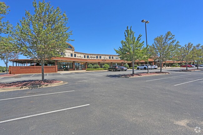


Property Detail
9575 Vaughn Rd
08-04-19-4-001-005.000
SEC 19 T16N R20E 4.55 AC IN S1/2 OF SE1/4 0804194001005000
Storebuilding
Montgomery
PUD
Alabama
B and X Area of moderate flood hazard, usually the area between the limits of the 100-year and 500-year floods.
1
0
4.55 AC
2025
Outlying Montgomery Cnty
005503
Montgomery
14,596 SF
Montgomery, AL
NEARBY LISTINGS FOR SALE OR LEASE
DEMOGRAPHICS near 9575 Vaughn Rd
1 mile
3 mile
5 mile
2025 Total Population
3,432
13,827
39,065
2030 Population
3,428
13,782
38,373
Pop Growth 2025-2030
(0.12%)
(0.33%)
(1.77%)
Average Age
37
38
40
2025 Total Households
1,213
4,578
14,661
HH Growth 2025-2030
(0.08%)
(0.31%)
(2.07%)
Median Household Inc
$110,250
$110,234
$102,411
Avg Household Size
2.80
2.70
2.50
2025 Avg HH Vehicles
2.00
2.00
2.00
Median Home Value
$301,654
$332,399
$330,438
Median Year Built
2007
2007
2002
Nearby Places
Map Layers
Map Styles
 Street
 Aerial
Layers
 Traffic
 Biking
Places
Listings with unknown addresses are not visible on the map
- Restaurants
- Banks
- Shops
- Fitness
- Groceries
PUBLIC TRANSPORTATION
AIRPORT
Montgomery Regional (Dannelly Field)
Drive
Walk
Distance
Montgomery Regional (Dannelly Field)
26 min
22.4 mi
Nearby Properties
Address
Land Use
TOTAL SIZE
Lot Size
Zoning
Address
Land Use
TOTAL SIZE
Lot Size
Zoning
25,762 SF
35.04 AC
PUD
Address
Land Use
TOTAL SIZE
Lot Size
Zoning
208,799 SF
17.34 AC
O-2
Address
Land Use
TOTAL SIZE
Lot Size
Zoning
160,604 SF
35.85 AC
B-2
Address
Land Use
TOTAL SIZE
Lot Size
Zoning
344,095 SF
30.02 AC
Address
Land Use
TOTAL SIZE
Lot Size
Zoning
170,644 SF
12.34 AC
Address
Land Use
TOTAL SIZE
Lot Size
Zoning
217,723 SF
23.90 AC
B-2
Address
Land Use
TOTAL SIZE
Lot Size
Zoning
56,956 SF
10.37 AC
B-2
Address
Land Use
TOTAL SIZE
Lot Size
Zoning
52,600 SF
11.63 AC
Address
Land Use
TOTAL SIZE
Lot Size
Zoning
9,792 SF
160 AC
Address
Land Use
TOTAL SIZE
Lot Size
Zoning
117,633 SF
52.48 AC
Address
Land Use
TOTAL SIZE
Lot Size
Zoning
228,855 SF
15.70 AC
M-1
Address
Land Use
TOTAL SIZE
Lot Size
Zoning
96,764 SF
13.64 AC
M-1
Address
Land Use
TOTAL SIZE
Lot Size
Zoning
168,209 SF
21.62 AC
Address
Land Use
TOTAL SIZE
Lot Size
Zoning
55,215 SF
9.78 AC
B-2
Address
Land Use
TOTAL SIZE
Lot Size
Zoning
168,209 SF
21.62 AC
Address
Land Use
TOTAL SIZE
Lot Size
Zoning
115,292 SF
49.50 AC
M-1
Address
Land Use
TOTAL SIZE
Lot Size
Zoning
113,724 SF
12.84 AC
B-2
Address
Land Use
TOTAL SIZE
Lot Size
Zoning
123,376 SF
23 AC
Address
Land Use
TOTAL SIZE
Lot Size
Zoning
34.70 AC
B-2
Address
Land Use
TOTAL SIZE
Lot Size
Zoning
9,806 SF
119.29 AC
Address
Land Use
TOTAL SIZE
Lot Size
Zoning
11,100 SF
10.50 AC
Address
Land Use
TOTAL SIZE
Lot Size
Zoning
53,827 SF
1.98 AC
B-2
Address
Land Use
TOTAL SIZE
Lot Size
Zoning
139,221 SF
11.77 AC
M-1
Address
Land Use
TOTAL SIZE
Lot Size
Zoning
9,615 SF
4.16 AC
Address
Land Use
TOTAL SIZE
Lot Size
Zoning
49,843 SF
11.99 AC
M-1
Address
Land Use
TOTAL SIZE
Lot Size
Zoning
52,059 SF
4.10 AC
O-2
Address
Land Use
TOTAL SIZE
Lot Size
Zoning
45,745 SF
1.50 AC
Address
Land Use
TOTAL SIZE
Lot Size
Zoning
92,065 SF
46 AC
Address
Land Use
TOTAL SIZE
Lot Size
Zoning
32,712 SF
1.66 AC
B-2
The World's #1 Commercial Real Estate Marketplace
Connect with us
© 2026 CoStar Group
The information above has been obtained from sources believed reliable. While we do not doubt its accuracy we have not verified it and make no guarantee, warranty or representation about it. It is your responsibility to independently confirm its accuracy and completeness. Any projections, opinions, assumptions, or estimates used are for example only and do not represent the current or future performance of the property. The value of this transaction to you depends on tax and other factors which should be evaluated by your tax, financial, and legal advisors. You and your advisors should conduct a careful, independent investigation of the property to determine to your satisfaction the suitability of the property for your needs.