Property Record
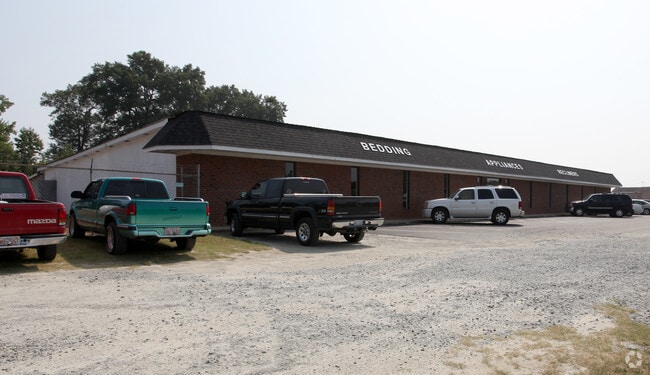
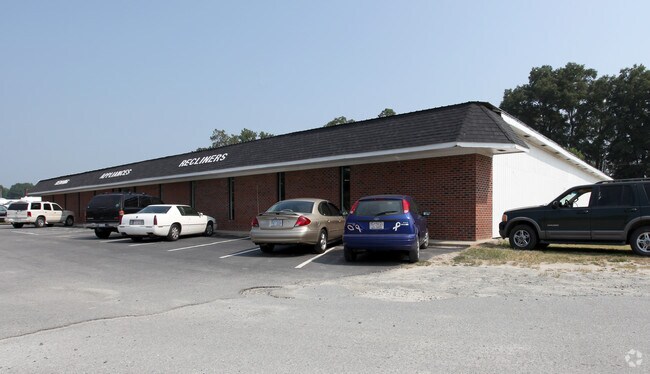
9577 Us Highway 70 E, Princeton, NC 27569

Property Detail
9577 Us Highway 70 E
04Q08021
HOME - US HWY 70 E AND NCSR 2371
Realpropertynec
JOHNSTON
RAG
North Carolina
B and X Area of moderate flood hazard, usually the area between the limits of the 100-year and 500-year floods.
18.40 AC
2025
Johnston County
2025
Raleigh/Durham
040501
Raleigh-Cary, NC
2,264 SF
NEARBY LISTINGS FOR SALE OR LEASE
DEMOGRAPHICS near 9577 Us Highway 70 E
1 mile
3 mile
5 mile
2025 Total Population
387
5,559
14,727
2030 Population
430
5,986
15,665
Pop Growth 2025-2030
+ 11.11%
+ 7.68%
+ 6.37%
Average Age
40
39
40
2025 Total Households
146
2,110
5,536
HH Growth 2025-2030
+ 10.96%
+ 7.77%
+ 6.43%
Median Household Inc
$49,090
$72,583
$76,395
Avg Household Size
2.60
2.60
2.60
2025 Avg HH Vehicles
2.00
2.00
2.00
Median Home Value
$153,124
$198,163
$195,402
Median Year Built
1987
1990
1992
Nearby Places
Map Layers
Map Styles
 Street
 Aerial
Transit
 Traffic
 Biking
Places
Listings with unknown addresses are not visible on the map
- Restaurants
- Banks
- Shops
- Fitness
- Groceries
Nearby Properties
Address
Land Use
TOTAL SIZE
Lot Size
Zoning
Address
Land Use
TOTAL SIZE
Lot Size
Zoning
30,242 SF
13.12 AC
COW
Address
Land Use
TOTAL SIZE
Lot Size
Zoning
17,000 SF
33.85 AC
RAG
Address
Land Use
TOTAL SIZE
Lot Size
Zoning
27,156 SF
9.81 AC
COW
Address
Land Use
TOTAL SIZE
Lot Size
Zoning
3,840 SF
3.05 AC
REW
Address
Land Use
TOTAL SIZE
Lot Size
Zoning
22,400 SF
10.64 AC
Address
Land Use
TOTAL SIZE
Lot Size
Zoning
19,778 SF
0.77 AC
REW
Address
Land Use
TOTAL SIZE
Lot Size
Zoning
3,811 SF
1.90 AC
COW
Address
Land Use
TOTAL SIZE
Lot Size
Zoning
28,778 SF
3.51 AC
COW
Address
Land Use
TOTAL SIZE
Lot Size
Zoning
286.62 AC
IND
Address
Land Use
TOTAL SIZE
Lot Size
Zoning
13,080 SF
4.40 AC
REW
Address
Land Use
TOTAL SIZE
Lot Size
Zoning
3,750 SF
3.69 AC
COW
Address
Land Use
TOTAL SIZE
Lot Size
Zoning
276.05 AC
RAG
Address
Land Use
TOTAL SIZE
Lot Size
Zoning
21,860 SF
5.31 AC
COW
Address
Land Use
TOTAL SIZE
Lot Size
Zoning
4,802 SF
8.34 AC
COW
Address
Land Use
TOTAL SIZE
Lot Size
Zoning
4,000 SF
3.54 AC
COW
Address
Land Use
TOTAL SIZE
Lot Size
Zoning
3,065 SF
2.24 AC
RES
Address
Land Use
TOTAL SIZE
Lot Size
Zoning
11,918 SF
2.73 AC
IND
Address
Land Use
TOTAL SIZE
Lot Size
Zoning
22,000 SF
17.08 AC
Address
Land Use
TOTAL SIZE
Lot Size
Zoning
10,576 SF
1.65 AC
COW
Address
Land Use
TOTAL SIZE
Lot Size
Zoning
129 AC
IND
Address
Land Use
TOTAL SIZE
Lot Size
Zoning
8,745 SF
6.37 AC
COW
Address
Land Use
TOTAL SIZE
Lot Size
Zoning
240 AC
RAG
Address
Land Use
TOTAL SIZE
Lot Size
Zoning
8,730 SF
1.51 AC
REW
Address
Land Use
TOTAL SIZE
Lot Size
Zoning
9,104 SF
108.21 AC
RAG
Address
Land Use
TOTAL SIZE
Lot Size
Zoning
2,501 SF
1.36 AC
COW
Address
Land Use
TOTAL SIZE
Lot Size
Zoning
4,131 SF
0.75 AC
COW
Address
Land Use
TOTAL SIZE
Lot Size
Zoning
11,000 SF
2.69 AC
COW
Address
Land Use
TOTAL SIZE
Lot Size
Zoning
2,601 SF
1.38 AC
RES
Address
Land Use
TOTAL SIZE
Lot Size
Zoning
1,600 SF
193.11 AC
RAG
Address
Land Use
TOTAL SIZE
Lot Size
Zoning
4,200 SF
2.26 AC
COM
The World's #1 Commercial Real Estate Marketplace
Connect with us
© 2026 CoStar Group
The information above has been obtained from sources believed reliable. While we do not doubt its accuracy we have not verified it and make no guarantee, warranty or representation about it. It is your responsibility to independently confirm its accuracy and completeness. Any projections, opinions, assumptions, or estimates used are for example only and do not represent the current or future performance of the property. The value of this transaction to you depends on tax and other factors which should be evaluated by your tax, financial, and legal advisors. You and your advisors should conduct a careful, independent investigation of the property to determine to your satisfaction the suitability of the property for your needs.