Property Record
9587 Pala Rd, Pala, CA 92059
NEARBY LISTINGS FOR SALE OR LEASE
Property Detail
9587 Pala Rd
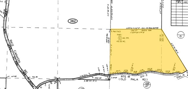
128-470-19
Parcel Map 1743
Sfr
SEC 32-9-2W SWQ (EX RD)DOC220132REC70 IN NEQ OF
A
San Diego
06073C0505G
California
2025
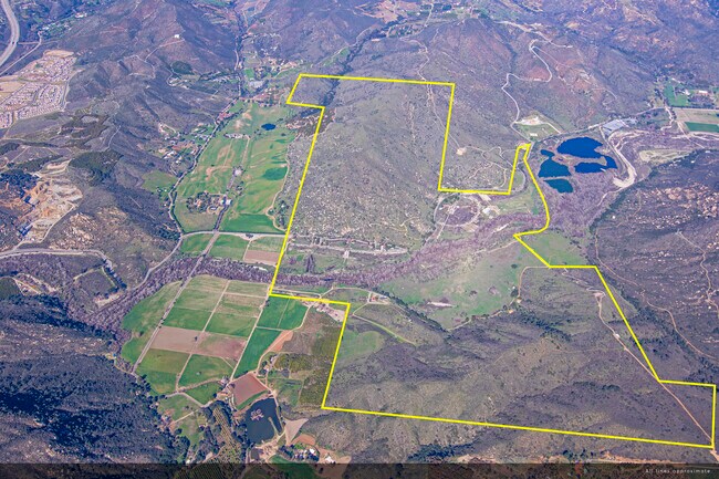
22.72 AC
2025
Outlying SD County N
018803
San Diego
2,636 SF
San Diego-Chula Vista-Carlsbad, CA
DEMOGRAPHICS near 9587 Pala Rd
1 mile
3 mile
5 mile
2024 Total Population
84
8,319
15,839
2029 Population
83
8,318
15,744
Pop Growth 2024-2029
(1.19%)
(0.01%)
(0.60%)
Average Age
38
40
43
2024 Total Households
26
2,812
5,557
HH Growth 2024-2029
(3.85%)
(0.04%)
(0.67%)
Median Household Inc
$96,428
$111,718
$114,024
Avg Household Size
3.00
2.90
2.80
2024 Avg HH Vehicles
3.00
2.00
2.00
Median Home Value
$678,571
$710,711
$746,706
Median Year Built
1985
1998
1993
Nearby Places
Map Layers
Map Styles
 Street
 Aerial
Transit
 Traffic
 Biking
Places
Listings with unknown addresses are not visible on the map
- Restaurants
- Banks
- Shops
- Fitness
- Groceries
Nearby Properties
Address
Land Use
TOTAL SIZE
Lot Size
Zoning
Address
Land Use
TOTAL SIZE
Lot Size
Zoning
97.01 AC
A70
Address
Land Use
TOTAL SIZE
Lot Size
Zoning
8,344 SF
183.35 AC
A72
Address
Land Use
TOTAL SIZE
Lot Size
Zoning
7,971 SF
167.53 AC
A72
Address
Land Use
TOTAL SIZE
Lot Size
Zoning
19,391 SF
1.71 AC
C36
Address
Land Use
TOTAL SIZE
Lot Size
Zoning
5,938 SF
19.72 AC
A70
Address
Land Use
TOTAL SIZE
Lot Size
Zoning
7,174 SF
3.88 AC
C36
Address
Land Use
TOTAL SIZE
Lot Size
Zoning
5.04 AC
A70
Address
Land Use
TOTAL SIZE
Lot Size
Zoning
5 AC
A70
Address
Land Use
TOTAL SIZE
Lot Size
Zoning
6,326 SF
12.32 AC
A70
Address
Land Use
TOTAL SIZE
Lot Size
Zoning
3,975 SF
21.64 AC
A72
Address
Land Use
TOTAL SIZE
Lot Size
Zoning
5,593 SF
15.38 AC
A70
Address
Land Use
TOTAL SIZE
Lot Size
Zoning
5,631 SF
40.69 AC
A70
Address
Land Use
TOTAL SIZE
Lot Size
Zoning
6,741 SF
3.52 AC
A70
Address
Land Use
TOTAL SIZE
Lot Size
Zoning
6,012 SF
4.13 AC
A70
Address
Land Use
TOTAL SIZE
Lot Size
Zoning
329.48 AC
A70
Address
Land Use
TOTAL SIZE
Lot Size
Zoning
4,716 SF
2.72 AC
A70
Address
Land Use
TOTAL SIZE
Lot Size
Zoning
3,200 SF
5.12 AC
A70
Address
Land Use
TOTAL SIZE
Lot Size
Zoning
153.36 AC
S
Address
Land Use
TOTAL SIZE
Lot Size
Zoning
3,570 SF
3.03 AC
A70
Address
Land Use
TOTAL SIZE
Lot Size
Zoning
3,501 SF
2.29 AC
A70
Address
Land Use
TOTAL SIZE
Lot Size
Zoning
2,292 SF
19.98 AC
A70
Address
Land Use
TOTAL SIZE
Lot Size
Zoning
2,767 SF
1.41 AC
A70
Address
Land Use
TOTAL SIZE
Lot Size
Zoning
3,672 SF
1.36 AC
A70
Address
Land Use
TOTAL SIZE
Lot Size
Zoning
6,237 SF
15.82 AC
A70
Address
Land Use
TOTAL SIZE
Lot Size
Zoning
3,241 SF
1.25 AC
RR
Address
Land Use
TOTAL SIZE
Lot Size
Zoning
5,927 SF
3.27 AC
A70
Address
Land Use
TOTAL SIZE
Lot Size
Zoning
4,715 SF
2.20 AC
A70
Address
Land Use
TOTAL SIZE
Lot Size
Zoning
3,305 SF
1.28 AC
A70
Address
Land Use
TOTAL SIZE
Lot Size
Zoning
168.37 AC
A70
Address
Land Use
TOTAL SIZE
Lot Size
Zoning
2,314 SF
15.12 AC
A70
The World's #1 Commercial Real Estate Marketplace
Connect with us
© 2026 CoStar Group
The information above has been obtained from sources believed reliable. While we do not doubt its accuracy we have not verified it and make no guarantee, warranty or representation about it. It is your responsibility to independently confirm its accuracy and completeness. Any projections, opinions, assumptions, or estimates used are for example only and do not represent the current or future performance of the property. The value of this transaction to you depends on tax and other factors which should be evaluated by your tax, financial, and legal advisors. You and your advisors should conduct a careful, independent investigation of the property to determine to your satisfaction the suitability of the property for your needs.