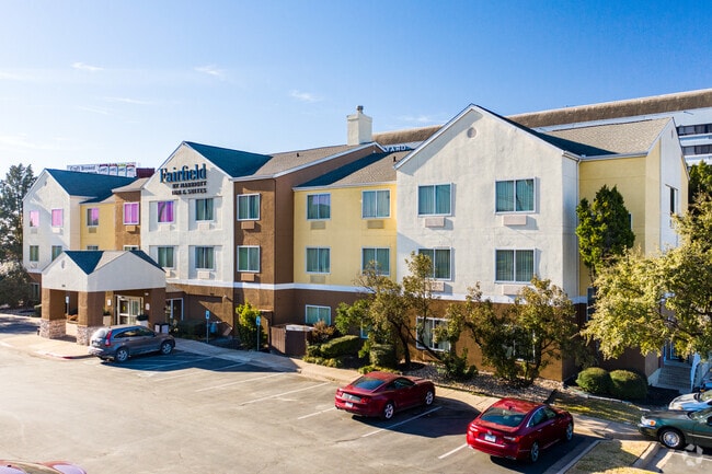
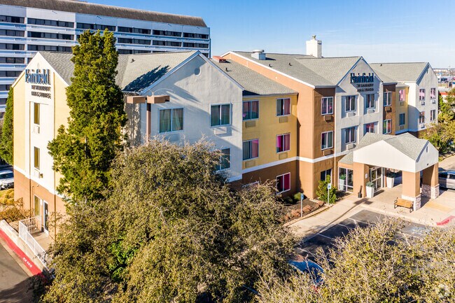
Property Record
959 Reinli St, Austin, TX 78751


Property Detail
959 Reinli St
Austin-Round Rock-San Marcos, TX
LOT A INTERSTATE OFFICE PARK (COMMERCIAL PERSONAL PROPERTY)
225500
Travis
Hotel
Texas
B and X Area of moderate flood hazard, usually the area between the limits of the 100-year and 500-year floods.
a
2025
1.29 AC
2025
Austin US-290/I-35 Area
002105
Austin
29,625 SF
NEARBY LISTINGS FOR SALE OR LEASE
DEMOGRAPHICS near 959 Reinli St
1 mile
3 mile
5 mile
2025 Total Population
18,599
169,286
374,375
2030 Population
19,720
177,873
394,168
Pop Growth 2025-2030
+ 6.03%
+ 5.07%
+ 5.29%
Average Age
36
36
37
2025 Total Households
8,887
75,359
162,233
HH Growth 2025-2030
+ 6.70%
+ 5.88%
+ 6.15%
Median Household Inc
$78,166
$79,149
$86,335
Avg Household Size
2.00
2.10
2.10
2025 Avg HH Vehicles
1.00
2.00
2.00
Median Home Value
$625,526
$702,257
$709,153
Median Year Built
1979
1984
1988
Nearby Places
Map Layers
Map Styles
 Street
 Aerial
Layers
 Traffic
 Biking
Places
Listings with unknown addresses are not visible on the map
- Restaurants
- Banks
- Shops
- Fitness
- Groceries
PUBLIC TRANSPORTATION
TRANSIT/SUBWAY
Highland Station (550-Metro Rail Red Line - Capital Metro)
Drive
Walk
Distance
Highland Station (550-Metro Rail Red Line - Capital Metro)
3 min
19 min
1.0 mi
COMMUTER RAIL
Austin (Texas Eagle - Amtrak)
Drive
Walk
Distance
Austin (Texas Eagle - Amtrak)
10 min
5.7 mi
AIRPORT
Austin-Bergstrom International
Drive
Walk
Distance
Austin-Bergstrom International
25 min
13.3 mi
Freight Ports
Calhoun Port
Drive
Walk
Distance
Calhoun Port
190 min
156.8 mi
Nearby Properties
Address
Land Use
TOTAL SIZE
Lot Size
Zoning
Address
Land Use
TOTAL SIZE
Lot Size
Zoning
28.39 AC
Address
Land Use
TOTAL SIZE
Lot Size
Zoning
Address
Land Use
TOTAL SIZE
Lot Size
Zoning
28.62 AC
Address
Land Use
TOTAL SIZE
Lot Size
Zoning
27.17 AC
Address
Land Use
TOTAL SIZE
Lot Size
Zoning
30.96 AC
Address
Land Use
TOTAL SIZE
Lot Size
Zoning
18.52 AC
Address
Land Use
TOTAL SIZE
Lot Size
Zoning
74.69 AC
Address
Land Use
TOTAL SIZE
Lot Size
Zoning
548,399 SF
23.82 AC
Address
Land Use
TOTAL SIZE
Lot Size
Zoning
623,000 SF
11.78 AC
Address
Land Use
TOTAL SIZE
Lot Size
Zoning
21 AC
Address
Land Use
TOTAL SIZE
Lot Size
Zoning
614,532 SF
66.07 AC
Address
Land Use
TOTAL SIZE
Lot Size
Zoning
1,234 SF
96.75 AC
Address
Land Use
TOTAL SIZE
Lot Size
Zoning
11.61 AC
Address
Land Use
TOTAL SIZE
Lot Size
Zoning
263,226 SF
1.43 AC
Address
Land Use
TOTAL SIZE
Lot Size
Zoning
973,370 SF
11.26 AC
Address
Land Use
TOTAL SIZE
Lot Size
Zoning
22.14 AC
Address
Land Use
TOTAL SIZE
Lot Size
Zoning
11.11 AC
Address
Land Use
TOTAL SIZE
Lot Size
Zoning
14.55 AC
Address
Land Use
TOTAL SIZE
Lot Size
Zoning
510,500 SF
9.26 AC
Address
Land Use
TOTAL SIZE
Lot Size
Zoning
401,418 SF
4.77 AC
Address
Land Use
TOTAL SIZE
Lot Size
Zoning
Address
Land Use
TOTAL SIZE
Lot Size
Zoning
19,284 SF
178.26 AC
Address
Land Use
TOTAL SIZE
Lot Size
Zoning
241,998 SF
2.42 AC
Address
Land Use
TOTAL SIZE
Lot Size
Zoning
238,650 SF
1.18 AC
Address
Land Use
TOTAL SIZE
Lot Size
Zoning
480,823 SF
18.46 AC
Address
Land Use
TOTAL SIZE
Lot Size
Zoning
322,150 SF
3.83 AC
Address
Land Use
TOTAL SIZE
Lot Size
Zoning
432,032 SF
6.70 AC
Address
Land Use
TOTAL SIZE
Lot Size
Zoning
609,823 SF
3.33 AC
Address
Land Use
TOTAL SIZE
Lot Size
Zoning
372,075 SF
4.97 AC
The World's #1 Commercial Real Estate Marketplace
Connect with us
© 2026 CoStar Group
The information above has been obtained from sources believed reliable. While we do not doubt its accuracy we have not verified it and make no guarantee, warranty or representation about it. It is your responsibility to independently confirm its accuracy and completeness. Any projections, opinions, assumptions, or estimates used are for example only and do not represent the current or future performance of the property. The value of this transaction to you depends on tax and other factors which should be evaluated by your tax, financial, and legal advisors. You and your advisors should conduct a careful, independent investigation of the property to determine to your satisfaction the suitability of the property for your needs.