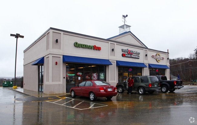
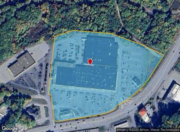
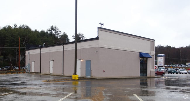
Property Record
96 Daniel Webster Hwy, Belmont, NH 03220
NEARBY LISTINGS FOR SALE OR LEASE
Property Detail
96 Daniel Webster Hwy
BLMT-000201-000009
Belknap
Commercialnec
New Hampshire
2024
28.55 AC
2024
Concord/New Hampshire North Area
965801
Other Market Areas
210,552 SF
Laconia, NH
DEMOGRAPHICS near 96 Daniel Webster Hwy
1 Mile
3 Mile
5 Mile
2024 Total Population
937
17,320
27,630
2029 Population
955
17,855
28,642
Pop Growth 2024-2029
+ 1.92%
+ 3.09%
+ 3.66%
Average Age
42
43
44
2024 Total Households
402
7,363
11,792
HH Growth 2024-2029
+ 1.49%
+ 2.73%
+ 3.42%
Median Household Inc
$55,172
$58,684
$65,590
Avg Household Size
2.20
2.20
2.30
2024 Avg HH Vehicles
2.00
2.00
2.00
Median Home Value
$213,187
$252,782
$274,437
Median Year Built
1975
1966
1975
Nearby Places
Map Layers
Map Styles
 Street
 Aerial
- Restaurants
- Banks
- Shops
- Fitness
- Groceries
SALE & LEASE HISTORY
LISTING DATE
SALE/LEASE

Apr 07, 2017
For Lease
Nearby Properties
Address
Land Use
TOTAL SIZE
Lot Size
Zoning
Address
Land Use
TOTAL SIZE
Lot Size
Zoning
Address
Land Use
TOTAL SIZE
Lot Size
Zoning
1,370 SF
92.23 AC
UC
Address
Land Use
TOTAL SIZE
Lot Size
Zoning
147,353 SF
18.97 AC
UC
Address
Land Use
TOTAL SIZE
Lot Size
Zoning
1,600 SF
24 AC
RS
Address
Land Use
TOTAL SIZE
Lot Size
Zoning
78,038 SF
35 AC
RA
Address
Land Use
TOTAL SIZE
Lot Size
Zoning
90,077 SF
25 AC
RA
Address
Land Use
TOTAL SIZE
Lot Size
Zoning
1,954 SF
Address
Land Use
TOTAL SIZE
Lot Size
Zoning
99,673 SF
34.76 AC
RESORT
Address
Land Use
TOTAL SIZE
Lot Size
Zoning
77,703 SF
1.50 AC
UC
Address
Land Use
TOTAL SIZE
Lot Size
Zoning
2,624 SF
10.50 AC
RA
Address
Land Use
TOTAL SIZE
Lot Size
Zoning
53,766 SF
1.30 AC
UC
Address
Land Use
TOTAL SIZE
Lot Size
Zoning
49,398 SF
29.36 AC
RS
Address
Land Use
TOTAL SIZE
Lot Size
Zoning
29,508 SF
6.38 AC
RA
Address
Land Use
TOTAL SIZE
Lot Size
Zoning
4,943 SF
6.71 AC
UC
Address
Land Use
TOTAL SIZE
Lot Size
Zoning
7,150 SF
4.40 AC
UC
Address
Land Use
TOTAL SIZE
Lot Size
Zoning
276 SF
21.72 AC
RS
Address
Land Use
TOTAL SIZE
Lot Size
Zoning
30,930 SF
11.11 AC
UC
Address
Land Use
TOTAL SIZE
Lot Size
Zoning
188,960 SF
19.70 AC
IP
Address
Land Use
TOTAL SIZE
Lot Size
Zoning
43,955 SF
5.06 AC
RA
Address
Land Use
TOTAL SIZE
Lot Size
Zoning
148,787 SF
15.47 AC
IP
Address
Land Use
TOTAL SIZE
Lot Size
Zoning
37,344 SF
15.35 AC
RS
Address
Land Use
TOTAL SIZE
Lot Size
Zoning
46,863 SF
8.71 AC
UC
Address
Land Use
TOTAL SIZE
Lot Size
Zoning
24,048 SF
1.60 AC
UC
Address
Land Use
TOTAL SIZE
Lot Size
Zoning
16,660 SF
1 AC
UC
Address
Land Use
TOTAL SIZE
Lot Size
Zoning
4,102 SF
34.50 AC
RES
Address
Land Use
TOTAL SIZE
Lot Size
Zoning
53,351 SF
1.90 AC
UC
Address
Land Use
TOTAL SIZE
Lot Size
Zoning
46,544 SF
3.77 AC
UC
Address
Land Use
TOTAL SIZE
Lot Size
Zoning
4.71 AC
RS
Address
Land Use
TOTAL SIZE
Lot Size
Zoning
7,726 SF
7.70 AC
RA
The World's #1 Commercial Real Estate Marketplace
Connect with us
© 2025 CoStar Group
The information above has been obtained from sources believed reliable. While we do not doubt its accuracy we have not verified it and make no guarantee, warranty or representation about it. It is your responsibility to independently confirm its accuracy and completeness. Any projections, opinions, assumptions, or estimates used are for example only and do not represent the current or future performance of the property. The value of this transaction to you depends on tax and other factors which should be evaluated by your tax, financial, and legal advisors. You and your advisors should conduct a careful, independent investigation of the property to determine to your satisfaction the suitability of the property for your needs.