Property Record
96 Palmer Rd, Monson, MA 01057


NEARBY LISTINGS FOR SALE OR LEASE
Property Detail
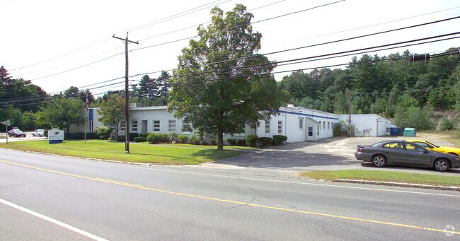
96 Palmer Rd
Manufacturinglight
Hampden
AE
Massachusetts
25013C0456E
5.62 AC
2025
Hampden County
2025
Hartford
813702
Springfield, MA
50,656 SF
MONS-000111-000000-000071
DEMOGRAPHICS near 96 Palmer Rd
1 Mile
3 Mile
5 Mile
2024 Total Population
894
8,490
18,650
2029 Population
879
8,334
18,255
Pop Growth 2024-2029
(1.68%)
(1.84%)
(2.12%)
Average Age
45
44
44
2024 Total Households
401
3,659
7,928
HH Growth 2024-2029
(1.75%)
(1.83%)
(2.19%)
Median Household Inc
$58,124
$64,805
$70,864
Avg Household Size
2.20
2.30
2.30
2024 Avg HH Vehicles
2.00
2.00
2.00
Median Home Value
$264,161
$271,670
$272,550
Median Year Built
1959
1966
1966
Nearby Places
Map Layers
Map Styles
 Street
 Aerial
- Restaurants
- Banks
- Shops
- Fitness
- Groceries
PUBLIC TRANSPORTATION
AIRPORT
Bradley International
DRIVE
WALK
Distance
Bradley International
60 min
29.7 mi
Worcester Regional
DRIVE
WALK
Distance
Worcester Regional
58 min
35.9 mi
Freight Ports
Port of Davisville, RI
DRIVE
WALK
Distance
Port of Davisville, RI
116 min
87.1 mi
Nearby Properties
Address
Land Use
TOTAL SIZE
Lot Size
Zoning
Address
Land Use
TOTAL SIZE
Lot Size
Zoning
674.33 AC
RR
Address
Land Use
TOTAL SIZE
Lot Size
Zoning
112,556 SF
20 AC
RR
Address
Land Use
TOTAL SIZE
Lot Size
Zoning
91,544 SF
18.47 AC
RV
Address
Land Use
TOTAL SIZE
Lot Size
Zoning
85,228 SF
46.53 AC
RV
Address
Land Use
TOTAL SIZE
Lot Size
Zoning
255.28 AC
RR
Address
Land Use
TOTAL SIZE
Lot Size
Zoning
21,928 SF
2 AC
CC
Address
Land Use
TOTAL SIZE
Lot Size
Zoning
10,080 SF
1.53 AC
VC1
Address
Land Use
TOTAL SIZE
Lot Size
Zoning
22.57 AC
I
Address
Land Use
TOTAL SIZE
Lot Size
Zoning
320 AC
Address
Land Use
TOTAL SIZE
Lot Size
Zoning
4 AC
RV
Address
Land Use
TOTAL SIZE
Lot Size
Zoning
714 AC
AR
Address
Land Use
TOTAL SIZE
Lot Size
Zoning
5.59 AC
CC
Address
Land Use
TOTAL SIZE
Lot Size
Zoning
84,748 SF
2 AC
HB
Address
Land Use
TOTAL SIZE
Lot Size
Zoning
53.88 AC
RR
Address
Land Use
TOTAL SIZE
Lot Size
Zoning
10,716 SF
0.31 AC
VC1
Address
Land Use
TOTAL SIZE
Lot Size
Zoning
2.75 AC
CC
Address
Land Use
TOTAL SIZE
Lot Size
Zoning
75.29 AC
RR
Address
Land Use
TOTAL SIZE
Lot Size
Zoning
2.37 AC
RV
Address
Land Use
TOTAL SIZE
Lot Size
Zoning
23,480 SF
2.06 AC
VC1
Address
Land Use
TOTAL SIZE
Lot Size
Zoning
106,171 SF
4.03 AC
IA
Address
Land Use
TOTAL SIZE
Lot Size
Zoning
12,516 SF
1.19 AC
CC
Address
Land Use
TOTAL SIZE
Lot Size
Zoning
8.08 AC
IA
Address
Land Use
TOTAL SIZE
Lot Size
Zoning
8,880 SF
1.64 AC
CC
Address
Land Use
TOTAL SIZE
Lot Size
Zoning
86,990 SF
1.05 AC
IA
Address
Land Use
TOTAL SIZE
Lot Size
Zoning
48,750 SF
24.38 AC
I
Address
Land Use
TOTAL SIZE
Lot Size
Zoning
0.65 AC
TR
Address
Land Use
TOTAL SIZE
Lot Size
Zoning
10,427 SF
0.33 AC
CC
Address
Land Use
TOTAL SIZE
Lot Size
Zoning
1.30 AC
HB
Address
Land Use
TOTAL SIZE
Lot Size
Zoning
23.04 AC
IA
The World's #1 Commercial Real Estate Marketplace
Connect with us
© 2025 CoStar Group
The information above has been obtained from sources believed reliable. While we do not doubt its accuracy we have not verified it and make no guarantee, warranty or representation about it. It is your responsibility to independently confirm its accuracy and completeness. Any projections, opinions, assumptions, or estimates used are for example only and do not represent the current or future performance of the property. The value of this transaction to you depends on tax and other factors which should be evaluated by your tax, financial, and legal advisors. You and your advisors should conduct a careful, independent investigation of the property to determine to your satisfaction the suitability of the property for your needs.