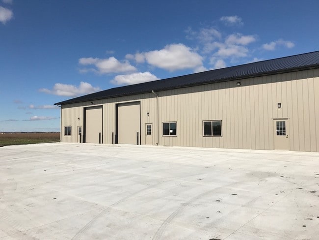
Property Record
9600 42Nd St S, Fargo, ND 58104

NEARBY LISTINGS FOR SALE OR LEASE
Property Detail
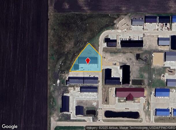
9600 42Nd St S
Fargo, ND-MN
Commerce On I29 2Nd Addition
64-0477-00060-000
LOT: 6 BLOCK: 1 ADDITION: COMMERCE ON I29 2ND ADDITION ADDITIONAL: COMMERCE ON I29 2ND LT 6 BLK 1 **3-8-17 REPLAT FROM 64-0475-00080-000, 00110-000 & 00120-000 PER PLAT DOC# 1503607 FOR 2017
Realpropertynec
Cass
X
North Dakota
27167C0025C
6
2024
1.14 AC
2024
Fargo
040504
Other Market Areas
DEMOGRAPHICS near 9600 42Nd St S
1 Mile
3 Mile
5 Mile
2024 Total Population
12
4,062
34,144
2029 Population
14
4,460
36,919
Pop Growth 2024-2029
+ 16.67%
+ 9.80%
+ 8.13%
Average Age
35
33
34
2024 Total Households
6
1,377
12,887
HH Growth 2024-2029
0.00%
+ 10.24%
+ 8.64%
Median Household Inc
$59,999
$117,009
$105,038
Avg Household Size
2.20
2.90
2.60
2024 Avg HH Vehicles
2.00
2.00
2.00
Median Home Value
$750,000
$423,809
$354,597
Median Year Built
1969
2010
2010
Nearby Places
Map Layers
Map Styles
 Street
 Aerial
- Restaurants
- Banks
- Shops
- Fitness
- Groceries
PUBLIC TRANSPORTATION
AIRPORT
Hector International
DRIVE
WALK
Distance
Hector International
24 min
15.5 mi
SALE & LEASE HISTORY
LISTING DATE
SALE/LEASE

Oct 03, 2017
For Lease
Mar 19, 2019
For Lease
Nearby Properties
Address
Land Use
TOTAL SIZE
Lot Size
Zoning
Address
Land Use
TOTAL SIZE
Lot Size
Zoning
42,366 SF
Address
Land Use
TOTAL SIZE
Lot Size
Zoning
223,126 SF
Address
Land Use
TOTAL SIZE
Lot Size
Zoning
1,784 SF
Address
Land Use
TOTAL SIZE
Lot Size
Zoning
18.05 AC
Address
Land Use
TOTAL SIZE
Lot Size
Zoning
Address
Land Use
TOTAL SIZE
Lot Size
Zoning
53,272 SF
9.34 AC
Address
Land Use
TOTAL SIZE
Lot Size
Zoning
45.87 AC
Address
Land Use
TOTAL SIZE
Lot Size
Zoning
19,840 SF
9.42 AC
Address
Land Use
TOTAL SIZE
Lot Size
Zoning
1.98 AC
Address
Land Use
TOTAL SIZE
Lot Size
Zoning
21,576 SF
Address
Land Use
TOTAL SIZE
Lot Size
Zoning
1.43 AC
Address
Land Use
TOTAL SIZE
Lot Size
Zoning
0.01 AC
Address
Land Use
TOTAL SIZE
Lot Size
Zoning
15,000 SF
32.53 AC
Address
Land Use
TOTAL SIZE
Lot Size
Zoning
9,872 SF
15.80 AC
Address
Land Use
TOTAL SIZE
Lot Size
Zoning
14,400 SF
4.83 AC
Address
Land Use
TOTAL SIZE
Lot Size
Zoning
1.84 AC
Address
Land Use
TOTAL SIZE
Lot Size
Zoning
1.89 AC
Address
Land Use
TOTAL SIZE
Lot Size
Zoning
21,664 SF
3.24 AC
Address
Land Use
TOTAL SIZE
Lot Size
Zoning
3.25 AC
Address
Land Use
TOTAL SIZE
Lot Size
Zoning
Address
Land Use
TOTAL SIZE
Lot Size
Zoning
14,596 SF
14.73 AC
Address
Land Use
TOTAL SIZE
Lot Size
Zoning
9,000 SF
3.61 AC
Address
Land Use
TOTAL SIZE
Lot Size
Zoning
1.27 AC
Address
Land Use
TOTAL SIZE
Lot Size
Zoning
Address
Land Use
TOTAL SIZE
Lot Size
Zoning
9,600 SF
Address
Land Use
TOTAL SIZE
Lot Size
Zoning
7.52 AC
Address
Land Use
TOTAL SIZE
Lot Size
Zoning
9,800 SF
Address
Land Use
TOTAL SIZE
Lot Size
Zoning
4.12 AC
Address
Land Use
TOTAL SIZE
Lot Size
Zoning
2,100 SF
1.39 AC
LC
Address
Land Use
TOTAL SIZE
Lot Size
Zoning
0.91 AC
The World's #1 Commercial Real Estate Marketplace
Connect with us
© 2025 CoStar Group
The information above has been obtained from sources believed reliable. While we do not doubt its accuracy we have not verified it and make no guarantee, warranty or representation about it. It is your responsibility to independently confirm its accuracy and completeness. Any projections, opinions, assumptions, or estimates used are for example only and do not represent the current or future performance of the property. The value of this transaction to you depends on tax and other factors which should be evaluated by your tax, financial, and legal advisors. You and your advisors should conduct a careful, independent investigation of the property to determine to your satisfaction the suitability of the property for your needs.